THURSDAY January 7, 2016
WEATHER: Cold in Wisconsin at 3:30 in the
morning. It was 80 at 2 pm in Honolulu;
72 when I got to Hilo and at 4,200 feet it was 60 at Kilauea Military Camp with
clouds that turned to partly cloudy.
TRAVEL: Milwaukee-Chicago-Honolulu-Hilo
to Kiluaea Military Camp (KMC) Hawaii Volcanoes National Park.
United Airlines cancelled my 0730 flight from MKE to ORD; luckily
my travel agent called me and arranged for a 0530 flight – allowed me time to
eat breakfast. The flight from Chicago
to Honolulu was 8 hours and 26 minutes.
We arrived in HNL a little after 2 pm Hawaiian time (4 hours earlier
than CST). The flight to Hilo was at 4pm
so I grabbed some dinner in the airport and checked into Kilauea
Military Camp (KMC) about
6:15pm.
 |
| KMC - one bedroom apartment |
 |
| KMC - entrance to Unit AD |
I’ve stayed at KMC before and rented a 3 bedroom 2
bath, with kitchen and living room several years ago. No I’ve got a nice 1 bedroom suite. Located
in Hawaii Volcanoes National Park the price is right and the location is
perfect. KMC is a Moral, Welfare & Recreation
(MWR) Facility for active and retired military/DOD employees.
Amenities
include general store, recreation center, bowling lanes, laundry, dining room, grill and gas station. The crater is just across the road less than
200 yards away. The Volcanoes
National Park Visitor Center is about a mile down the road.
FRIDAY January 8, 2016
WEATHER: cool 56 at 5 am (EL 4000) –
sunrise 6:57 am - should reach a high of
70 here today it will be 10 degrees warmer on the coast
TRAVEL: Volcanoes National Park
 |
| Hawaii - Volcanoes National Park - If planning a "Brief Visit" These are the 'must see. I spent almost 3 full days in the park and still there were more trails to walk.' |
Volcanoes
are land builders –Volcanoes are monuments to the the Earth’s origin - they
created the Hawaiian Island chain. Kīlauea
and Mauna Loa, two of the world's
most active volcanoes, are still adding to the island of Hawaii. Mauna Loa is the most massive mountain
on Earth occupying an estimated volume of 19,999 cubic miles. The current
summit of Mauna Loa stands about
56,000 feet (17,000 m) above the depressed sea floor. This is more than 27,000
feet (8,230 m) higher than Mount Everest.
In contrast to the explosive continental volcanoes, the more fluid and less
gaseous eruptions of Kīlauea and Mauna Loa produce fiery fountains and
rivers of molten lava. These flows, adding layer upon layer, produce a barren
volcanic landscape that serves as a fountain for life.
Hundreds
of species of plants and animals found their way across the vast Pacific on
wind, water, and the wings of birds. A few survived, adapted, and prospered
during this time of isolation. The arrival of humans - first Polynesians, then Europeans - and the plants and animals they brought with them
drastically altered this evolutionary showcase, this grand natural experiment.
Hawaii Volcanoes National
Park displays the
results of at least 70 million years of volcanism, migration, and evolution in
the Hawaiian Island-Emperor Seamount chain-processes that would thrust a bare land from
the sea and clothed it with complex and unique ecosystems and a distinct human
culture. Created to preserve the natural setting of Kīlauea and Mauna
Loa, the park is also
a refuge for the island's native plants and animals and a link to its human
past. Park managers and scientists work to protect the resources and promote
understanding and appreciation of the park visitors. Research by scientists at
the Hawaiian Volcano Observatory makes Kīlauea one of the best
understood volcanoes in the world, shedding light on the birth of the Hawaiian
Islands and the beginnings of planet Earth. Each eruption is a reminder of the
power of natural
The CRATER
RIM DRIVE is a 6 mile drive along the edge
of Kiluaea Caldera with several stops, trails and points of interest. I’ve been here twice before but there is
always something different and more to explore.
 |
| The SULPHUR BANKS TRAIL l is a 'must do' A 1.6 mile round trip from the Visitor Center. You can see it's lcoations from the map. Steam vents, view of the Kilauea Caldera - mostly level. |
 |
| Sulphur Banks Trail Steam Vents |
At the VC I watched a ½ hour film (no
change here and still not that informative) and listened to a short ranger talk
– not very informative – but then maybe I was expecting more . . . .the VC and
much of the park was built/developed by a Hawaiian CCC in the 1930’s.
I returned to my vehicle
via the Crater Rim Trail (.8 mile).
 |
| Kiluaea Caldera with steam rising from Halema'uma'u Crater View from Kiluaea Looklout below Jagger Museum There is red hot lava in the crater. During the evening the lava reflects off the steam giving the "glow'" |
A drive to the Kiluaea
Lookout, Jagger
Museum and Hawaiian
Volano Oberservatory completed this
trip on the Crater Rim Drive. The lava in the Halema’uma’u
Crater of the Kiluaea Caldera is still creating a steam cloud
that draws crowds to view its glow in the evening.
The next stop was
the Kiluaea Iki Trail parking lot. I had walked this 4
mile, 400 foot descent and ascent in the Kiluaea Iki Crater several years ago. A great walk but it will take 3 hours and plenty of water. The last time I walked this, I didn’t know
there was a trail guide and
didn’t fully understand the story of Kiluaea Iki. I thought I’d walk it in the right direction this time with 15 numbered trail markers explained . .
. .
didn’t fully understand the story of Kiluaea Iki. I thought I’d walk it in the right direction this time with 15 numbered trail markers explained . .
. .
 |
| Thsese are photoes of the 1959 Kilaeea Iki eruption . Avery close to Kiluaea Caldera. Iwalked |
Prior to 1959, the
floor of Kiluaea Iki Crater was covered with trees.
 |
| The Kiluaea Iki Trail Pakring Lot is about .4 mil s to the left of this aerial view of the Thruston Lava Tube Parking area. |
 |
| Floor of Kiluaea Iki from Pu'a Pua'i Overlook Can you see the trail at the bottom? |
BOTTOM LINE: Walked this before – maybe
tomorrow.
I walked the Crater
Rim Trail (1.0 mile round
trip) to the Thurston Lava Tube Trail (.4 mile). I've Been here twice before, but it was a short walk.
 |
| A picture of the lava fountain that sprung from the edge of Kiluaea Iki creating Pu'u Pua'i cinder cone The lava fountain eruptions crated a lava lake in Kiluaea Iki Crater |
A drive to the Pu’u
Pua’i Overlook allows you to peer
into the Kiluaea Iki Crater and is one terminus of the Devestation Trail (1.0 mile round trip). This paved walk skirts the 1959 Pu’a
Pua’i cinder cone.
CHAIN OF CRATERS ROAD – is a 38 mile drive
from Crater Rim Drive,
descending 3,700 feet to the coast -
ending at the 2003 lave flow.
 |
| Deveatsion Trail - to the ight if the cinder cone of Pu'u Pua'i Befroe 1959 this was part of Crater Rim Drive around Kiluaea Caldera |
I’ve driven Chain of Craters Road before but didn’t stop at every crater – this time I did and took a side trip down the 9 mile one-way, one lane, paved Hilina Pali Road to the Halina Pali Overlook. Here I walked a 1 mile round trip down and up the Halina Pali Trail – just because I could.- continuing on the trail is for serious wilderness hikers.
 |
| Map of Volcanoes NP showing Crater Rim Drive aournd Kiluaea Caldera - Chain of Craters Drive to the Ocean and the road to the Halina Pali Overlook and trail connections |
 |
| Petroglyph |
 |
| Petroglyphs Trail of course it is all across a lava bed |
 |
| Halina Pali Trail |
 |
| End Chain of Craters Road Sea Arch |
Clearest sky and
the brightest stars I’ve seen since last January in the Big
Cypress Swamp/Everglades.
 |
| The"glow" in the night sky caused by the red hot lava reflecting off the steam from the volcano |
SATURDAY January 9, 2016
WEATHER: cool 54 and sunny in the
morning, warms quickly and walking in the sun can break a sweat, in the 70’s
and haze by afternoon, it was 80 at the coast at the end of Chain of Craters
road – 60 back on top at 6 pm with the sun setting.
TRAVEL: Volcanoes National Park
 |
| The Mauna Ulu Trail The Chain of Craters Road was covered in lava flows due to the 1969 eruption. The trail is worth the walk. A hike up Pu'u Huluhulu allows you to see Mauna Ulu cinder cone |
Manuna Ulu/Pu’u Huluhulu Trail - A 2.5 mile walk
through a lava landscape from the 1969-1974 Mauna Ulu
flow. I started this trail about 8:30 am and finished 2 hours later. I had not walked this before, bought a Mauna Ulu Eruption Guide
and found the 16 numbered stops interesting.
The trail guide tells the story of one of the longest known rift zone
eruptions of Kilauea. The trail is fairly well marked but I did get
a bit confused on the lava fields, once going straight into a’a lava field when
I should have turned left and gone over a lava ridge along the 1969
fissure. The route is easy except for
the ¼ mile 210 foot steep climb up Pu’u Huluhulu Cone – a trail worth the effort.
On May 24, 1969 earthquakes signaled the opening of a
large fissure in a quiet forest along the Chain of Craters Road.
Red-hot lava emerged, a new eruption and the birth of Mauna Ulu. Over 5 years 6 miles of the road, cultural
sites, and coastal grasslands were buried in the lava’s flow to the sea. During
the course of the eruption 5 pit craters, along Chain of Craters Road, were partially or
completely filled with lava.
 |
| Mauna Ulu from Stop 13 along the Mauna Ulu Trail This cinder cone is still steaming - you cannot walk up it's side This is a close up take from Pu'u Huluhulu |
The floor of Hi’iaka Crater was covered when it erupted in May
1973. Pele’s sister Hi’iaka is known to
nurture new forests after an eruption.
A short eruption occurred on the floor of Pauahi Crater in May
1973. A few months later, new fissures
split the walls and lava flooded the crater’s floor. Its names means “destroyed by fire.”
‘Alo’i Crater,
named for the favorite pig of Kahawali,
chief of Puna, was filled during the eruption.
When Kahawali
refused to race Pele,
she (in the form of lava), chased him to the sea. The road used to skirt ‘Alo’i.Crater. Today it is covered by the 1969-1974 flows.
 |
| Geologists watched Mauna Ulu erupt in distance from behind this wall on Pu'u Huluhulu until a new fissure started to spew hot rock on them. They ran down and didn't follow the trail. |
The Mauna Ulu
Lava Shield also cascaded into Makaopuhi Crater, but only filled the
deeper half of the giant pit. It was
named “eye of the eel” for a lens of bluish lava that appeared on the lower
crater wall. The former Chain of Craters Road
also skirted this crater.
After completing the Mauna Ulu Trail, I returned to the Visitor Center and walked the
following series of connecting trails: VC-Volcano House –
Crater Rim Trail (1.0) - Kiluaea Iki Trail (.2) -Waldron Ledge Trail (.9) – Halema’uma’u
Trail (.9) – Illahia Trail (.4) – Crater
Rim Trail (.7) to VC. This walk took 2 hours. Most of
these trails I had not walked before.
 |
| Crater Rim Trail to Kilauea Iki Trail to Waldron Ledge Trail - into the caldera and follow the Halema;uma'u Trail out of the caldera to the Iliahia Trail to the Crater Rim Trail and return to the Volcano House/Visitor Center |
I was 1:30 pm, I
was hungry, pretty well used and decided that there was not enough time to walk
the entire Kilauea Iki Trail. I returned
to KMC, took a shower, and rested.

SUNDAY January 10, 2016
WEATHER: clear and 52 with the sun
rising; 52 and sunny on Mauna Loa at 6662 ft, a warm 75 and sunny for the hikes
in Kahuku and 76 and hazy-cloudy to the west in Kona – looked like rain higher
up Mauna Loa on it’s western slopes.
TRAVEL:
KMC – Mauna Loa Lookout –Kahuku - Pu’uhonua O Honaunau – Outrigger Royal Sea
Cliff Condo Resort, Kailuea-Kona
HAWAII VOLCANOES NATIONAL PARK
 |
| If you're adventurous and have a few days and the right gear - this would be an interesting wilderness walk. |
 |
| View of Kilauea Caldera - stem rising from Mauan Loa Trail |
 |
| End of Mauna Loa Road Looking down the one lane road |

 |
| Volcanoes NP - Kahuku Unit Ranger Station NPS spares no expense to give these folks shade |
 |
| Vocanoes NP Kahuku Unit Entrance Sign |
The trailhead is
near the makeshift entrance station manned by rangers/volunteers. They do offer guided hikes on weekends on
other trails that I did not walk.
 |
| Pu'u o Lokuan Trail Stop 12 Grassland |
 |
| Volcanoes NP - Kahuku Unit Trails Map The Pu'u o Lokuana Trail is #2 on the bottom The Kahuku Forest Trail is #5 near the top |
 |
| Kahuku Forest Trail Looking into the forested pit crater walls is on other side |
I hiked the KAHUKU FOREST TRAIL – a 2.4 mile trail with an ascent of 250 feet. It took me 1 ¼ hours to make this hike with 11 numbered markers. The trail crosses through pastures with lare koa and ohi’a trees and leads to the edge of a huge collapsed crater. From the craters rim you can see a natural forest refuge protected by the sheer walls of the pit.
 261 PU’UHONUA O HONAUNAU National Historic
Park
261 PU’UHONUA O HONAUNAU National Historic
ParkIn old Hawaii, if you had broken a law, the penalty was death. Perhaps you had entered into an area that was reserved for only the chiefs, or had eaten forbidden foods. Laws (kapu) governed every aspect of Hawaiian society. The penalty for breaking these laws was certain death. Your only option for survival is to elude your pursuers and reach the nearest puuhonua, or place of refuge.
This was my third visit to this site – one time is enough. You can spend about an hour,
 |
| Pu'uhonua NHP wall built to separate commoners from royalty |
The pu’uhonua, place of
refuge, was separated from the royal grounds by a massive stone wall. This place was used for centuries. In 1819, Kamehameha II abolished traditional religious practices
and many of the old religious sites and structures were destroyed or
abandoned. In the 1920’s the site was
set aside as a County Park. It became a National Historic Park
in 1961 to maintain a setting for old
Hawaiian ways.
The
pu'uhonua is still
considered a sacred site. Therefore the it has a lot of restrictions, no
commercial filming, nudity, beach chairs, towels, mats, beach umbrellas,
coolers, picnicking, pets, weddings or wedding photos, smoking and recreational
activities such as Frisbee throwing, football tossing, etc. are permitted – of
course the oceans playground is run by entrepreneurs right next door.
 |
| Royal Sea Cliff Living/Dinning/Kitchen |
 |
| Royal Sea Cliff Resort Kona |
MONDAY January 11, 2016
WEATHER: 73 and hazy to mostly sunny in Kona at 7 am. It got up to 82 – this is Hawaiian winter – same temperatures as summer but with less humidity.
TRAVEL: Outrigger - Kaloko-Honokohau – Pu’ukohola Heiau - Outrigger.
A miracle or just what Lombardi always said – ‘are all professionals – on any given day anyone can win.’ The Green Bay Packers, 2nd in NFC North beat the Washington Redskins in the NFL Wild Card Round. Packers 35 – Redskins 18. I had a busy day yesterday – just found out this morning.
262 KALOKO-HONOKOHAU National Historic Park
 |
| Entrance off the main highway. Open air VC is right rear. |
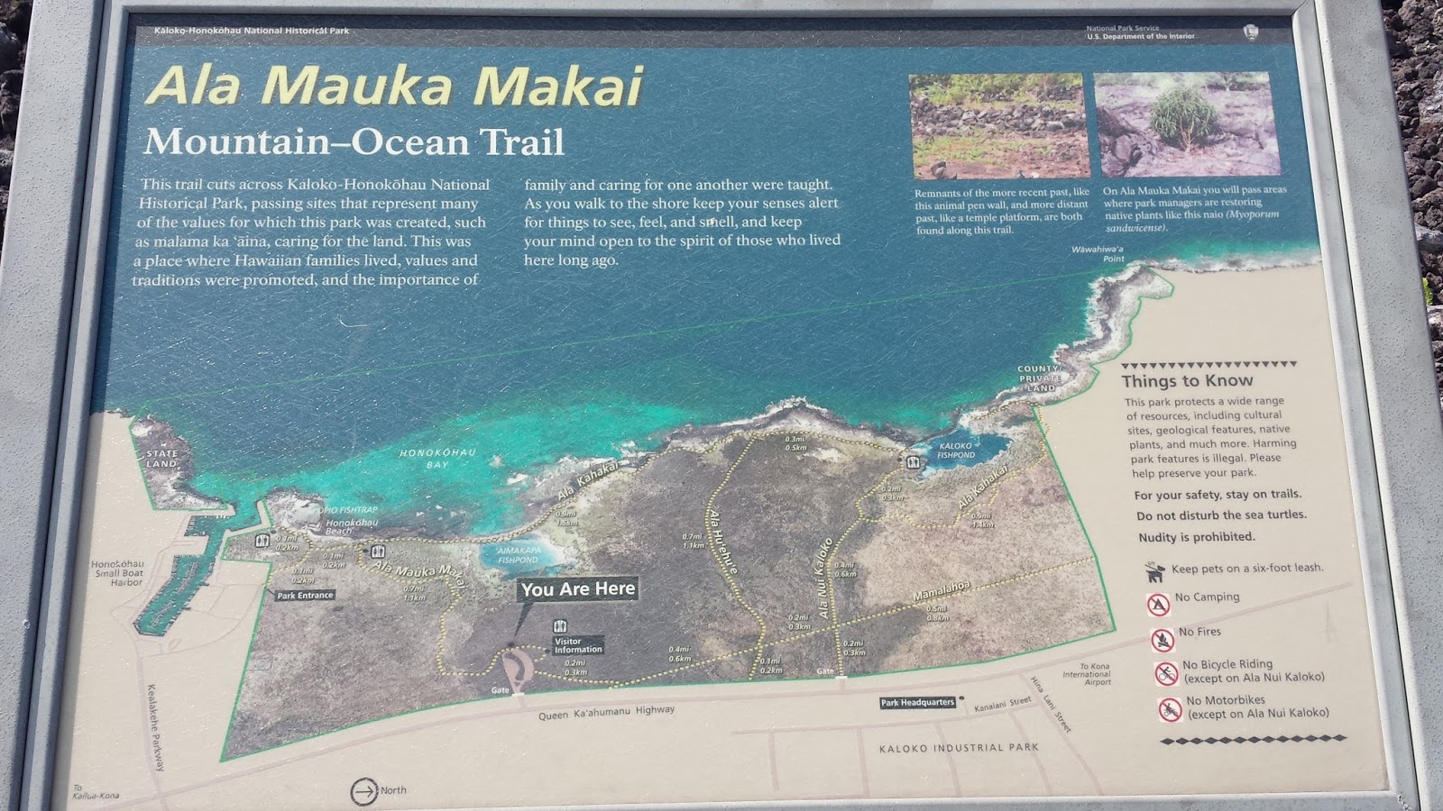 |
| This map was at the Visitor Center. I entered and walked the trail that starts top right. |
 |
| This is the entrance by the Honokohua Small Boat Harbor |
I entered from the Honokohau Small Boat Harbor and walked the 2 miles of the Ala Hele Ike Hawai’I Trail to the VC and back.. There were no brochures at this entrance. I did pass the Ai’opio Fishtrap, the Anchialine Fish Ponds, and a short petroglyph board walk trail.
 |
| Ancient Hawaiian Fish trap & beach |
Honokohau Beach, by the fishtrap, used to be known as a “nude beach” – not so since the NPS started to develop the land in 1978.
The ancient Hawaiians established an agricultural community here – on lava rock – because of a close to the surface fresh water source. The remains a heiau (religious temple) were on the trail to the VC. Of course, there were no interpretive markers.
There are a number of trails that extend north of the VC. Kaloko Industrial Park is directly across the street from the VC. This is an ancient Hawaiian homeland. In a conversation with a ranger, I Iearned that local residents petitioned to have NPS take the land or it surely would have been lost to development.
 |
| Pu'ukohola Heiau entrance sign |
Another 45 minute drive north past the airport along
Highway 19 is Pu’ukohola Heiau National Historic Site. A ranger identified this site as ‘the most
important historical site in Hawaii.’ He believe it so because this it tells the
story of Kamehamea, his rise to
power, and unification of the Hawaiian Islands.
 |
| Pu;ukohola Heiau map |
Pu'ukohola Heiau, one of the last major temples built in the Hawaiian Islands, was constructed by Kamehameha the Great from 1790 to 1791. Arguably one of the greatest leaders in Hawaiian History, Kamehameha became the first person to unite the warring islands into the Kingdom of Hawai'i. Pu'ukohola Heiau played a crucial role in the unification of the Hawaiian Islands, for Kamehameha built the temple as a result of a prophecy that came through a priest named Kapoukahi. Thiskahuna, or priest, told Kamehameha that if he were to build a heiau on the hill known as Pu'ukohola, and dedicate it to his family’s war god Kuka'ilimoku, he would be able to conquer all of the islands.
 |
| The story of the rise of King Kamehamea who united the Hawaiian islands. Doesn't this story of prophecy and birth sound familiar? |
 |
| After moving all those stones these Hawaiians must have been muscle bound. His rival should never ou were hunted down accepted the hospitality. From what I have read, there was no mercy for enemies i.e. if you were on the losing side you were hunted down and killed. Hence the Places of Refuge. |

 |
| The Heiau |
 |
| Pu'ukohola Heiau |
The VC was built in 2007. There is a ½ mile paved trail that runs to
the ocean and up to the heiau.
You are not allowed to gain entry to the heiau.
The drive time to the Summit (EL 10,023 ft) is about 2 hours. The Park Alert correctly identified the Headqaurters VC closed but does not mention that Heleakala VC (at the summit) was open.
During
the drive up it was cloudy, when at the Park Entrance
Station
(EL 7,000 ft) it cleared. Definitely above
the clouds – unexpected. It was
about 1 ¼ hours to drive the 22 miles from the entrance to the summit. The views – I don’t think the pictures really
can paint the picture.
I
did walk the short Leleiwi Overlook Trail (.5 miles round
trip. It provides a view of the cinder
cones and cliffs of Healeaka’s Wilderness Area that you cannot really see from
the road..
The
Haleakala Visitor Center (EL 9,740 ft)
is a small stone building built in 1933.
Staff were available here – manning a small bookstore. Several trails begin here.
The
last snow was in 2007. It began at 7,000 ft – the entrance station.
BOTTOM LINE: If you visit Maui – take an afternoon to drive to the summit of Pu’u’ula’ula in Haleakala National Park.
After the 2 hour and 40 minute drive, I met some friendly and helpful rangers at the VC. These rangers must like what they do. If you come here – you really have to want to come here. Radio reception is sporadic, because of the mountains, so I bought a Israel Kamakawiwo
’ole CD Facing Future . . . . . many of the same songs on other IZ CDs but different arrangements . . . just what I needed for the drive back to Kahului.

The Pipiwai
Trail (4 mile round
trip) is a forested trail with some boardwalks.
There is a 400 foot elevation change to arrive at the Makahiku
Falls Ovelook (.5 miles one way). The trail continues another 1.5 miles through
bamboo and guava forests to the base of Waimoku Falls.
There are more than one Warning Signs about the hazards of the trail –
it’s not all that bad.
This is a full day
venture. Mostly because of almost 6 hours on the road. Parts of the
bamboo forest are very dark at noon – I don’t think you want to be on this
trail when the sun is setting. I saw
plenty of 10-15 person tour buses – perhaps another way to enjoy the trails –
without the drive – but I’d check to see if I could bring a cooler along for some
refreshment on the trip back – leave the driving to the driver..
THURSDAY January 14, 2016
TRAVEL: Fly Leave Kahului, Maui 12:05pm –Arrive Hoolehua,
Moloka’i 1:35 pm, car
rental
Not much going
on in Moloka’i The main town is
Kaunakikai, it is not very
big. I don’t think there is a car
dealership on the island. I did stop and
see St. Joseph’s church built by Saint Damien. There was a monument there to a
Civil War Captain – that worked with Father Damien.
Found out later that Damien also built the Painted
Church near Kaelekukua on the Big
Island.
Hotel Molokai: I
finally found Hawai’i – for a
vacation I think I could spend more than a few days here. Good hotel – it has FREE
WIFI in the room –
but cell service only on a bench – but free phone to the mainland - laid back island - not many people – this place has a nice
room – on the ocean – there is a pool - views of Lana’i to the south – setting sun to the west. Tonight there was a very small Hawaiian
Wedding on the grounds
– a hula dancer – the blowing of the conch – there was live music – Hawaiian –
a 3 man group - at the bar – dinner on the ocean - a traditional Hawaiian male did a dance to
one of the band’s songs - locals come
here – I found Hawai’i
 Kaluapapa
Trail
(7.4 miles round trip – START EL 1,700
END sea level) – the trail is referred to by several names and print literature
and signs do not agree on its length and elevation.
Kaluapapa
Trail
(7.4 miles round trip – START EL 1,700
END sea level) – the trail is referred to by several names and print literature
and signs do not agree on its length and elevation.
 When Hansen's disease
(leprosy) was introduced to the Hawaiian Islands, King Kamehameha V
banished all afflicted to the isolated
Kalaupapa peninsula on the north shore of Molokai.
When Hansen's disease
(leprosy) was introduced to the Hawaiian Islands, King Kamehameha V
banished all afflicted to the isolated
Kalaupapa peninsula on the north shore of Molokai.
Since 1866, more than 8,000 people, mostly Hawaiians, have died at Kalaupapa. Once a prison, Kalaupapa is now refuge for the few remaining residents who are now cured, but were forced to live their lives in isolation. Not much more than a hundred people remain on in Kalaupapa – at least 40 are NPS personnel, another 40 work for the hospital, 10 work for Hawaii DOT to maintain the airport. – the remainder are islanders who were former patients. Most of these people are over 70. They are cured of Hansen’s disease but elderly, and some need constant care.
Hansen’s disease is caused by bacteria. Hansen
was a Norwegian who discovered this. It can be treated by pharmaceuticals.
Additionally, at least 95% of humans have a genetic resistance to the
disease. Therefore, the disease can only
be contracted by 4-5% of the human race.
It is transmitted through air and touch.
This was confusing. I paid the $50 – lunch was not included. I have no idea what the mule tour costs, but
lunch is included. The bus arrived about
1030 and got us back to the trail about 2pm – this is when I started the walk
up.
Sure-footed
Molokai mules are another way to
visit. Contact Kalaupapa Rare Adventure,
LLC for information about rates and reservations. The mule-ride operation
is located on 'topside' Molokai off Highway 470. near Pala'au State Park and the Kalaupapa Overlook.
The rain stopped when I got to the other side of the island near
Kaunakakai. I still think this is – Hawai’i. Much more to see on
Moloaka’i
- forget Maui
– I could have stayed here for 2-3 more days.
Hotel Moloka’i was overflowed with parked vehicles when I got back around 4:30 pm. Locals must have come to hear the group playing tonight – 4-8 pm. I took a shower, cleaned my shoes, did laundry, updated the blog and went to dinner around 7 pm. The group wasn’t that good – but it was Friday night – early crowd was full of Q-tips.
SATURDAY January 16, 2016
TRAVEL: Drove from the Hotel Moloka’i to the airport, caught the 0945 Makani
Kai flight to Honolulu, Oahu, called Charlie’s
Taxi for a ride to
the Hale Koa Hotel
HALE KOA HOTEL – opened in 1975 as an all ranks, all services
hotel. It’s mission is
“to provide a first class hotel and recreation facility at affordable prices for military members and their families.” It is owned by the Department of the Army on the site of Fort DeRussy.
Today the Hale
Koa is entirely
self-supporting with salaries and operating expenses, to capital improvement
projects all paid for with monies generated from the hotel’s operations.
Of course the
room was not ready yet at the Hale Koa so I walked to Snapper’s for a fish and chips lunch –
been here before – ‘a Wisconsin bar – in Hawaii’ – back to the Hale
Koa for an hour
around the pool – checked in – and headed back to Snapper’s for the Green
Bay – Arizona game.
A walk of about a mile to 8 am mass at St. Augustine by the Sea,
right across from Waikiki Beach and next
to Cheeseburger In Paradise. The priest
was polyneisan-Hawaiian. It appears
that many Tongans attend here as well as many tourists. A large church – at least 250 in
attendance. The group that provided the
music for the mass was better than any I’ve heard here in Hawaii. They could make recordings, guitar, bass,
rhythm, harmony. – all with a Hawaiian flavor.
Really done well. The church is
hosting a visit from a Pacific Cardinal at the noon mass and a seven choir concert
this evening.
This was my 4th
visit here. The park sites are adjacent
to the US Naval Base at Pearl Harbor. Hardly did I see a ranger, and the staff here
mostly selling tour tickets, refreshments, audio headphone tours and bookstore
items were helpful but not very knowledgeable.

The USS Utah
Memorial honors 429 sailors who died when the ship capsized.
I did not take the
shuttle to Ford Island, tickets are free but on a first come first served basis. I did
visit the museums that tell the story of December 7th and World
War II in the Pacific.
 Although
not yet open to the public, Honouliuli National
Monument
will tell the history of internment, martial law, and the experience of
prisoners of war in Hawai‘i during World War II. Honouliuli
will
be a place to reflect on wartime experiences and recommit ourselves to the
pursuit of freedom and justice. I
couldn’t find a ranger to tell me where this was located on Oahu. The NPS did have a
passport stamp for the site.
Although
not yet open to the public, Honouliuli National
Monument
will tell the history of internment, martial law, and the experience of
prisoners of war in Hawai‘i during World War II. Honouliuli
will
be a place to reflect on wartime experiences and recommit ourselves to the
pursuit of freedom and justice. I
couldn’t find a ranger to tell me where this was located on Oahu. The NPS did have a
passport stamp for the site.

In
the coming months and years, you will see more notices regarding the new
monument. Honouliuli National Monument is managed by staff of the National Park Service Pacific
West Region. I couldn’t find a ranger to tell me where
this was located on Oahu. The NPS
did have a passport stamp for the site.
Arrival at Pago
Pago (Pahn-go Pahn-go)
International Airport on Tutuila Island, about 9:35 pm Samoan Time – you go back an hour from
Hawaii time. Very humid and you have to go through customs again. The airport seemed more like a Mardi
Gras – not
celebrations - but plenty of people – welcoming those coming home – and
probably waiting to fly to Hawaii on the plane that just got in. I found Avis, who pawned me and several
others to a service called World Wide Car Rental – we’ll see how this works. Car rental in Samoa is expensive. I have a Toyota RAV4 – smells like garbage –
actually I think the windows were left open in the rain – I wondered why the
‘little tree’ air freshener was hanging from the mirror - on second thought the seats are covered - this is the Pacific - ner the equator - I think it's called the smell of mold.
Sadie’s By the Sea, restaurant, bar, beach, pool . . . . . . breakfast
at the on-site Goat
Island Café was serenaded
by alternating Frank Sinatra and Louis Armstrong songs – this place can’t be all that bad I am here
for 4 days.
The
National Park of American Samoa is open
24-hours per day, year round. The Visitor Center, park store, and headquarters
are open on weekdays from 8:00 am to 4:30 pm. However, they are closed on
weekends and federal holidays. Yesterday, Monday 18 Jan was Martin Luther King
Day. They were closed. Don’t visit here
on a weekend – closed. Sunday is a day
of worship – everything is closed – there are plenty of churches.
Turning down a road
with a sign National Park of Samoa, it took me to a trailhead identified as Fagasa.
Not having a map or know how long the trail was, and without water, I
didn’t hike the trail but headed back down the road. This was Fagasa
Pass. I found out later that this is the Mount
‘Alava Trail – a 7 mile
roundtrip hike through the rain forest to a coconut and banana plantation
Reaching the main coastal road (American Samoa DOT saves money by not having road signs) I turned left until I found another sign saying National Park of Samoa. I turned left and headed up a road and eventually reached two ‘remote’ coastal villages Afono and Vatia, on the other side of the island. I also found two sets of two park employees policing up the road. I knew I was in the park, they were very friendly and told me the road dead-ended and the VC was back in town ‘on the second floor . . . look for the flags . . . next to tire . . . . across from Pago Way Service Station’ I continued down the road
Polo Island Trail – a short .1 mile trail. Signs
warn of unfriendly dogs. The ranger said to drive on the unimproved road
eventually I did arrive at the end of the road and three interpretive signs.
The route back is up the seven ladders with ropes and down the trail with 20 switchbacks.
It took a little over an hour to walk this trail. It was hot and humid.
The trailhead is just before the Vatia School (Mount ‘Alava Elementary).
Lower Saima Ridge Trail – is a .4 mile round-trip - at first I thought it was longer but it only took a half hour to walk round-trip so a ½ mile is probably correct Billed as an interpretive trail – I didn’t find much interpretation except to find the archeological site of an overgrown ancient star mound.
There are views of
the northeast coastline and the Vai’ava Strait National Natural Landmark. The route to the rocks
was steep and slippery. I didn’t have a
walking sitck for balance and there were two people resting on the rocks below. I didn’t make the final descent and headed
back up. Looking north you can see the tall and skinny Pola
Island, a nesting place
for seabirds.
 America Samoa’s islands make up the eastern part of the Samoan
Archipelago. The people who live here are Polynesian.
Today, Samoan’s are regarded as the largest full blooded Polynesian race left in the Pacific.
America Samoa’s islands make up the eastern part of the Samoan
Archipelago. The people who live here are Polynesian.
Today, Samoan’s are regarded as the largest full blooded Polynesian race left in the Pacific.
I did drive to Aua and found the “fruit bat tree” along the road that the ranger on Tuesday recommended to stop and see. Ok – so I saw a bunch of bats hanging in a tree.
Blunts Point Trial – Couldn’t locate the trailhead of a .6 mile trail located between Faga’alu and Utulei on the coast road. This is not a trial in the
National Park of American
Samoa. The trailhead is supposed to be next IBM
Laundromat – tried twice
could not find it. About 5:30 pm I went out
and found the Blunts Point Trailhead – there is a laundromat but it has no name. I think I’ll walk up it tomorrow morning.
 Sadie’s By The Sea checkout time is noon. It would be ½ day’s rate to keep the room
until 6 pm. I decided to keep the room
for ½ a day. The plane is scheduled to leave atl 11:20 pm and the airport is open air – not comfortable – no bars or
restaurants – pretty bare bones. Got up
early to use WIFI and update the
blog – it was good until 6 am – then is
all but stopped – intermittent service –
not good enough to update the blog.
Sadie’s By The Sea checkout time is noon. It would be ½ day’s rate to keep the room
until 6 pm. I decided to keep the room
for ½ a day. The plane is scheduled to leave atl 11:20 pm and the airport is open air – not comfortable – no bars or
restaurants – pretty bare bones. Got up
early to use WIFI and update the
blog – it was good until 6 am – then is
all but stopped – intermittent service –
not good enough to update the blog.
Blunts Point Trial – Found the trailhead last night . A .6 mile trail located between Faga’alu and
Utulei on the coast
road. This is not a trial in the
National Park of American Samoa. The
trailhead is next to an unnamed Laundromat.
Stairs continued
on up so I climbed them and found a second gun and some girls listening to
music – apparently it’s semester finals and they were killing time after an
exam.
The stairs
continued up. I past some concrete
pillars but when the trail decided to head down back into the rain forest – I
turned around and headed back. The walk
up and down took about 50 minutes.
I tried again to
find the Fagatele Bay Trail but was unsuccessful. I didn’t have a map and believe I was always
taking the left one road early. The turn
left is after you go through Fatiga. I did find Vaitogi, a Turtle and Shark Legend
Site (no idea what the legend is).
The beach had a WWII pill box and a Rotary sponsored lifesaving ring.
I went to the US
Post Office (the only one
on the island) and got a medium flat rate box. I noticed the envelope I picked
up yesterday was wet – condensation from the water bottles in my pack
transferred to the envelope. Ouch! - - -
- - it also transferred to my National Park Passport Book page – now some of my Hawaii
and Arizona and California passport date stamps look like
blurs of green ink. Oh well this blog
documents my visits.
Stayed the extra half day at Sadie’s By The Sea. Packed, around the pool, read, somehow could nap. Check-out is 6 pm. Dinner at Sadie's By The Sea, then to the airport for the long wait and long flight - maybe I slept a little.
SUNDAY

8am Mass at St. Augustine By The Sea – about a one mile walk
through Waikiki Beach – this church is right across the road from the beach –
high rent property – right across the street is the beach named for Prince
Jonah Kuhio (Kuhio Beach Park). Same
musical group very good – a different priest – the “one body” reading from Paul.

Kuhio Beach Park and the prince has an good story.
Finished reading 2 short books, “Mark Twain In Hawaii: Roughing It in the 1860’s” by Samuel Langhorne Clemens “Mark Twain.” Twain came to Hawaii in 1866 to spend four months as a correspondent for California’s Sacramento Union. Twain drew on his articles to supplement this narrative published in 1872. Written in a light touch his humorist touch is evident as he describes Oahu, Hawaiian history, religion, legends, visits to Kealakekua, Honaunau -“The City of Refuge,” walks up the slopes of Kilauea and into the crater to the edge of the boil, and finally a visit to Maui and a walk up and through the 10,000 ft of Heleakala.
Hilton Guam Resort & Spa. A very nice
resort with resort prices. I will not have time to enjoy the facilities.
War in the Pacific National Historical Park was
established to commemorate the bravery and sacrifice of those participating in
the campaigns of the Pacific theater of World War II and to
conserve and interpret outstanding natural, scenic, and historic values and
objects on the island of Guam for the benefit and enjoyment of present and
future generations.
The T.Stall Visitor Center is a new museum with exhibits featuring the latest technology, gripping personal stories, museum artifacts, and multiple language support. needs. The VC is located just outside of the Naval Base Guam. If I would have researched and thought ahead I may have been able to get a room here.
The VC theater offers a compelling 10-minute movie, The Battle for Guam, in 4 languages (English, Japanese, Mandarin, and Korean). The film is captioned for hearing impaired visitors. I had a private showing. Mostly Japanese and Chinese visit.
 Asan Beach Unit - In June 1944, the United States Armed
Forces were ready to retake the island of Guam.
The Japanese also knew of this plan. Most of the permanent and elaborate
defense installations were placed at Tumon
Bay. On June 16, 1944 US cruisers, battleships, and aircraft bombed and
shelled Asan and Agat Beaches. The Japanese now knew
where they planned to attack.
Asan Beach Unit - In June 1944, the United States Armed
Forces were ready to retake the island of Guam.
The Japanese also knew of this plan. Most of the permanent and elaborate
defense installations were placed at Tumon
Bay. On June 16, 1944 US cruisers, battleships, and aircraft bombed and
shelled Asan and Agat Beaches. The Japanese now knew
where they planned to attack.
The
lead elements of the 3rd Marine Division
crossed the reef from 200 to 500 yards offshore and landed on Asan Beach, which was defended by the
Japanese 320th Independent Infantry Battalion and naval troops manning the
coastal defense guns. The plan was to fight between Adelup and Asan Points,
referred to as "the devil's horns". From east to west, two battalions
of the 3rd US Marine Regiment landed
on Beach Red 1, one battalion of the 3rd US Marine Regiment landed on Beach Red
2, three battalions of the 21st US
Marines came ashore on Beach Green, in the middle, and three battalions of
the 9th US Marines landed on Beach
Blue adjacent to Asan Point.
The 3rd Marine Division operation order
called for the three regiments to land abreast, capture the high ground
immediately inland, and prepare for further operations to the east and
southeast. Marines assaulted beaches, took Orote
Peninsula, and the land behind Asan
and the Force Beachhead Line from Adelup
Point to Mt. Chachao/Mt. Tenjo.
The Army's 77th Infantry Division
fought in Agat, and took Mt. Alifan and the Force Beachhead Line
from Facpi Point to Mt. Tenjo. The Asan
area was secured on July 28th, but
it took until August 10, 1941 to eliminate all organized resistance on the rest
of Guam.
Agat Bay Unit - Ga'an Point in Agat
was part of the southern landing site of the United States forces in
the liberation of Guam on July 21, 1944.
The southern landing area encompassed from Bangi
Island to Apaca Point. This area was strategically chosen in order to help
secure Orote Peninsula to the north.
Orote Peninsula was important because of the airfield and entrance to Apra Harbor as a supply port. The plan was to overtake Ga'an Point, where the entire beach front at Agat could be used to offload supplies and equipment that were critical for the inland advance.
The Japanese 38th Regimental Combat Team
had command post headquarters at Mt.
Alifan and the Japanese forces heavily fortified the area from Facpi Point to Agat Bay. The Japanese defense weapons placed at Ga'an Point included a single-barrel,
Japanese, dual purpose 25 mm machine cannon and a 200 mm short barrel naval gun,
a 25mm machine cannon, and a double-barreled anti-aircraft gun. The Japanese
also had extensive defenses consisting of numerous pillboxes built in coral
outcroppings, and concrete blockhouses that held a 75mm and 37mm gun to fire
upon the beaches. A Japanese inscription can be seen today in the concrete
blockhouse.
 On July 21, 1944, the first wave of the Southern Landing Force invaded Guam in Agat. The young men in the assault were
part of the 1st Provisional Marine
Brigade, which consisted of the 4th and 22nd Marine Regiments. The 4th Marines were to storm onto beaches
designated White 1 and 2, establish a beachhead, protect the flank of the
brigade, and then proceed to secure Mt.
Alifan. The 22nd Marines, after
landing at beaches designated Yellow 1 and 2, were to secure Agat Village and drive north and cut
off Orote Peninsula.
On July 21, 1944, the first wave of the Southern Landing Force invaded Guam in Agat. The young men in the assault were
part of the 1st Provisional Marine
Brigade, which consisted of the 4th and 22nd Marine Regiments. The 4th Marines were to storm onto beaches
designated White 1 and 2, establish a beachhead, protect the flank of the
brigade, and then proceed to secure Mt.
Alifan. The 22nd Marines, after
landing at beaches designated Yellow 1 and 2, were to secure Agat Village and drive north and cut
off Orote Peninsula.
 In 1944
Agat was centered more to the north and no buildings remain from the original
village.
In 1944
Agat was centered more to the north and no buildings remain from the original
village.
The
fighting at Agat was severe, particularly during the first night as the
Japanese 38th Regiment launched a major counterattack. Ultimately, it took 3 days to firmly establish the
southern beachhead.
On July
24, 1944, the reported losses of US forces numbered near 1,000. The island
itself was not declared secure until August
10, 1944. The total casualties for the Japanese forces from July 21 -
August 10 were estimated over 10,900.
 Asan Bay Overlook
was completed in 1994 in conjunction with the 50th Anniversary
commemoration of the Liberation of Guam, Asan Bay
Overlook
serves as a memorial to those that lost their lives or suffered atrocities
during the war. This unit features beautiful views of the sea-side villages of Asan and
Piti and a perspective of the landing beaches used
by Marines during the battle. The Asan Bay
Overlook
includes landscaped walkways,
established view sheds, and several commemorative bronze sculptures which
depict the events on Guam during
the World War II
Japanese occupation and battle in 1944.
Asan Bay Overlook
was completed in 1994 in conjunction with the 50th Anniversary
commemoration of the Liberation of Guam, Asan Bay
Overlook
serves as a memorial to those that lost their lives or suffered atrocities
during the war. This unit features beautiful views of the sea-side villages of Asan and
Piti and a perspective of the landing beaches used
by Marines during the battle. The Asan Bay
Overlook
includes landscaped walkways,
established view sheds, and several commemorative bronze sculptures which
depict the events on Guam during
the World War II
Japanese occupation and battle in 1944.
The
Asan Bay Overlook Memorial Wall contains the
names of 1,880 U.S. servicemen who died in the 1941 defense of Guam against the
attacking Japanese armed forces and those who died retaking the island from
Japan in 1944 along with the names of the 1,170 people of Guam who died and
14,721 who suffered atrocities of war from 1941.
Fonte Plateau Unit - Once a Japanese naval communications center, Fonte Plateau unit is
located on Nimitz Hill, overlooking Asan Bay. Site of one of the more bitter battles between the U.S. Marines and the Japanese, the high land of Fonte Plateau, later renamed to Nimitz Hill, was once the CINCPAC headquarters for Admiral Chester Nimitz. This is now part of the Naval Base.
 Based on my reading
of 1954 USMC monograph of “The
Recapture of Guam.”
Based on my reading
of 1954 USMC monograph of “The
Recapture of Guam.”
 Over 50,000
Japanese fighting men gave their lives in the defense of the three
islands.
Over 50,000
Japanese fighting men gave their lives in the defense of the three
islands.
Holiday Inn Old Sydney: Staff very
friendly and helpful - it was around 11am but my room was ready. I was looking forward to a day of rest & recuperation. Took a short walk and nap; updated the blog - WIFI works great
FREE because I am a
Holiday Inn member ELSE $18.95 per day
- got about an hour’s worth of sun at the pool.
The 8th floor has good views of the Sydney
Harbour Bridge. Located in The Rocks – plenty of shops, restaurants
and bars- a happening place. Took about
a mile walk down to a shopping mall of sorts . . . . called Westfield
Sydney. Lot’s going on here.
TRAVEL: Pre-arranged tour – 8:15 am bus pickup at the
Four Seasons Hotel, about a 10 minute walk down George Street. Arrived
at 7:55 asked bellman about pickup at 8:10 – he indicated that AAT
Kings Day Tours picks up at the
other side of the hotel Harrington St – my error I didn’t read the itinerary
completely.
THE SYDNEY SPECTACULAR TOUR – 9 ½ hour introduction to Sydney
STOP 1 AR 0900 Millson’s Point - is a suburb located in North Sydney at the north end of the Sydney Harbour Bridge. Along the harbor there ar good views of the Sydney Harbour Bridge and Opera House. The Sydney Harbour Bridge the 6th longest spanning-arch bridge in the world, and the tallest steel arch bridge. Australian’s simply call it ‘the bridge.’ The bridge was designed and built by a British firm and opened in 1932.
Sydney Opera House is a multi-venue performing arts center,identified as one of the 20th century's most distinctive buildings. Designed by Danish architect Jorn Utzon, the building was formally opened on 20 October 1973, after Utzon’s design was selected in 1957 as winner of an international design competition. People living across the harbor opposed construction believing it would devalue their property. The Sydney Opera House became UNESCO World Heritage Site on June 28, 2007.
STOP 2 AR 0950 Arabanoo Lookout -
Arabanoo was an indigeneous Australian forcibly abducted by the European settlers of the First Fleet at
STOP 3 AR 1029 Manly Beach This was a 30 minute stop. Manly Beach was named by Captain Arthur Phillip for the indigenous people living there – he wrote that the native people's “confidence and manly behavior made me give the name of Manly Cove to this place".
Stop 4 AR 1155 Kings Wharf – Darling Harbour – I upgraded and took a two hour
Captain Cook Harbor Cruise – lunch was buffet – adequate –it was a good place
to spend time while a thunderstorm passed through for most of the cruise. At
least I saw another part of the harbor.
The rain stopped just about the time we got off.
STOP 5 AR 1440 Mrs. MacQuaries Chair. The location provides one of the best vantage points in Sydney.
The historic chair was carved out of a rock ledge for Governor Lachlan Macquarie's wife, Elizabeth, as she was
known to visit the area and sit enjoying the panoramic views of the harbor.
STOP 6 AR 1545 The Gap is an ocean cliff on the South Head peninsula in eastern Sydney. The area, which faces the Tasman Sea, is located in the eastern suburb of Watsons Bay, in the municipality of Woollahra, near South Head. We stopped here just long enough for a few photos.
STOP 7 AR 1605 Bondi Beach is a popular Sydney beach attracts an average of
10,000 people a day. It can hold up to
30,000. The coach guides kept reminding people
to always "swim between the flags", i.e. always swim between the red and yellow
flags to avoid dangerous rip tides. It
is pronounced Bon-dye Beach.
WEATHER: 67 at 7 am sunny and clear;
cloudy on the drive to the Blue Mountains then it cleared low 70’s, cool
and pleasant walking the Jameson Valley; rained on the drive from
Luera to Featherdale
Wildlife Park (2pm-3pm);
cleared then clouded up; thunderstorm, lightning and heavy-heavy rain on the
drive from Featherdale to the cruise pickup point on the Paramatta River near the Year 2000 Olympic
Park &
Village; stopped for
the walk from Circular Quay (Opera House) back to the Holiday Inn.
Sunrise 6:14 AM –
Sunset 8:02 PM days are getting shorter down here
A bit more
background – the Blue Mountains received their name from the vapor released from eucalyptus trees which
creates a blue mist. Quite frankly I
didn’t notice anything blue about the mountains at all . . . . The 3 explorers who first found a route
through the Blue Mountains were named Blaxland, Wentworth and Lawton. There is a town named after each on the east
side of the mountains. There are at
least 5 Australian National
Parks within the Blue
Mountains.
STOP 1 AR 1000 Scenic World The entry ticket was not included in the tour, I
bought one for $30 AUS. We spent a little over 2 hours here. Scenic World is privately owned in the middle Blue Mountains NP.

STOP 2 AR 1230 Echo Point Lookout – this was a 15 minute drive. We got off the bus near where one end of the Skyway from Scenic World terminates. Thee are trails that lead to the Three Sisters and Katoomba Falls. With enough time, these appear to be worthwhile walks.
STOP 3 AR 1310 Leuria – a lunch stop that reminded me of many places I’ve
visited – plenty of restaurants and shops.
SUNDAY January 31, 2016
St. Patrick’s Church is located several blocks away. Opened
on March 18, 1844, a date supposedly avoided so as not to mar St. Patrick’s Day
with inebriated revelers and religious bigotry.
It claims to be one of the oldest Catholic Church’s in Sydney. It has been run by the Marist
Fathers (Society of Mary) since 1868.
Interesting service – about 70 in attendance – the priest entered from the
sacristy but exited from the front
(holy) door.
 The 2nd
reading today was “love is patient . . .
. . the only three things that last
are faith, hope and love, and the greatest of these is love” Appropriate for an anniversary. The priest had a good homily – seemed liked a
prelude to my visit to the Australian Museum – taking a theme from the gospel
‘prophets are not recognized in their own time: - he went over the injustice
and apology given to the Aboriginal peoples – Australia seemed to take after
America in bigotry, racism, eradication of indigenous people and in the vein of
Obama – an apology in 2008 by the prime minister.
The 2nd
reading today was “love is patient . . .
. . the only three things that last
are faith, hope and love, and the greatest of these is love” Appropriate for an anniversary. The priest had a good homily – seemed liked a
prelude to my visit to the Australian Museum – taking a theme from the gospel
‘prophets are not recognized in their own time: - he went over the injustice
and apology given to the Aboriginal peoples – Australia seemed to take after
America in bigotry, racism, eradication of indigenous people and in the vein of
Obama – an apology in 2008 by the prime minister.
My intent was to
walk to Hertz, to get
bearings for tomorrow – in the process I stopped at Hyde
Park, the Australian
Museum was well worth
the price of admission – spent more than 2 hours in the museum. The museum was just a block from Hertz. However by the time I finished with
the museum, Hertz was already
closed 15 minutes. Well, at least I know
where it is. There were 3 levels with
several galleries. The Ground Level
housed the Original Long Gallery, First Australians, and Wild
Planet.
The 2nd
Level housed several mineral collections – a rival to the mineral collection in
the UP of Michigan near the School of Mines.
The 4th
Level contains the Rooftop Café. Is is not open air but has great
views of Sydney.
On the walk back
I passed many of the places the tour bus passed on Friday such as: St Mary’s Cathedral (Australia has a St. Mary), the Hyde
Park Barracks
Museum, the Sydney
Hospital, the Parliament
House, and State
Library.
I continued the
walk to Circular Quay and walked around the Opera House.
I did not take
the offered tour. I did have an excellent lunch at a restaurant with outdoor service on walk of Circular Quay just before the Opera House..
TUESDAY January 12, 2016
WEATHER: normal for Hawaii, 70’s in Kona,
clouds forming on the mountains – same in Maui plenty of clouds around the
mountatins
TRAVEL:
Fly Leave Kailuea-Kona, Hawaii 10:28 am – Arrive Kahului, Maui 11:03 am, car rental,
travel to Maui Beach Hotel then Haleakal National Park
Maui Beach Hotel. Not much to say about this place. At 1130 my room wasn’t available – the hotel
and rooms are clean. The room is small,
older hotel, well kept, no beach, no pool, NO WIFI, warm water I've taken colder showers..
I originally thought I’d sit around the pool
for an afternoon – Not - there is no pool. I decided to drive to Haleakala
National Park – Summit Unit . I was
concerned but it turned out to be a good decision.
264 HALEAKALA National Park, Island of Maui, Hawaii
The item below was
on the website:
PARK ALERT: Headquarters Visitor Center restrooms (7000 ft of
elevation) are open. The building remains closed for renovations. Haleakala
Visitor Center at the summit will issue backcountry, camping, and cabin permits
from sunrise to 3pm
It continued to warn that a visit to Haleakalā National Park includes the remote Summit and Kīpahulu Districts. An ambulance can take up to 45 minutes to
arrive at either district. This sounds like Death Valley and other parks in the southwest.
 |
| Heleakala National Park on the Island of Maui. The Park HQ Visitor Center (EL 7,000 ft) was closed. There is another VC, that was open, at the Summit (EL 10,023 ft) but even this map does not identify it. I drove around the island (3 hours) to reach the Kipalulu VC on Wedensday. |
The drive time to the Summit (EL 10,023 ft) is about 2 hours. The Park Alert correctly identified the Headqaurters VC closed but does not mention that Heleakala VC (at the summit) was open.
 |
| Haleakala - map of the road to the summit - plenty of trails to walk |
 |
| Kalhaku Overlook |
There
are plenty of trails – day trips to overnights in the wilderness. A popular hike is the 11 mile full-day hike
which ends at the Halemau’u Trailhead but begins at the
Keonehe,ehe,e Trailhead 7 miles up the
road. A downhill, walk – of course you
need someone to drive you to the top. NPS suggests start early and another park
visitor will take you to the top – sure . . . .
 |
| Leleiwi Overlook |
 |
| Heleakala VC EL 9,740 ft |
The
Pu’u’ula’ula Summit (EL 10,023 ft)
features an enclosed viewing are.
Although there was little wind on the mountain – there was a cool wind
at the summit. The clouds below are
ever-changing cloud formations and the views of Mauna
Kea
and Mauna Loa (85 and 100 miles to the SSE) on the Big Island of Hawaii were a
surprise. There is an astronomical
observatory here also.
 |
| Haleakala Summit (EL 10,023 ft - looking to the Big Island of Hawaii Mauna Kea is on the left - Manau Loa on the right - well above the clouds |
On the trip down the road I stopped at the Kalahaku
Overlook (on a dangerous
curve up and only accessible on the road down).
Again great views down the mountain.
There is a short path to a viewpoint.
BOTTOM LINE: If you visit Maui – take an afternoon to drive to the summit of Pu’u’ula’ula in Haleakala National Park.
WEDNESDAY January 13, 2016
WEATHER: another Hawaii day
TRAVEL:
Maui Beach Hotel – Starbucks (for WIFI and
update pictures to the blog) – drive along the coastal road to the Kipahulu Unit of Haleakala National Park ( a 90 mile – 3
hour drive one way) I started the drive
from Left at 8 am and arrived 10:40 am.
Most of the drive was on 50 miles of curvy winding road – average speed
less than 25 mph and an unbelievable amount of one way bridges – over 40 . . .
. at least 30 miles of this road is cut right along the side of the mountain.
The State of the Union was given last night – “story time with Barack Obama” Chris Christy . . . . “a state of denial” Ted Cruz . . . .
“living in a fantasyland” Donald Trump vitriolic rhetoric?
“we need a problem solver . . . not another political speech” Bill O’Reilly
- and
in the face of Iran’s capture of 2 small US Navy vessels and freeing the
sailors, were going to close and give Iran a $100 billion deal - “the most powerful nation in the world
. . . . the state of our Union is strong” Barack Obama.
Went to Starbucks for FREE WIFI – few electrical
outlets and extremely slow download for pictures to the blog, but it saves
connect hours to the phone. . Spent an hour here – got very little done. .
HALEAKALA National Park – Kipahulu District,
Maui


After the 2 hour and 40 minute drive, I met some friendly and helpful rangers at the VC. These rangers must like what they do. If you come here – you really have to want to come here. Radio reception is sporadic, because of the mountains, so I bought a Israel Kamakawiwo
’ole CD Facing Future . . . . . many of the same songs on other IZ CDs but different arrangements . . . just what I needed for the drive back to Kahului.
The ride to this
site is a little of Road America, reminiscent of travel in the Sierra’s and Sequoia
National Park, and it could be a
road in Jurrasic Park without the dinosaurs.

 |
| Healeakal NP Pipiwai Trail - bamboo forest |
The Kuloa
Point Loop Trail (.5 mile loop)
starts at the VC and provides view of the ocean and archeologic sites. There is a 80 ft change in elevation each
way. Hikers can swim in the three pools
below the waterfall.
 |
| Haleakal NP Pipiwai Trail - boardwalk |
 |
| Haleakal NP End of the Pipiwai Trail Waimoku Falls |
 |
| Healeakala NP Pipiwai Trail |
 |
| Haleakala NP - Kuloa Loop Point Trail the end of the 3 pools/falls at the ocean |
 |
| Haleakala NP Kuloa Point Loop Trail 1st fall and pool |
THURSDAY January 14, 2016
WEATHER: just like Hawaii
 |
| North Coast of Molaki'i from Mankani Kai 10 seater airplane |
 |
| Mule Barn - empty - it was 3 pm and they were most likely still on the trail |
Went to Starbucks before the flight - again for WIFI – incredibly slow
– takes forever to download a picture for the blog. Hundreds of pictures will only post a small
portion.
I met an
interesting person on the Makani Kai Charter flight here – a 10 person plane
– short flight – I gave the person a ride to a condo complex renting for 6
months – pleasant conversation.
 |
| St. Joseph Church built by Father Damien on the south shore of Moloka'i |
Drove to Kaluapapa
Overlook - this could be a disaster but the mule tour to
Kaluapapa National Historical Park, which I
thought I had made a reservation for
- well – NOT. So I decided that I would walk the 3.2 mile one way, 1,700
foot descent to Kaluapapa – booked a walk on line for 0745. Hope this works out – Yes, it is 1,700 feet
uphill also.
 |
| Kalaupapa from the Kalaupap Overlook at the end of the road |
 |
| Hotel Moloka'i reception |
 |
| Hotel Moloka'i sunset from the dinner table |
FRIDAY January 15, 2016
WEATHER: Hawai’i temperature 70’s –
cloudy on the northern shore, surf was up and by 3pm the sky cried. Climbing back up the Pali
reminded of a
scene from Hambruger
Hill with the rain
coming down, except that I wasn’t slipping all over the mud and people weren’t
shooting at me- but there was mud and mule poop.
TRAVEL: Drove to the Mule Barn – no organization
there – walked to the gate where it says DO NOT ENTER – thought there would be a group
going doing and up – NO – Do
It Yourself so I started
down the trail. 3.2 miles one way and a
descent of 1,700 feet and it still had mud and mule poop - like do think anybody would really clean it up - let nature run its course - It took me 1 hr and 40 minutes to get the
bottom.
 |
| St. Damien contracted Hansen's Disease - and died at Kalaupapa, Moloka'i |
265 KALAUPAPA National Historical Park, Moloka’i
 |
| Kalaupapa Trail - view on the way down the trail |
 Kaluapapa
Trail
(7.4 miles round trip – START EL 1,700
END sea level) – the trail is referred to by several names and print literature
and signs do not agree on its length and elevation.
Kaluapapa
Trail
(7.4 miles round trip – START EL 1,700
END sea level) – the trail is referred to by several names and print literature
and signs do not agree on its length and elevation.
Kalaupapa
NHP
ranks with one of those – you really have to want to visit. However, if on Moloka’i, I don’t see how you couldn’t want to visit here. Make reservations for the mule ride at least
2 weeks or more in advance. A lot less
stress than the trail.
 |
| These waves were next to the trail on the way down. Going up they some of the big ones were actually on the trail. I wasn't expecting to be inundated with water up to the crotch on the way up. It caused concern because now my shoes and socks were wet for the arduous walk up. |
 |
| Gravesite of St. MArianne Cope a 2nd Saint of Moloak'i who worked with St. Damien |
 When Hansen's disease
(leprosy) was introduced to the Hawaiian Islands, King Kamehameha V
banished all afflicted to the isolated
Kalaupapa peninsula on the north shore of Molokai.
When Hansen's disease
(leprosy) was introduced to the Hawaiian Islands, King Kamehameha V
banished all afflicted to the isolated
Kalaupapa peninsula on the north shore of Molokai. Since 1866, more than 8,000 people, mostly Hawaiians, have died at Kalaupapa. Once a prison, Kalaupapa is now refuge for the few remaining residents who are now cured, but were forced to live their lives in isolation. Not much more than a hundred people remain on in Kalaupapa – at least 40 are NPS personnel, another 40 work for the hospital, 10 work for Hawaii DOT to maintain the airport. – the remainder are islanders who were former patients. Most of these people are over 70. They are cured of Hansen’s disease but elderly, and some need constant care.
 |
| Kaluapapa National Historical Park HQ |
Kalaupapa National Historical Park is dedicated to
preserving the memories and experiences of the people forcibly sent here so
that valuable lessons may be learned. The park is now more than thirty years
old, having been established December 22, 1980. The park's mission is to
provide a well-maintained community that ensures the present patient-residents
of the Kalaupapa Settlement may live
out their lives peacefully and comfortably. The park supports education
concerning Hansen's disease
(leprosy), a disease shrouded in fear and ignorance for many centuries.
 |
| The Damien Tours Bus parked in Kalawao. This was the lunch stop. |
To
visit Kalaupapa, visitors must take the commercial tour offered through Damien Tours, which is owned and operated by a Kalaupapa resident. The tour provides stops at all major points of
interest at Kalaupapa, including the
NPS Kalaupapa Bookstore. The tour
stops for lunch at Kalawao on the
windward side of the peninsula with scenic views of the north shore cliffs and
off-shore islands.
 |
| Kalaupapa The surf was up |
The walk back up took just about 2 hours – yes it was muddy –
and the surf was up. For a while , I
wasn’t sure I was on the right trail .
At one point, about ..2 of a mile along the trail the waves crashed onto
the shore and covered me with water to my crotch. A bit scary - if more waves would have
continued to crash that high. It made
the walk up a little more concerning – wet socks and boots and shorts.
It didn’t really matter, the sweat soaked my shirt within a ½ hour - a about one hour up the trail it started to rain. Even so, I think I’d do this again.
 |
| Hotel Molokai |
 |
| This was the Thursday night group They were good Note the Packer Fan |
Hotel Moloka’i was overflowed with parked vehicles when I got back around 4:30 pm. Locals must have come to hear the group playing tonight – 4-8 pm. I took a shower, cleaned my shoes, did laundry, updated the blog and went to dinner around 7 pm. The group wasn’t that good – but it was Friday night – early crowd was full of Q-tips.
SATURDAY January 16, 2016
WEATHER: another day in Hawaii
 |
| Diamond Head from the air |
 |
| Makani Kai airlines boarding in Moloka'i |
No TSA checks when you fly Makani
Kai and the
terminal, if you want to call it that, is on the other side of the field in
Honolulu.
 |
| Honolulu - Waikiki a land of concret towers - the green pace with the two short towers is the Hale Koa/Fort DeRussy Really the only green space along Waikiki Beach - peaceful compared ot he commercial ventures cccupying the land |
 |
| Hale Koa Hotel - Street Level View Yes, there is an army guard at the entry point on the road |
“to provide a first class hotel and recreation facility at affordable prices for military members and their families.” It is owned by the Department of the Army on the site of Fort DeRussy.
Fort DeRussy was established in 1906, on a 72 acres parcel of land in
Waikiki that was then,
considered undesirable. At that time
only the Mona Hotel was in Waikiki. Battery Randolph, now an army museum, was built
as a coastal defense fort with walls 20 feet thick.
 |
| Hale Koa - mao |
This was my 3rd
stay here and it truly is the gem of Waikiki Beach because of it’s green
space. Except for a small private part
of the Royal Hawaiian Hotel everything in Waikiki is paved or built upon.
A stay at the
Hale Koa is reason enough to visit Hawaii – truly a resort with several
restaurants, bars, three swimming pools, a spa, a small PX and a variety of
weekly entertainment ranging from a Luau, to comedy, to a Magic In Paradise
Dinner show.
Tour, travel and
rental car services are also offered at the hotel-resort.
 |
| The best thing about a Wisconsin Bar is when its in Hawaii |
A family member reminded
me, via text, that January 8 was James Longstreet’s b-day – OK it’s on my calendar
for next year.
Arizona 26 – Green Bay 20 – it was a good game -
tied - but the Cardinals won it
in overtime. End of the season.
FREE FAST WIFI and the best sleep at the Hale
Koa since I started
this trip.
SUNDAY January 17, 2016
WEATHER: another day in paradise
TRAVEL: walk to St. Augustine by the Sea for mass and cab rides to and from the Arizona
Memorial. I should have rented a car for the money
spent on cabs.
 |
| St. Augustine By The Sea Waikiki |
266 WORLD WAR II VALOR IN THE PACIFIC National Memorial. Pearl
Harbor, Oahu
 |
| World War II Valor In The Pacific National Monument Entrance |
The park has
several areas to visit. Museums and a Navy Shuttle to the Arizona
Memorial. I’ve been on the Arizona
Memorial and the Battleship
Missouri. I’ve never had
the desire to walk through the USS
Bowfin submarine – I
guess several times through the sub moored in Manitowoc gave me the picture.

Central to the
parks mission is memorializing those who fell during the attack on Oahu on
December 7, 1941.
The USS Arizona Memorial is built over the sunken hull of
the ship. It honors the 1,177 crewmen
who died. The hull is the tomb of over
900 sailors who remain within. Oil still
bubbles up from the Arizona.
 |
| Ford Island in Pearl Harbor - Battleship Row USS Arizona- right USS Misssouri- mooored left |
 |
| Japan's Concquest's in the Pacific Dec 1941 - Feb 1942 |
Other park sites
include the Battleship Missouri Memorial and the Pacific Aviation Museum.
 |
| Direction of Japaanese Torpedo Attack on Ford Island Battleship Row is to the right - they are named after states. The 3 ships on the outside right to include the USS Arizona are not named here. |
267 HONOULIULI National Monument
 Although
not yet open to the public, Honouliuli National
Monument
will tell the history of internment, martial law, and the experience of
prisoners of war in Hawai‘i during World War II. Honouliuli
will
be a place to reflect on wartime experiences and recommit ourselves to the
pursuit of freedom and justice. I
couldn’t find a ranger to tell me where this was located on Oahu. The NPS did have a
passport stamp for the site.
Although
not yet open to the public, Honouliuli National
Monument
will tell the history of internment, martial law, and the experience of
prisoners of war in Hawai‘i during World War II. Honouliuli
will
be a place to reflect on wartime experiences and recommit ourselves to the
pursuit of freedom and justice. I
couldn’t find a ranger to tell me where this was located on Oahu. The NPS did have a
passport stamp for the site.
In 2002, the Honouliuli site was
discovered by volunteers from the Japanese Cultural Center
of Hawai'i. Since that time, Honouliuli has become
the subject of scholarship and awareness campaigns.
President
Barack Obama
announced the designation of Honouliuli National Monument by Presidential
Proclamation on February 19, 2015. Honouliuli National Monument is a new national park
unit without formal services and programs at this time.

MONDAY January 18, 2016
WEATHER: another day in Hawaii
TRAVEL: Fly Left Honolulu, Oahu Hawaii 4:45 pm - Arrived Pago
Pago, American
Samoa, rented a car
Updated the blog
and breakfast -visited the pool area again for an hour of sun. Checked out of the Hale
Koa at noon –
stored my bags – it was a Monday - the Army Museum at Fort
DeRussy was closed, read and caught a cab to the Inter
Island Terminal around 3:00 pm. Had to go through customs – you need a
passport to get to American Samoa.
The Hawaiian
Airlines flight was
better than expected. It’s the only
commercial carrier flying to American
Samoa – there are two
flights leaving Honolulu weekly. Scheduled for 4:45 pm it
took off at 5:10 pm. It was a 5 hour and 25 minute flight. I was served a meal and haven’t ever been charged for a bag by Hawaiian.
I sat next to a NPS employee – a
Samoan – who works as a dive enforcement officer for NPS. A friendly guy – perhaps I’ll run into him
again over the next few days.
 |
| Sadie's By The Sea entrance |
It was dark and
I was tired but after 4 round-a-bouts, a right turn and 20 minutes along the
coast road I found Sadie’s By The Sea.
Sadie’s By the Sea. The AC is
run by a remote and runs only when the key card is in a slot – similar to the
condo in Kona – the AC remote was unique.
It was humid but cooled quickly.
A large room with a king bed, TV, FREE WIFI, microwave, frig, and bath. I went to bed.
TUESDAY January 19, 2016
WEATHER: partly cloudy to mostly sunny LOW
81 HIGH 91s
TRAVEL: National Park of American Samoa,
on the island of Tutuila
 |
| Sadies By the Sea - beach |
 |
| Sadies's By the Sea Pago Pago Harbor - view from dining room |
268 NATIONAL PARK OF AMERICAN SAMOA
American Samoa, the only U.S. territory south of the Equator, consists of 10
rugged, highly eroded volcanic islands (five inhabited) and two coral atolls
(one inhabited). The land area of the territory is 76 square miles.
 |
| American Samoa - Pago Pago Harbor - formed by the collapse of a volcanic crater Tot the right (white) are the tuna ships and the Starkist Tun factory Tot the left is the Port of Pago Pago |
The
islands are located 2,600 miles southwest of Hawaii and 1,800 miles
northwest of New Zealand, between Fiji and Tahiti.
The Samoan chain stretches east to west for more than 300 miles between 13 and
15 degree south latitude (below the Equator). It is just east of the International Date Line, in the time zone that is one hour
earlier than Hawaii.
 |
| American Samoa - Tutulia Island - Villages and Trail Heads and national LandmarksN 6-Fagasa Pass Trail 1-Pono Island Trail 10-Tuafanua Trail 2-Lower Saima Ridge Trail 4-Blunts Trail 3- Fagatele Bay Trail 12-Le'ala Shoreline Trail |
Flying here was the
first time I crossed the equator.
 |
| NP of American Samoa Visitor Center entrance on the right Located on the second floor of this building |
It took me a while
to find the VC – passed it on the
road twice. It is on the second floor of
a building next to a Toyoto dealer and across the street from a gas station,
but I did find the park.
 |
| American Samoa Sign at Fagasa Pass |
 |
| American Samoa Fagasa Pass Trailhead |
Reaching the main coastal road (American Samoa DOT saves money by not having road signs) I turned left until I found another sign saying National Park of Samoa. I turned left and headed up a road and eventually reached two ‘remote’ coastal villages Afono and Vatia, on the other side of the island. I also found two sets of two park employees policing up the road. I knew I was in the park, they were very friendly and told me the road dead-ended and the VC was back in town ‘on the second floor . . . look for the flags . . . next to tire . . . . across from Pago Way Service Station’ I continued down the road
This
park is relatively new and remotely located - ready for an exploring spirit. I eventually did find the VC
and a ranger there provided a day hike trail map and suggested several trails
to walk. The ranger indicated that the
park gets about 3,000 visitors annually, including some people from 20 cruise
ships that make port here in a year’s time.
Driving
the coast road, most of the people live on the coast - the rest is
mountains, I discovered a fairly large
port/harbor with a Starkist Tuna Factory – it’s a fish
processing plant – I didn’t stop to take a picture of Charlie the Tuna. It
appears fishing is a major part of the economy.
I
stopped at the airport to see if Avis would give me a
25% discount because of my USAA affiliation – the agent there was
clueless – only an order processor – same guy that pawned me off to World
Wide Car Rental yesterday. It cost
$3 to park and no discount.
I
found several schools, a high school near the airport and another near Pago Pago. The kids in
all the schools, wear uniform white shirts/blouses and the traditional lava
lava (sarong) skirt. The pattern/color of the lava lava is unique to the
school. School appears to let out around 2 pm they
either walk or take many of the local buses home.
There
is one ACE Hardware store that sells everything from nuts and bolts to
appliances, two McDonald’s, at least one car dealership but few
cars. Most of the homes are not air
conditioned. The island power plant
appears to be fueled by oil. There are
no chain restaurants or hotels/motels. I
did see one police cruiser and a motorcycle cop.
Sadie’s By The Sea – in the evening it appears the a mix of 50’s to 80’s
is played in the
Goat Island Café – mostly early
60’s
WEDNESDAY January 20, 2016
WEATHER: another day in Samoa, sun comes
up around 6 am, sets around 7pm.
TRAVEL: American Samoa
268 NATIONAL PARK OF AMERICAN SAMOA
I took the same
road as yesterday through Afono and Vatia to the end of the
road.
 |
| Polo Island Trail This is the road to the trail head |
 |
| Polo Islnd Trail End of the road 3 signs |
The interpretive signs
at the end of the road covered the swiftlet – a small bird that nests in
caves, the breadfruit and the laufala – art of weaving baskets
and cloth.
It was a short
trail through the rain forest to a rocky beach.
Tuafanua Trail – a 2.2 mile round-trip from Vatia Village through tropical rain forest to
the coast. This is a “up-down two-time”
trail. The route up has 20 switchbacks
covering at least 400 feet of ascent.
The steep descent is down seven ladders (steps) with ropes to a quiet,
rocky beach. I only lost my balance once on the way down – thank goodness I was
holding on the rope. The trial ends on a
rocky beach with a different view of Polo Island and Vai’ava
Strait.
 |
| Polo Island Trail rocky beach |
 |
| Polo Island Trail Start of the trail |
 |
| Polo Island Trail End of the Trail |
 |
| Tuafnua Trail Several Hermit crab were on the trail going up. This one decided on a plastic cup shell. |
 |
| Tuafanua Trailhead - marked with orange ribbon |
There are plenty of
little black lizards called skinks, on the trail and birds in the trees. The lower part of the trail had a number of
hermit crabs – reminded me of the trail to the beach on St. John’s, Virgin Islands.
 |
| Tuafanua Trail this was the last rope ladder. Coming down I slipped to the right - left on the picture. Good thing I had hold of the rope. |
 |
| Tuafanua Trail This was the end of the 1st rope ladder and start of the 2nd looking up. |
 |
| Tuafanua Trail end of the the trail |
The route back is up the seven ladders with ropes and down the trail with 20 switchbacks.
It took a little over an hour to walk this trail. It was hot and humid.
The trailhead is just before the Vatia School (Mount ‘Alava Elementary).
 |
| Tuafnua Trail - the beach and the reverse view of Vai'ava Strait |
 |
| Lower Saima Ridge Trail - Interpretive Marker |
Lower Saima Ridge Trail – is a .4 mile round-trip - at first I thought it was longer but it only took a half hour to walk round-trip so a ½ mile is probably correct Billed as an interpretive trail – I didn’t find much interpretation except to find the archeological site of an overgrown ancient star mound.
 |
| Lower Saima Ridge Trail Vai'ava Strait National Landmark & Polo Island from the top of the trail |
I headed back to
the hotel, had lunch at McDonald’s and intended to read and sit around the pool. I was beat – I laid down and fell asleep –
rain forest hikes drained me of energy pretty good.
Sadie’s By The Sea – the WIFI code expired, I got a new from the desk
– this time the connection for downloads is much slower – like Starbuck’s on
Maui - slooooow
 |
| American Samoa National Natural Landmarks |
THURSDAY January 21, 2016
WEATHER: mostly cloudy in the morning 80’s, short rain between 10 and 11 am
TRAVEL: Jean B. Haydon
Museum – US Post Office – NP of American Samoa VC – Aua (fruit bat tree) – attempted to find the
Blunts Point Trail 2x but could not
find the IBM Laundromat where the trail starts – attempted to find the
Fagatele Bay Trail but missed the
turn – it started to
rain - returned to
Sadie’s By The Sea
Sadie’s By The Sea – WIFI unreliable
and slow this morning, lost about
1 ½ hours worth of updates to the blog. WIFI hasn’t been the same since the
code changed.
This morning’s breakfast music was a mix of Richie Valens “Donna,” Fats Domino “Blueberry Hill,” Frankie Avalon, “Venus,” Brian Hyland, “Sealed With A Kiss,” The Shirelles, “Dedicated To The One I Love.” I was waiting for “Get A Job” but it seems a good number of Samoan businessmen meet here for breakfast – wearing a lava lava, long sleeve shirt and tie, and leather sandals - retirees appear more casual they wear flip flops.
This morning’s breakfast music was a mix of Richie Valens “Donna,” Fats Domino “Blueberry Hill,” Frankie Avalon, “Venus,” Brian Hyland, “Sealed With A Kiss,” The Shirelles, “Dedicated To The One I Love.” I was waiting for “Get A Job” but it seems a good number of Samoan businessmen meet here for breakfast – wearing a lava lava, long sleeve shirt and tie, and leather sandals - retirees appear more casual they wear flip flops.
 America Samoa’s islands make up the eastern part of the Samoan
Archipelago. The people who live here are Polynesian.
Today, Samoan’s are regarded as the largest full blooded Polynesian race left in the Pacific.
America Samoa’s islands make up the eastern part of the Samoan
Archipelago. The people who live here are Polynesian.
Today, Samoan’s are regarded as the largest full blooded Polynesian race left in the Pacific. |
| Jean P. Haydon Museum |
Archeologists
suggest that the early Polynesians traveled from Southeast Asia into the Pacific, populating the islands of
the western Pacific, from Papua, New Guinea to Samoa and Tonga.
It was from Samoa and Tonga
some time later
that Polynesians migrated east and populated the Cook Islands, Niue and Tahiti before heading north to Hawaii and south to Aotearoa (New Zealand) on the last legs
of the great Polynesian migration.
Jean P. Haydon Museum – free - not much here but some artifacts, art, and
photos of American Samoa
Stopped by the NP of
American Samoa VC again - met a
young female ranger from the Pacific Northwest, and Bert who was not diving
today.
 |
| Fruit Bats in tree near Aua |
 |
| Fruit Bats |
I did drive to Aua and found the “fruit bat tree” along the road that the ranger on Tuesday recommended to stop and see. Ok – so I saw a bunch of bats hanging in a tree.
 |
| Blunts Point Trailhead |
Fagatele Bay Trail is another 1 mile round-trip trail located
outside the park on private land that leads to the Fagatele
Bay Marine Sanctuary. The female ranger has been here and confirmed
it exsits but I could not find the trailhead.
You have to ask permission from the family at the end of the road to
hike past their property through the gate.
Le’ala Shoreline Trail also located outside the park is a 3.2 mile
round-trip that begins in Vailoatai Village and follows the coast line through thick vegetation
with occasional views of the Le’ala shoreline. It
is described as a steep trail traveling in and out of ancient volcanic craters
and comes to an end at the junction with the Fagatele Bay Trail.
Sounded like more than I wanted to tackle today..
Star Mounds were where Samoans built up a site to snare pigeons.
‘Aunu’u Island – Decided not to drive here and catch a local alia
boat for a trip to ‘Aunu’u National Natural Landmark is located on the island . There is a ½ mile trail. The female ranger kind of said it is not
worth the trip. Much of the water
surrounding this island is part of the National Marine Sanctuary of American Samoa.
A NPS brochure describes how park divers (Bert and his buddy Ian) treat an invasive starfish that eats/destroys coral.
Finished reading
“The Recapture of Guam.” The book is
an official USMC monograph written in 1954 by Major O. R. Lodge, USMC. A
narrative that is a bit complicated to follow because of the lack of maps
referenced but not included in the printing I purchased (probably on my last
visit to Hawaii at the World War II Valor in the Pacific NHP bookstore). – it is a bit too detailed – much worse
than reading any Civil War battle narrative. Looks like
Lodge wanted to be
the sure that the generals and battalion commanders did all the leading –
mostly unnamed Marines and Japanese soldiers die. It was the 50’s – I hope he
got promoted. At any rate – I wanted to
read it to provide background for my upcoming visit to Guam.
WIFI extremely slow
tonight. Same as some RV parks – way too
many guests signing in . . . . . . sometimes it won’t even connect. The best night day was Tuesday – just as fast
as at home.
FRIDAY-SATURDAY January 22-23, 2016
WEATHER: American Samoa 80’s
TRAVEL: American Samoa - Fly Leave Pago-Pago
American Samoa 11:47 pm –
Arrive Honolulu, Oahu Hawaii 6:05 am, through Customs & Immigration , cab to Hale Koa Hotel
 Sadie’s By The Sea checkout time is noon. It would be ½ day’s rate to keep the room
until 6 pm. I decided to keep the room
for ½ a day. The plane is scheduled to leave atl 11:20 pm and the airport is open air – not comfortable – no bars or
restaurants – pretty bare bones. Got up
early to use WIFI and update the
blog – it was good until 6 am – then is
all but stopped – intermittent service –
not good enough to update the blog.
Sadie’s By The Sea checkout time is noon. It would be ½ day’s rate to keep the room
until 6 pm. I decided to keep the room
for ½ a day. The plane is scheduled to leave atl 11:20 pm and the airport is open air – not comfortable – no bars or
restaurants – pretty bare bones. Got up
early to use WIFI and update the
blog – it was good until 6 am – then is
all but stopped – intermittent service –
not good enough to update the blog.
Bright Side – this place has the fluffiest
towels I’ve encountered yet on this trip and the beer is probably the least
expensive. A bottle of water or a cup of
coffee and coffee cost more than a 2 bottles of beer. The local brand is Vailima
 |
| This is the trailhead looking down Did I say there is a 'dog problem' in American Samoa They are everywhere |
 |
| Blunts Point Trail Looks like the trail ends here - but it didn't |
Located at the
top of this trail are the remains of a gun battery that protected Pago
Pago Harbor in 1941.
The trail starts
out like a jeep trail makes a turn and
appears to end at a holding tank of some sort.
An attempt to go straight, I
wasn’t the first to try it, told me this is the wrong way. The trail continues around the tank between
it’s fence and the cliff side to a set of stairs the continue up. Here I found the fist gun.
 |
| Blunts Point Trail the fence is to the right - a cliff to the left but steps if you walk between them |
 |
| Blunts Point Trail the 1st gun |
 |
| Blunts Point Trail - this is the 2nd gun Note the uniform lava lava worn by the girl on the left |
The Japanese
advance in the Pacific never reached Samoa.
TIMELINE - American Samoa
Feb 14, 1872 – Commander Richard W. Meade, USN commanding USS Narragansett, anchored
in Pago Pago Harbor to investigate the possibility of establishing a naval
station.
Mar 2, 1872 - the first American-Samoa Treaty
was signed giving the US the exclusive right to establish a coaling station on
Pago Pago Harbor.
Feb 19, 1900 – President William McKinley put Tutuila and all the Samoan islands east
of 171 degrees longitude under the authority of the USN. The Sec of the Navy named this “US Naval
Station Tutuila.”
Jul 7, 1911 – the islands of Tutuila, ‘Aunu’u, and Manu’a formerly US Naval Station
Tutuila were designated as “American Samoa”.
Feb 17, 1941 – a double anti-torpedo net was extended from Blunts Point to Whale Rock
Jul 10, 1941 – the 1st Samoa Battalion, USMC Reserve was organized. All recruits enlisted as privates and were
paid 70 cents per day with a uniform allowance of $5. After 4 months their pay was raised to $1 per
day.
Jan 11, 1942 – a Japanese submarine surfaced about 10,000 years off the coast of
Tutuila between Southworth Point and Fagasa Bay and fired about 15 projectiles
from its 5.5 inch deck gun. The fire was
not returned. This was the only Japanese
attack on Tutuila during WW II.
During WWII
Tutuila was home
to ::
USMC Advanced
Jungle Warfare Training Center
Tafuna Air Base
– Marine Air Group 13 (MAG13) – now Pago Pago International Airport.
USN Mobile
Hospital No.3 (MOB3) – near Mapusaga
Jan 15, 1944 – the 1st Samoa Battalion USMC Reserve was disbanded.
Dec 31, 1949 – The US Naval Station Tutuila was disestablished.
July 1, 1951 – American Samoa and all Navy property were transferred to the
Department of the Interior from the Navy Department.
 |
| Buses like this are everywhere Each one if different Gives a whole new meaning to "owner-operator" |
American Samoa –
Cultural Event - I had a rental car with
the island smell of mold in it but open window, AC and some Glade helped. Another mode of transportation is riding the bus. The buses often
blast music so loudly that talking on a cell phone isn’t possible. They are
made out of pick-up trucks and each bus is a work of art, or at least, classic
kitsch. They run up and down the island all day long, quit around 6pm and don’t
run on Sunday. The local name is aiga (aye-enga) bus,
which means family bus and they are individually owned and painted. You hop
on, throw your money on the dash board
as you leave ($1.00 in town, $1.50 to anywhere else). When you get to your
stop, if there is no pull cord, rap on the ceiling or tap your quarter on the
window. People tuck quarters in their ears since most lava lava (sarongs) don’t have pockets. The bus is a cheap way
to get around, ask anyone for the current local price and directions if it’s your
first time on the bus. The name of the village the bus is going to is usually
posted on the front. There are bus stops in town, but anywhere else just wave
when you see the bus and they’ll usually stop.
 |
| Vaitogi - I should have asked someone to explain the legend |
 |
| Vaitogi - Pillbox |
 |
| Vaitogi - Rotary sponsored Life Saving Station |
 |
| Vaitogi - there were dogs here also |
Stayed the extra half day at Sadie’s By The Sea. Packed, around the pool, read, somehow could nap. Check-out is 6 pm. Dinner at Sadie's By The Sea, then to the airport for the long wait and long flight - maybe I slept a little.
After the flight
from Pago Pago to Honolulu. I caught a cab to the Hale Koa Hotel.
Made a reservation for Friday night so I’d have a room a 6:30 Saturday
morning arrival – did laundry – updated the blog – this is the best FREE WIFI
yet - a day of rest.
SUNDAY-MONDAY January 24-25, 2016
WEATHER: another day in Hawaii – cooler
than American Samoa
TRAVEL: Fly Leave Honolulu, Oahu Hawaii 2:45 pm – Arrive Guam :6:40 pm. Cross the International Date Line – arrival on Monday 6:40
pm - lose a day. Car rental and drive to
Hilton Guam
Resort, Tumon Bay,
Guam. Flight will leave about 15 minutes
late.
SUNDAY

 |
| St. Augustine's inside |

 |
| Prince Jonah Kuhio |
Finished reading 2 short books, “Mark Twain In Hawaii: Roughing It in the 1860’s” by Samuel Langhorne Clemens “Mark Twain.” Twain came to Hawaii in 1866 to spend four months as a correspondent for California’s Sacramento Union. Twain drew on his articles to supplement this narrative published in 1872. Written in a light touch his humorist touch is evident as he describes Oahu, Hawaiian history, religion, legends, visits to Kealakekua, Honaunau -“The City of Refuge,” walks up the slopes of Kilauea and into the crater to the edge of the boil, and finally a visit to Maui and a walk up and through the 10,000 ft of Heleakala.
Also read “A
Brief History of Hawaii” by George Armitage – truly brief - about 8,000 words in pamphlet style. If you visit Hawaii these two short reads are
better than any travel articles you may find about the islands and their
history.
Heard “Over the Rainbow” again today – Hawaii Aloha
. . . . . . .
MONDAY
Arrived in Guam about 6:45 pm Monday night
January 26th – 3,800 miles SW
of Hawaii. Compared to American
Samoa, Guam (and on second thought maybe slow is good) is light years ahead – a modern
airport – very little broken English – customs did not make me feel like I was
visiting a foreign country – great service from AVIS - long flight 7 hours 45
minutes. Arrived at the Hilton Guam Resort & Spa around 8 pm, bought some Asahi
Dry (Japanese I
first had this beer in Chitose) and tuned into the 1st quarter of
Arizona – Carolina game. Final score Carolina 49 – Arizona 15. Based on the 1st quarter it was a
slaughter.
TUESDAY January 26, 2016
WEATHER: 80’s a shower around noon, mostly cloudy to partly
sunny the rest of the day
TRAVEL: T Stall Newman Visitor Center (named after the park's 1st Superintendent), Naval Base Guam
 |
| Hilton Guam Reosrt & Spa Beach |
 |
| Hilton Guam Resort & Spa |
Unfortunately,
my time here in Guam is going to be
all too short. In my planning, I did not
consider the loss of a day and an early morning
departure.
My dad was in the Navy and stationed here during World War II. From what I can gather he was a land based sailor with duties of refueling the fleet. He also told me stories of how he ,although a sailor, went out on search and destroy patrols, with the Marines during World War II. It was still a brutal fight. Although, formal Japanese Army resistance had ceased on Guam there were thousands of Japanese soldiers till hiding in the rain forests.
 |
| Naval Base Guam Adjacent to the T. Stall Newman VC I stopped by the Navy Exchange |
My dad was in the Navy and stationed here during World War II. From what I can gather he was a land based sailor with duties of refueling the fleet. He also told me stories of how he ,although a sailor, went out on search and destroy patrols, with the Marines during World War II. It was still a brutal fight. Although, formal Japanese Army resistance had ceased on Guam there were thousands of Japanese soldiers till hiding in the rain forests.
269 WAR IN THE PACIFIC National Historic Park
There just wasn’t
enough time in the day to see it all.
 |
| War In The Pacific - Asan Beach |
 |
| Asan Beach 50th Anniversary Memorial |
The T.Stall Visitor Center is a new museum with exhibits featuring the latest technology, gripping personal stories, museum artifacts, and multiple language support. needs. The VC is located just outside of the Naval Base Guam. If I would have researched and thought ahead I may have been able to get a room here.
The VC theater offers a compelling 10-minute movie, The Battle for Guam, in 4 languages (English, Japanese, Mandarin, and Korean). The film is captioned for hearing impaired visitors. I had a private showing. Mostly Japanese and Chinese visit.
The
Park has several units identifying USMC objectives during the recapture of
Guam. These units are not gated and some are considered a bit remote.
 Asan Beach Unit - In June 1944, the United States Armed
Forces were ready to retake the island of Guam.
The Japanese also knew of this plan. Most of the permanent and elaborate
defense installations were placed at Tumon
Bay. On June 16, 1944 US cruisers, battleships, and aircraft bombed and
shelled Asan and Agat Beaches. The Japanese now knew
where they planned to attack.
Asan Beach Unit - In June 1944, the United States Armed
Forces were ready to retake the island of Guam.
The Japanese also knew of this plan. Most of the permanent and elaborate
defense installations were placed at Tumon
Bay. On June 16, 1944 US cruisers, battleships, and aircraft bombed and
shelled Asan and Agat Beaches. The Japanese now knew
where they planned to attack.
The US
attack was supposed to take place on June 18, 1944 but was delayed because of
the battle for Saipan and the naval
battle of the Philippine Sea, known
as the Marianas Turkey Shoot. The new invasion date was scheduled for July 21,
1944. This decision also allowed preparation for an Army division to be part of
the invasion. Japanese defensive positions were placed on top and on both sides
of Asan and Adelup Points. But the previous defenses in Tumon Bay were left because there was not time to move them. The
fortifications of Japanese beach defenses were extensive.
Obstacles
and mines were placed on the fringing reef. The beaches and immediately inland
were filled with obstacles and tank traps. Further inland were machine gun
positions, pillboxes, heavy weapons, artillery and coastal defense guns. And
higher inland to shoot down on the beaches were machine guns, heavy weapons, and
artillery.
 |
| Asan Beach Map - this was the north landing beach of the 3rd Marine Division if you look closely you can read the code names for the landing beaches for the regiments of the Division |
 |
| Asan Beach - July 21, 1944 |
 |
| Asan Beach today |
About
55,000 young Marines and Army soldiers participated in the battle for Guam. 1,866 American
servicemen were
killed in action or died of wounds during twenty one days of combat. Because of
their sacrifice we now enjoy freedom on Guam today.
 |
| American Advance July 30, 1944 |
Orote Peninsula was important because of the airfield and entrance to Apra Harbor as a supply port. The plan was to overtake Ga'an Point, where the entire beach front at Agat could be used to offload supplies and equipment that were critical for the inland advance.
 |
| Agat Bay Landing Site - Japanese Coastal Defense Gun |

 In 1944
Agat was centered more to the north and no buildings remain from the original
village.
In 1944
Agat was centered more to the north and no buildings remain from the original
village.
The
next wave of soldiers were the 305th
Regimental Combat Team, part of the 77th
Army Infantry Division, but
temporarily attached to the 1st Marine Brigade for the initial assault. The 305th Regimental Combat Team landed
later that day at 1400. They waded ashore because there were no LVT's (Landing
Vehicle Tractors) available. The 305th Regimental Combat Team was to make a passage of lines of the 4th Marine Regiment
and protect that sector of the beachhead.
 |
| Agat Beach Japanese Positions on the beach |
 |
| Agat Beach today |

 |
| Asan Beach Overlook - The Asan Beach Unit is the nicely trimmed looking park straight out - that was the landing site |
 |
| Asan Bay Overlook Memorial Wall |
Piti Guns Unit – I never found this place. I think there is a trail but I did not find
it. The
Piti Guns Unit is
the site of three Vickers type Model 3 140mm
coastal defense guns. The Japanese manufactured these Model 3 coastal defense
guns in 1914. During the Japanese Occupation from 1941-1944, the Japanese built
up defensive positions on Guam. The Chamorro population was forced to work in
building up these defenses, and did so here at Piti Guns. Imagine if you can the
dense vegetation that existed here at the time and how hard it would have been
to not only hike up the side of this steep terrain but also carry thousands of
pounds of steel.
These
guns were strategically placed in what was in 1944 a village consisting mostly
of rice paddies. This area was chosen with consideration to the firing range of
the guns. These guns have a firing range of close to 10 miles and were intended
for use against ships and landing craft. When the United States Armed Forces
came to retake the island on July 21, 1944 these guns were not fully
operational. Consequently, not one of the three coastal defense guns was ever
fired. But, these guns are representative of the type of weapons used by the
Japanese on Guam
for the fortification efforts.
 |
| Fonte Plateau - Japanese Comunications Bunkers on the reverse slope This pull off was not marked, luckily I had seen a picture and recognized the bunker |
Fonte Plateau Unit - Once a Japanese naval communications center, Fonte Plateau unit is
located on Nimitz Hill, overlooking Asan Bay. Site of one of the more bitter battles between the U.S. Marines and the Japanese, the high land of Fonte Plateau, later renamed to Nimitz Hill, was once the CINCPAC headquarters for Admiral Chester Nimitz. This is now part of the Naval Base.
Mt. Chachao/ Mt. Tenjo Unit provided the
Japanese defenders with a view of United States troops landing at Asan Beach and a scenic overview of Apra Harbor and Orote Point. The unimproved
trail leads to foxholes, trenches, and a World War I American gun emplacement. Not enough time to drive and walk the trail
Mt. Alifan Unit
is the site of a
former Japanese command post, contains the remains of bomb craters, fox holes,
and trenches. The slopes of these hills saw intense battles between United States Marines and the defending Japanese forces. This area
is undeveloped, making access difficult.
I did not attempt to locate Mt. Alifan.
 Based on my reading
of 1954 USMC monograph of “The
Recapture of Guam.”
Based on my reading
of 1954 USMC monograph of “The
Recapture of Guam.”
A SHORT TIMELINE OF THE WAR IN THE PACIFIC
Dec 7, 1941 - Japan’s
attack on Pearl Harbor
Jun 4-7, 1942 - Battle of the Coral
Sea
Aug 1942 – Feb 1943 Guadalcanal Campaign
Jul 1942 – Aug 1943 New Guinea Campaign
Feb-Mar 1944 Marshall
Islands Recaptured
Jun 19-29, 1944 Battle of the Philippine Sea Jun – Aug 1944 Marianas
Campaign
Feb – Mar 1945 Iwo
Jima Campaign
Apr – Jun 1945 Okinawa Campaign
Jun-Aug 1945 B-29 Bombings of Japan
The capture of Guam was the final phase of a much
larger campaign that included the seizure of Saipan and Tinian.
It was possession of all three islands that gave the US such an
overwhelming strategic advantage in the remaining year of WW II.
 Over 50,000
Japanese fighting men gave their lives in the defense of the three
islands.
Over 50,000
Japanese fighting men gave their lives in the defense of the three
islands.
The US assault
force numbered 54,891 at Guam, 67,545 at Saipan, from which 42,290 men were
drawn for the Tinian landing. Records show that more than a fifth of the
total assault troops became casualties in 54 days of organized combat between
15 June and 10 August 1944. Of the 24,439 casualties 4,679 were killed in action.
For every American killed , ten Japanese lost their lives.
Of primary importance
was the development of B-29 airfields on the three islands. Raids launched from these airfields brought
total war to Japan. The naval base
developed on Guam was capable of
supporting 1/3 of the Pacific Fleet.
The Guam island population by August 31,
1945 had swelled to over 220,000., with 21,838 Guamanians, 65,095 Army, 77,911
Navy, and 58,712 Marine troops.
WEDNESDAY January 27, 2016
WEATHER: it really didn’t matter - inside
a building or on a plane all day
TRAVEL: o-dark-thirty
wakeup - Fly Korean Airlines Leave Guam 4:20 am – Arrived at Osaka, Japan 7:10 am (3 hr 50 minutes)
- LAYOVER in Osaka of about 2 ½ hours. –
There is a one
hour time difference between Guam and Osaka.
Left Osaka 9:30
am - Arrived Incheon-Seoul, South Korea 11:25 am for a LAYOVER of 7 ½ hours. No time
difference.
Finished Reading
“Paul Ryan: The Way Forward - Reviewing the American Idea” by Paul Ryan. An easy read . . . . . a story of Ryan’s
Wisconsin politics, plans and faith – especially in family and American
principles.
At Seoul-Incehon
I purchased a
pass for the HUB Club – It cost $24 for 3 hours. I
bought 6 hours worth of food, drink a comfortable chair, table and mostly
quiet. With plenty of time, I started to read “We’ll
Always Have the
Movies: American Cinema During World War II” a book published by University
Press of Kentucky. It brought back
many memories of films I watched on TV during the 50’s and 60’s and is a pretty
good study, in depth, of some of the more notable movies. A good film history.
Left Incheon, South Korea 7:10 pm – Arrived Sydney, Australia 7:00 am (9 hr 50 minutes) Thursday
morning. There is a 2 hour time
difference between Seoul and Sydney.
Sydney is in the same time zone as Guam.
Korean Airlines is a good airline – I was served hot meals on the
flights from Guam and Seoul – a continental breakfast from Osaka. The planes seats have adequate leg room. The
cabin staff was efficient, caring and provided excellent service. United could learn a few things.
There was a
transfer customs check that you go through in Osaka and Incheon, as well as,
the formal customs check in Sydney.
Obviously, there
are no US National Parks in Australia or New Zealand.
However, since I was almost 2/3 of the way to Australia - Hawaii is 4,220 miles from home; Guam is 3,801
miles from Hawaii –
it’s another 5,078 (straight line
miles if you could do that) from Guam to Sydney – I thought – Why not – I’ll probably never be
this close again. So off the Australia
and New Zealand.
The start of a
new adventure.
THURSDAY January 28, 2016
WEATHER: 73 when I arrived in Sydney at 5
am, took me a little while to understand why it wasn’t dark until 8:30 pm –
it’s summer “down here” – days are longer.
TRAVEL: I found the pre-arranged SUNBUS from the airport to the Holiday
Inn Old Sydney. Most of my travel,
transfers and car rentals were arranged by the travel agent.
Lesson Learned
today – never take your phone to pool if your swimming suit has pockets.
Greater Sydney is the location of 4.8 million people
Australia is known for its Sydney Opera House, Great
Barrier Reef,
the vast Outback (interior desert wilderness) and unique animal species including kangaroos and duck-billed
platypuses.
FRIDAY January 29, 2016 - A 44th Anniversary
WEATHER: 71 at 6 am high in low 80’s
partly cloudy – thunderstorm between 1230-1330- then it cleared Sunrise 6:13 AM
– Sunset 8:03 PM
 |
| Front of Four Seasons Hotel on George St the coach pickup was on Harrison St the other side of the hotel |
 |
| Caption on the rear of the coach This is the way to see Sydney |
The coach was
short on leg room but seats were leather, comfortable. Two drivers/guide
alternated narration, Mark & Peter made a good team. Bus was only ½ full about 19 people. This was a good way to see Sydney – a city with plenty of suburbs
and winding streets. The narration gave
me a lot of background and some history on the city, as well as, stopping
and/or passing, the “gotta see” tourist points.
EARLY HISTORY
Captain James Cook sailed along and mapped the east coast of what he
called New South
Wales in 1770. He named Botany Bay because his botanist &
naturalist found over 200 new species of plant life. He reported it as a possible place to
establish a colony. He bypassed the entrance
to what is now Sydney Harbour, thinking it ‘insignificant.’
With the loss of
the American colonies, the British were looking
for a new place to send their undesirables, crooks and criminals. A fleet of ships, under the command of Captain
Arthur Phillip was sent to Botany
Bay to establish a new
penal colony. Phillip deemed the place uninhabitable
because of the lack of fresh water. He
sailed a bit further up the coast and found the entrance to Sydney
Harbour. He established a colony on Sydney
Cove (Circular Quay). The flag was
raised on January 26, 1788 – today that day is celebrated as a holiday –
Australia Day. The place was named The Rocks because of it was mostly sandstone. The sandstone was cut to form building blocks
for the buildings as the colony grew.
 |
| Sydney Harbour Bridge - Millson's Point |
STOP 1 AR 0900 Millson’s Point - is a suburb located in North Sydney at the north end of the Sydney Harbour Bridge. Along the harbor there ar good views of the Sydney Harbour Bridge and Opera House. The Sydney Harbour Bridge the 6th longest spanning-arch bridge in the world, and the tallest steel arch bridge. Australian’s simply call it ‘the bridge.’ The bridge was designed and built by a British firm and opened in 1932.
 |
| Here's looking at you. Millons's Point Sydney Opera House in the background |
Sydney Opera House is a multi-venue performing arts center,identified as one of the 20th century's most distinctive buildings. Designed by Danish architect Jorn Utzon, the building was formally opened on 20 October 1973, after Utzon’s design was selected in 1957 as winner of an international design competition. People living across the harbor opposed construction believing it would devalue their property. The Sydney Opera House became UNESCO World Heritage Site on June 28, 2007.
 |
| Arabanoo Lookoout - Harbor Entrance What Capt. Cook passed by as'insignificant' |
Port Jackson on New Year's Eve, 1788, in order to
facilitate communication and relations between the Aborigines and the
Europeans. Arabanoo was the first Aboriginal person of Australia to live among Europeans. In order to at
first prevent him from escaping,
Arabanoo was usually restrained by handcuff and rope, or iron chains, and
was locked in a hut with a convict at night. When Arabanoo
was first cuffed, he believed the handcuffs to be unique ornaments, but he
became enraged when he discovered the purpose. In the aim of improving
relations, the kidnapping of Arabanoo
did not do a great deal of good. He did not learn English very quickly,
"At least not to the point where he could make Captain Arthur Phillip any wiser on the grievances of the
natives." In any case, convicts would soon launch vigilante attacks on the Aboriginal people near Botany Bay. In 1789, smallpox broke out in the settlement, and spread among the
Indigenous population. Having no immunity, an estimated 2000 died. After only 6
months among the settlers, Arabanoo
died of smallpox, which he called galgalla,
on 18 May 1789. He was buried in the garden of the government building. Colonel David Collins said of his death
was "to the great regret of everyone who had witnessed how little of the
savage was found in his manner, and how quickly he was substituting in its
place a docile, affable, and truly amiable deportment".
 |
| Mally Beach Shopping Mall |
 |
| Manly Beach |
STOP 3 AR 1029 Manly Beach This was a 30 minute stop. Manly Beach was named by Captain Arthur Phillip for the indigenous people living there – he wrote that the native people's “confidence and manly behavior made me give the name of Manly Cove to this place".
 |
Darling Harbour |
We got on the
coach and received a commentary on The Rocks and other points of interest. The Rocks became
established shortly after the colony's formation in 1788. The original
buildings were made mostly of local sandstone, from which the area derives its
name. From the earliest history of the settlement, the area had a reputation as
a slum,
often frequented by visiting sailors and the like. Today it is an artsy, touristy, trendy part
of Sydney not far from what is considered City Center.
We passed Hyde
Park, St.
Mary’s Cathedral, Parliament
House and the Royal
Botanic Gardens on our way to a
stop at Mrs. MacQuaries Chair.
 |
| Mrs. Macquaries Chair |
 |
| Mrs. Macquaries Chair |
 |
| Gap Park - ,map |
 |
| The Gap - South Head |
STOP 6 AR 1545 The Gap is an ocean cliff on the South Head peninsula in eastern Sydney. The area, which faces the Tasman Sea, is located in the eastern suburb of Watsons Bay, in the municipality of Woollahra, near South Head. We stopped here just long enough for a few photos.
 |
| Bondi Beach Surfer's Lifesaving Club |
 |
| Bondi Beach |
BOTTOM LINE: This was a very
good tour. The guides probably made it
what it was. I learned a lot about
Australia and Sydney. It seemed much
more informative than any NP Ranger led tour . . . maybe because I could tell
this guys really liked what they were doing..
SATURDAY January 30, 2016
 |
| Four Seasons Hotel on George St Viewed from Circular Quay |
TRAVEL: Pre-arranged tour – 8:00 am bus pickup at the
Four Seasons Hotel, Harrington Street entrance; Scenic
World (Blue Mountains) -.Echo
Point Lookout – Leura – Featherdale Wildlife
Park – Paramatta River Cruise to Circular
Quay. AAT Kings Day Tours
A BLUE MOUNTAINS, WILDLIFE, CRUISE – 10 hour tour
This tour pickup
(8 am) was at the same location as yesterday.
The bus was nearly full – there were 50 people on board. It was a one hour drive to
 |
| Blue Moutains - Clouds Above the Jameson Valley Three Sisters on the left |
The Garrison
Church in Sydney has 3
entrances – the center for the general population, right and left for soldiers
and convicts – the driver referenced class distinction – nothing about the Trinity.
In 1994 a ranger
found a living fossil plant thought to be extinct in one of the remote parts of
the Blue Mountains. The plant was seeded and grown
today it is a flourishing species due to man’s intervention.
 |
| Scenic World Railway Top Station It got really steep after this |
 |
| Scenic world Railway |
STOP 1 AR 1000 Scenic World The entry ticket was not included in the tour, I
bought one for $30 AUS. We spent a little over 2 hours here. Scenic World is privately owned in the middle Blue Mountains NP.
I took the incline Railway down to the
bottom of the valley. The route was
originally used by coal miners in more primitive cars.
The bottom of
the valley is rainforest. I walked about
2 miles of interpretive trails. All the
trails are on a raised boardwalk. The
trails continued a descent so there was a walk up. It was cooler in the valley rainforest but
the walk up the inclines still brought on a bit of a sweat.
I took the
Cableway up from the Valley, with views of Orphan Rock, the Three
Sisters and Katoomba
Falls.
To conclude the
ride portion of the tour I took a Skyway gondola the across the Jameson Valley to Echo
Point Lookout, passing Orphan
Rock, and Katoomba
Falls.
 |
| Scenic World Walkway Map |
 |
| Scenic World Walkway View of Cliff Edge of valley |
 |
| Scenic World Walkway boardwalks |

 |
| Echo Point - Katoomba |
STOP 2 AR 1230 Echo Point Lookout – this was a 15 minute drive. We got off the bus near where one end of the Skyway from Scenic World terminates. Thee are trails that lead to the Three Sisters and Katoomba Falls. With enough time, these appear to be worthwhile walks.
 |
| Echo Point - Three Sister |
 |
| Echo Point - view of the Jamison Valley - Scenic World is across the valley |
 |
| Leuria Street - Corner where I had lunch |
 |
| Welcome To Featherdale Wildlife Prrk |
STOP 4 AR 1515 Featherdale Wildlife Park.
This is close to Sydney in a suburb
called Blacktown. Not a zoo - a wildlife park –
many animals living in small spaces – I did see the animals Australia is known
for: kangaroo, wallaby, platypus, Tasmanian Devil, crocodile,
wombat, koala bear, emu, dingo, cocktoos and fruit bats. This is
not a large park but interesting. The
coach left at 4:30 pm just as a thunderstorm with a very heavy rain opened up
for about 30 minutes.
 |
| Featherdale - kids feeding Wallaby |
 |
| Featherdale - Emu |
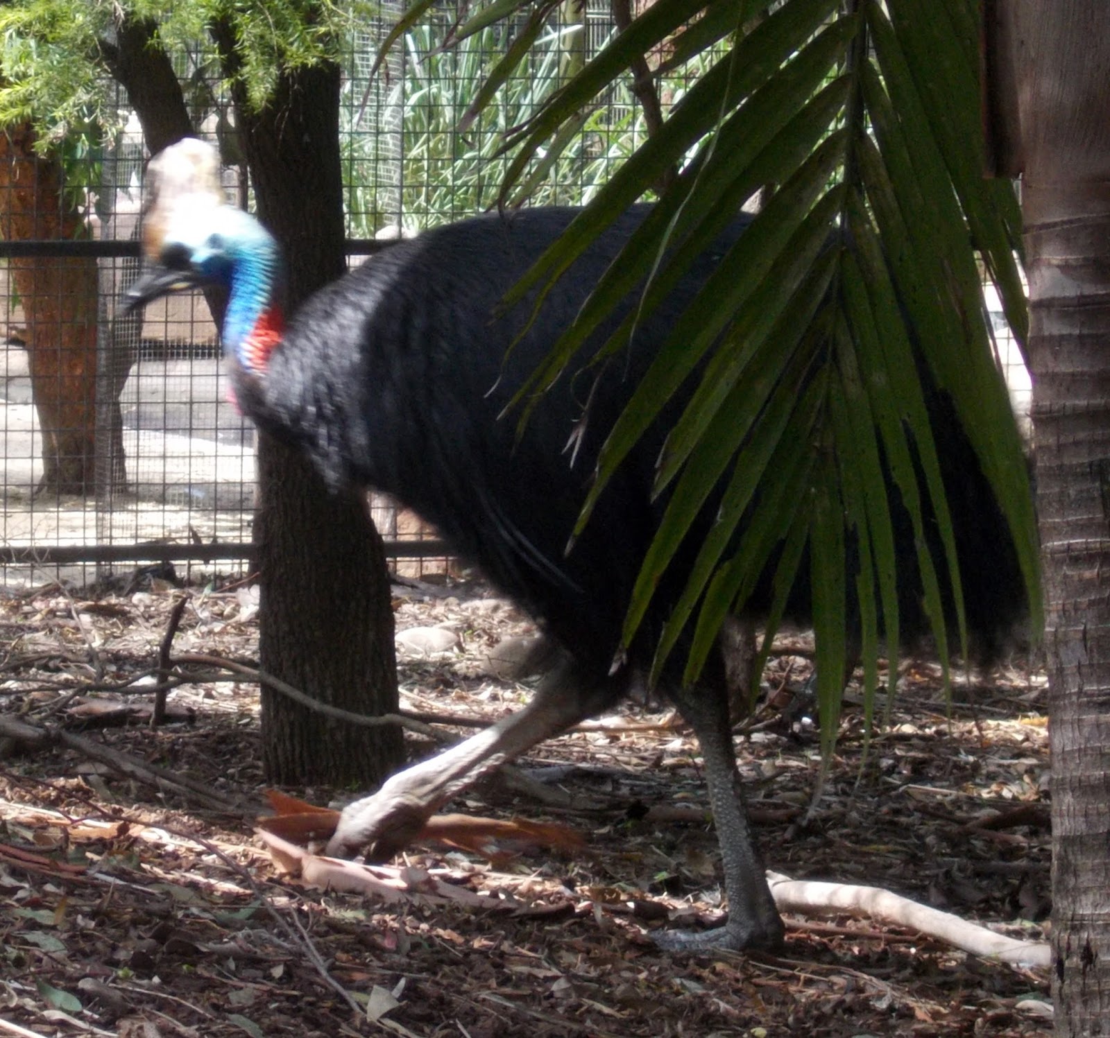 |
| Featherdale- Cassaway |
 |
| Paramata River Boat - I really think it was a ferry |
STOP 5 AR 1700 I departed the coach for a ride down the Paramatta
River to
Circular Quay. The ride to the drop off point passed the site
of the 2000 Olympics. The rain had just stopped. The trip on the river may have been more interesting
if it hadn’t been so cloudy – the narration was mediocre. I do remember passing a rather elegant home
that was the backdrop and filming location of The Great Gatsby.
I got back to my hotel around 6:15 pm
 |
| Docking in Circular Quay - Royal Carribean Cruise Ship in background |
 |
| Coming into Circular Quay Opera House |
SUNDAY January 31, 2016
WEATHER: sunny all day 70’s to low 80’s
Sunrise 6:15 AM –
Sunset 8:02 PM
TRAVEL: A free day in Sydney . . . .
 |
| St. Patrick's Sydney, Australia |
 The 2nd
reading today was “love is patient . . .
. . the only three things that last
are faith, hope and love, and the greatest of these is love” Appropriate for an anniversary. The priest had a good homily – seemed liked a
prelude to my visit to the Australian Museum – taking a theme from the gospel
‘prophets are not recognized in their own time: - he went over the injustice
and apology given to the Aboriginal peoples – Australia seemed to take after
America in bigotry, racism, eradication of indigenous people and in the vein of
Obama – an apology in 2008 by the prime minister.
The 2nd
reading today was “love is patient . . .
. . the only three things that last
are faith, hope and love, and the greatest of these is love” Appropriate for an anniversary. The priest had a good homily – seemed liked a
prelude to my visit to the Australian Museum – taking a theme from the gospel
‘prophets are not recognized in their own time: - he went over the injustice
and apology given to the Aboriginal peoples – Australia seemed to take after
America in bigotry, racism, eradication of indigenous people and in the vein of
Obama – an apology in 2008 by the prime minister. |
| Australian Museum - Sydney |
 |
| Colonial treatment of the aborigine nations was not kind |
The 4th
Level housed an exhibit entitled Surviving Australia with displays of
all the things in Australia that can kill, eat, or bite you – I had almost
forgot. There are also exhibits named Dinosaur,
Pacific Sprit, Birds & Insects and two areas especially for
kids called Search & Discover and Kidspace..
 |
| St. Mary's Cathedral from Museum Roof Hyde Park to the left The Rooks to the right rear |
I also visited a
Special Expedition called Trailblazers: Australia’s 50 Greatest Explorers.
 |
| Circular Quay - Shops & Restaurants The Harbour Bridge is left rear The Opera house is at the end of this walk |
 |
| Opera House is located at the end of Circular Quay |
the offered tour. I did have an excellent lunch at a restaurant with outdoor service on walk of Circular Quay just before the Opera House..
I seems like a
different cruise ship arrives every morning to dock at Circular
Quay; after the
previous ship leaves the night before – a busy passenger terminal.
TRAVEL: walked a little more than a mile to Hertz in
downtown Sydney (30 minute walk) and drove back to the Holiday
Inn Old Sydney to pick up my
bags. The drive back was a trip – literally . . . . . I rented a GPS device but
thought I knew my way back to the Holiday Inn, so I did not use the GPS – well
driving is not the same as walking – I did explore the way I was going to leave
Sydney but had to
cross the Harbour Bridge twice – yes there is a toll. It took me an hour to get back, set the GPS,
and load my bags.
I’m glad I
rented the GPS but I should have just purchased Australia/New Zealand and
brought my own GARMIN. I’m pretty sure I would have had many false
starts and hit a few dead-ends and become a bit frustrated. Rent a GPS.
Novotel Newcastle Beach – I’m not sure what I expected but this is a 4 or 5
Star Hotel. A block from the ocean,
balcony with an ocean view, stocked bar.
Parking was $22 per day; looks like I joined the Le Club Accorhotel's, a loyalty program, which
supposedly will get me free internet ELSE $24.95 per day.
Today was
supposed to be a free day, I’ve already visited the Blue
Mountains. Australia has 100’s of National
Parks but they do not
appear to all have Visitor Centers like US NPs.
They are more like state or county parks . . . . . they may or may not
have rangers and a VC.
MONDAY February 1, 2016
WEATHER: cloudy all day – high of 88
when I got to Newcastle Beach, but the sun was behind the clouds, probably a good
thing or it would have really been hot
Sunrise Sydney 6:16 AM – Sunset 8:01 PM
 |
| Holiday Inn Old Sydney on George St in The Rocks |
It took about an
hour to get out of North Sydney (34 km) – extremely slow – then another one hour to Newcastle.
The GPS was indispensible. A
total drive of about 134 km total.
I traveled
Highway M1 north out of Sydney to a turnoff that took me east
to the coast to Newcastle. M1 is a 4 lane expressway – the
trip reminded me of a drive through the Appalachians on the east coast. Travelling round-a-bouts to the left is an
interesting experience.
According to the
map, there were several National Parks to the west of M1 that I did not visit.
Yengo NP, Wollemi
NP, Gardens of
Stone NP and Turon NP. These NPs are not necessarily set up like the
US NPs.
 |
| Newcastle - view from room balcony |
 |
| Newcastle Beach |
I walked to the
beach and then took an hour stroll looking at shops. I found a book store but there were no books
on Australia’s National Parks. Lots of
restaurants - few were open. Delicious
tortellini at the hotel.
TUESDAY February 2, 2016
WEATHER: clear and sunny at 6 am, it’s
been warm – they say 8 degrees above normal – that’s worth at least 16 degrees
Fahrenheit
Sunrise Newcastle 6:16 AM – Sunset 7:56 PM
TRAVEL: Novotel Newcastle Beach, Newcastle,
NSW to Novotel
Pacific Bay Resort, Coff’s Harbour, NSW
 |
| Sydney - Newcastle - Coffs Harbour - Byron Bay - Brisbane |
The drive took 6
½ hours (LV 0950 AR 1630) including a
short break for lunch and covered about 300km.
Traffic was slow in many places due to construction – the road is not
all 4 lane . . . . yet – a work in progress. Interesting – no billboards along the highway
– rest areas every 30 km or so
SPEAK AUSTRALIAN:
I have not had a
Foster’s since arriving and have never seen Foster’s on tap or in a bottle
shop.
bottle shop -liquor
store
carpark -parking
lot/ramp/garage
passing -overtake
stopping bay -truck/car
pullout
lift -elevator.
caravan park -trailer/rv
park
tyre -tire
The long drive
did not leave much time for off the road ventures to visit National Parks or
take scenic drives. I passed several to
include turnoffs for Hunter Wetlands NP, Barrington NP, Myall Lakes NP, Crowdy Bay NP, Cograbakh NP
 |
| Novotel Pacific Bay Resort Coffs Harbour |
Novotel Pacific Bay Resort – I found this place by luck – the GPS would not recognize the intersection
of Bay St and Pacific Highway.
Definitely, a resort - the staff
at the reception desk were not as helpful as the people in Newcastle.
A beautiful nine hole par three golf course, large pool, fitness
centers, I never did walk to the beach. WIFI is not free except in the lobby.
 |
| Pacific Bay Resort Coffs Harbour Putting Green front |
The lobby of
this resort did have two brochures on Australian National Parks.
Visitor Guide National Parks & Reserves of the NSW North
Coast – identifies the 97 parks and
reserves in the region. The parks were
developed as a refuge for an outstanding diversity of plants and animals. Park
fees apply at some parks. The National
Parks respectfully
acknowledge the Aboriginal people of the North Coast and their strong
connection to their land and waters and they pay respect to Elders past and
present.
 |
| Pacific Bay Resort Coffs Harbour |
Most of these parks
are wilderness. Many are designated World Heritage Sites.
Visitor Guide Dorrigo National Park – Dorrigo Rainforest Centre is open from 9am to 4:30
daily. This park is south and west of Coff’s
Harbour. I may visit tomorrow morning.
Yuraygir National Park if north of Coff’s Harbour. I may also visit this on the
way to Byron Bay tomorrow.
I thought about a short round of golf in the morning but I think the parks will take precedence. The course here a 9 hole Par 3 looks beautiful and challenging.
 The drive to Dorrigo
National Park & the Dorrigo
Rainforest Centre was 68 km and
1hr 27 min. After updating the blog,
checking e-mails and having breakfast, I left at 9 am and got to the Rain
Forest Center about 10:30
am. I was a drive up the mountain . . .
. similar to the Blue ridge or somewhere
in the Appalachians of Pennsylvania but the forest was certainly different.
The drive to Dorrigo
National Park & the Dorrigo
Rainforest Centre was 68 km and
1hr 27 min. After updating the blog,
checking e-mails and having breakfast, I left at 9 am and got to the Rain
Forest Center about 10:30
am. I was a drive up the mountain . . .
. similar to the Blue ridge or somewhere
in the Appalachians of Pennsylvania but the forest was certainly different.
I left the park around 2 pm and got to Byron Bay around 6:30pm – a trip of 4 hours that included a wild goose chase in an attempt to locate Yuraygir National Park from the Pacific Coast Highway. There are signs on M1 – after that it’s anybody’s guess – never found another sign. Saw a lot of farm/ranch country – the cicadas resound from the forests.
 Dorriga National Park – Dorrigo Rainforest Centre – A World
Heritage Site. After the drive up the mountain, I located Dorrigo
Rainforest Centre. It was marked on the highway. There was a lengthy documentary on the rainforest,
a small VC, bookstore/gift shop, and restaurant – Cost was a nominal $2
Australian.
Dorriga National Park – Dorrigo Rainforest Centre – A World
Heritage Site. After the drive up the mountain, I located Dorrigo
Rainforest Centre. It was marked on the highway. There was a lengthy documentary on the rainforest,
a small VC, bookstore/gift shop, and restaurant – Cost was a nominal $2
Australian.
Dorrigo National Park is part of the Gondwanna Rainforests of Australia, a name given collectively to over fifty remnant
rain forests in New South Wales and South-eastern Queensland. These forests are protected and
recognized with World Heritage Status.
The Wonga
Walk is 6.6 km loop
(circuit in Australian) is an asphalt track – entirely shaded. The descent is easy the trek up can work up a
sweat. You descend into the valley and
pass Tristania Falls and coming up you pass Crystal Shower Falls.
The Apartments Inn Byron Bay – an apartment – full kitchen, dining, living, bedroom, bath and balcony. I was located on the 2nd (top) floor). Utilized the washer/dryer. I arrived after hours (the office closed at 6 pm) but there was a safe with an envelope and my keys. Parking was beneath the building. A handy restaurant bar next door called St. Elmo served a fine dinner. The bartender reminded me of Russell Crowe (an Australian). A lot of young people – seems a lot of guys wear long hair with it pulled to the rear in a small topknot/bun.
THURSDAY February 4, 2016
Byron Bay is best described as Lake Geneva with surfing – complete with
real estate brokers offices and pictures of homes for sale.
World Heritage areas
I think I
located Burleigh Headland NP. Burleigh headland is a prominent Gold Coast
landmark. To reach the southern entrance of the park, turn off the Gold Coast
Highway at the traffic lights immediately north of Tallebudgera Creek. It looked like the right place per an internet
map. The GPS took me there. Of Course there was no sign and
it was raining so I loaded a new address and drove to Gold
Coast Harley-Davidson.
Then I thought
I’d attempt to locate Nerang NP. The GPS said it was a drive of 4 km.
So I drove up
another mountain and into a rainforest.
On the road I passed a sign indicating I had entered Springbrook
NP. Springbrook National Park is located about 100km south of
Brisbane and comprises four sections on and around the plateau; Springbrook
section extends along the crest of the plateau, Mount Cougal section to the south
east and Natural Bridge and Numinbah sections to the west. I took a left and headed up a
road with a 17% grade. The road appears
to follow a ridge or the spine of a mountain separating two valleys. There were no turnouts or scenic overlooks
but the views were worth the drive. The
drive itself was a bit exciting. The VW
Golf coughed a
little on the way up. I took it slow
coming down and continued to Natural Bridge NP.
 Natural Bridge NP actually appears to be a unit of the Springbrook
National Park. It has a
picturesque Natural Bridge rock formation - once formed by
the force of the waterfall over the erosive basalt cave. There is a
1 ½ km circuit (loop trail) that took about a ½ hour to walk. More
rainforest. A descent through ancient Gondwana rainforest to
the Natural Bridge rock arch and back up.
Natural Bridge NP actually appears to be a unit of the Springbrook
National Park. It has a
picturesque Natural Bridge rock formation - once formed by
the force of the waterfall over the erosive basalt cave. There is a
1 ½ km circuit (loop trail) that took about a ½ hour to walk. More
rainforest. A descent through ancient Gondwana rainforest to
the Natural Bridge rock arch and back up.
The GPS was doing pretty good at locating HD dealers so I tired to Gasoline Alley HD located off the Pacific Highway near Brisbane.
The trip to Brisbane
Airport was
uneventful but thank goodness for the
GPS – “don’t leave home without it” – a lot less stress - gassed up – turned in the car at the International
Terminal – took the
Orange Bus to the Domestic Terminal – checked in and took a 2 hour flight north. When I arrived in Cairns
(pronounced can)
it was 31 C or 88 F and 75%
humidity and cloudy. There was a agent
with my name on a placard that drove me to the Pacific Hotel.
Cairns, located in
northern Queensland, is chic with a casual seaside, tropical lifestyle feel – home to two
World Heritage sites -the Great Barrier Reef and the ancient Daintree
Rainforest. The Pacific Hotel is located on the Esplanade, a 2.5 km stretch along the
city’s shore that features shops, as well as, parks, bike paths,
and the Lagoon – a popular
saltwater swimming pool..
Went for a walk
- found a store called Aussie Bush Hats. The owner
was very friendly, told him I wanted a hat that would keep the sun off my face
and neck, resist rain and easily packable
. . . . he suggested an
Australian made hat with the name of Traveller – he did not have the color and
size that I wanted – he said he would order.
If it’s in by Tuesday, I may buy it.
It is made out of rabbit fur, the crown crushes down flat even with the
brim. – perfect. I queried about a place
for a beer and a snack. He suggested the Salt House at the end of the wharf
boardwalk. They had great spring rolls.
Walked the Esplanade – passed the Lagoon and found Grill’d – a place recommended by the guy at the bottle shop – sliders were better than Fred’s. Stop at an art shop – contemporary Aboriginal Art – very interesting – there is stuff in there that I like.
Great Barrier Reef is a World Heritage area, off the coast of Queensland in northeastern Australia, is the largest living
thing on Earth, and even visible from outer space. The 2,300km-long ecosystem
comprises thousands of reefs and hundreds of islands made of over 600 types of
hard and soft coral. It's home to countless species of fish, mollusks and
starfish, plus turtles, dolphins and sharks.
There are also 1050 islands and cays - these include 600
continental islands and 300 coral cays, while the remaining 150 islands are
inshore mangrove islands which are important to the functioning and health
of the Great Barrier Reef. Together, the biodiversity and
interconnectedness between species and habitats represents one of the richest
and most complex natural ecosystems on earth.
The Wavedancer
Low Isles tour was arranged
to include the bus pickup. While on the
bus, I was “adopted” by a tour guide with about 20 Americans on the bus. I met a couple from Mequon,
WI. The guide made some valuable commentary about
history and background as we headed up the Captain Cook Highway to Port
Douglas. Port Douglas, like
Cairns is located on
the Coral Sea, not the Pacific Ocean.
My tour was a
catamaran dual sailing/motor that took us to the Low Isles – a casual ride of about an
hour. We boarded at 9:30 am, were served
tea and coffee, and listened to a presentation by a marine biologist, name
John, about the reef – definitely promotes ecologist - what do you call an tree
hugger – who loves the ocean – not sure
but he can’t hug the coral he’ll may kill it. After a while his repeated dull jokes and “we
can change” message got old – but still some interesting stuff.
There were also stories about the Crown of Thorns Starfish destroying the coral. Crown-of-thorns starfish (also known as COTS) are marine invertebrates that feed on coral. They occur naturally on reefs throughout the Indo-Pacific region, and when conditions are right, they can reach plague proportions and devastate hard coral communities. The Australian Marine Park Operators Association has programs to control COT outbreaks. This is what the American Samoan diver for the NPS did for the National Park of American Samoa.
The snorkeling
led by the John, (another guy Hans or Franz was the lifeguard), found and
passed around sea cucumbers and other marine life. This was different that any
snorkeling I had done before.
After a buffet
lunch on board, John led a short island tour walk. For about 45 minutes –
interesting – but same dull jokes.
Looked like rain in many places but never where I was. Met up with the folks on the bus who went to
the outer reef – the guy from Mequon agreed with me – the Virgin Islands were much
better. Maybe the Great
Barrier Reef is overrated?
Dinner at an
Italian restaurant on the Esplanade – great vegetarian pizza – but a bottle of beer was
an expensive $11.50 AUS - interesting -
in the background one of the songs was “The Wicked Game”.
WEATHER: 20C/68F at 9am, 83% humidity,
forecast for light rain; travel about 200 km to the east Whitianga where the forecast is similar –
cloudy without rain. Few suntans here in
New Zealand.
The dirve
reminded me a little bit of the drive around the island of Maui – narrow roads – one way bridges
– drive along the flat and through the mountains. Out of Auckland, it’s like driving in the
caldera of a volcano – much older than any of Hawaii’s. Remnants of cinder cones covered in grass it
is very obvious. The Maori are Polynesian and the place names
reflect that heritage – like Hawaii – way too many vowels.
I did not stop in Coromandel – thought I may come back tomorrow so I continued through the mountains to Marina Park Apartments, Whitianga (POP 4,000),
MARINA PARK APARTMENTS – I arrived about 5pm. These were not easy to find – a small sign – frustration of not having a GPS. This place is a a completely furnished apartment adjacent to the Marina and 2 blocks from shopping, restaurants, etc. It has a washer and dryer. I took advantage of the facility this time and went to a supermarket to purchase some bread, juice, fruit for at least breakfasts and lunch. Free WIFI.
Accor-Novotel Lakeside – this will be home for the next 4 nights - a fine
hotel. WIFI works. The staff is excellent. I received 2 $50 NZ
certificates good for dinner at the hotel restaurant – basically 2 dinners
balances are not transferable. I
received as part of a promotion that was on when the agent made the booking
last year.
The Novotel
Lakeside is adjacent to Lake
Wakatipu – again a
location in the middle of the happening area of town. There are plenty of restaurants and shops
within a block or two. Queenstown is advertised as set against the Southern Alps
of New Zealand – no wonder why this is what I imagine Switzerland is like. Plenty of adventure sports available –
besides, rafting, biking, paragliding and winter back-country skiing – the Kawarau
Gorge Suspension Bridge is among bungee jumping’s original sites.
SKYLINE GONDOLA RIDE to Bob’s Peak above Queenstown. This is a steep cableway.
Rising 1,463 feet over a distance of 2,393 feet - that’s close to a 37%
grade – very steep. I had considered
walking down, but the ride up convinced me that it would be way too hazardous –
worse than the rope ascent/descent on American Samoa. I saw the trail – a series of switchbacks
with a cable rope the entire way – and it really didn’t look secure in the
traverse. Adventure is what this place
offers – a walk down would be a real adventure.
There is bungi
jumping and hang gliding and a better option is a luge track. Actually, it isn’t quite like the winter
Olympics luge. New Zealanders must have
an affinity to rolling down hills – like the Big Wheels at Mt.
Ruapehu – only this is
on a track with 4 wheel carts – actually it looked like it could have been fun.
PURE GLENORCHY LORD OF THE RINGS SCENIC TOUR – Glenorchy is located at the
northern end of Lake Wakatipu. The Village of Glenorchy with a population of 200 is
framed by the what in the Lord of the Rings are the Misty
Mountains. Glenorchy serves as the gateway to Mt.
Aspiring National Park which is also
part of Te Wahipounama (South West New Zealand World Heritage Areae ). There are many walking tracks
(trails) here. The location was used to
create Beorn’s House in the The
Hobbit. Up the Dart River the
woods became the setting for
Mirkwood. After Lord of the Rings made
the area famous several other films have been made here to include The
Chronicles of Narnia, Prince
Caspian, Wolverine and the most
recent Taylor Swift video.There were only 3 on the tour – the driver was
outstanding. The two girls on the tour
were from Los Angeles – one a PhD in bio-engineering – now doing whatever ‘ the
other an theater major – “and all the stars, that never were, are parking cars
and pumping gas” --- or traveling in New Zealand.
THURSDAY February 25 2016
CHALLENGE RAFTING – Met a bus about 4 blocks from the hotel to catch an 8:15 am ride to
the base of the rafting adventure.
There we were sent through a production line to get wet suit bottom,
tops, booties, a paddle, helmet and life jacket. Then we got an the bus again and drove 40
minutes through what might have been Skipper’s Canyon to unload the rafts and
begin the adventure on the Shotover River.
The river was named Shotover by the first
European, William Gilbert Rees to
settle on the shores of Lake Wakatipu in 1860. He
named it after his business partner, George Gammie's English estate, Shotover
Park. It was also referred to as the Overshot by the early gold miners, but it was
the name Shotover that stuck. The area was once home to a gold rush in 1862. Remnants of that era are in the area. The road is narrow and winding through some
beautiful countryside.

The group was divided to man the 5 or 6 rafts, each with a guide. Our guide’s name was “Chief”. The water was fast moving as it wound though the narrow and steep Skipper Canyon. The wet suits were nice to have – the water was cool but not cold –probably in the low 60’s – I never asked the temperature of the water. We went through several rapids classified as 3 or 4 – still nothing compared to the Little Pigeon River in the Great Smokies or the New River Gorge in West Virginia. Chief never explained anything about the river or the formations or the name or the rapids were travelling. The group was fun - - - the trip took about 2 hours.
This tour was advertised as follow: Discover Milford Sound Coach-Cruise-Coach - The pristine Milford Sound is part of the World Heritage Fiordland National Park, in the south west of the South Island, and is famed for its pristine natural beauty and remote atmosphere. It is New Zealand’s best known fiord and the only one that can be reached by road. Maori are believed to have discovered Milford Sound more than 1,000 years ago, returning seasonally to collect the prized pounamue (greenstone). The fiord extends 15km inland from the wild Tasman Sea and is regularly visited by wildlife including penguins, seals and dolphins. pounamu (greenstone).
Cascading waterfalls, sheer rock faces and dense rainforest. Your sightseeing tour to Milford Sound is made even more enjoyable by our glass-roofed coaches, which provide spectacular panoramic views as you travel along the Milford Road – one of the world's most scenic roads – and through the Homer Tunnel, before arriving for your Milford Sound cruise. Enjoy striking views of iconic Mitre Peak from the head of the Sound – it rises 1,692 metres from the south shore and is named for its resemblance to a bishop’s mitre (head dress).
I boarded the
bus at my hotel at 7:10 am – there were 14 people on board. By the time the pickups were finished it was
at least 8 am as we headed out of Queenstown and it’s suburbs to Milford
Sound.
Saw a RAINBOW over Queenstown. Travelled through Kingston - on the other end of Lake Wakatipu – on to Garston to a range called the Steeples once sight of a goldmine.
The driver provided an excellent narration. I learned some more Kiwi phrases:
We entered Fjiordlands
National Park and stopped
around 10 am at Te Anua on Lake Te Anua.
Here we entered a 78 mile stretch of road with 420 :kinks and corner” on
the road to Milford Sound
Entering Fjiordland National Park we drove through the Eglinton River Valley (Flats) and
made a short stop at Mirror
Lake. With the rain there was not much mirror
effect reflecting the mountains. Past a
sign indicating 45 Latitude South – midway between the South Pole and the Equator. Another short relief stop at Knobs
Flat. Continued the drive along the Hollyford
River and passing Christy
Falls. Learned that moss can hold up to 25x it’s
weight in water and we started into a valley that had to be Peter
Jackson’s inspiration for
Rivendell – waterfalls everywhere – with the rain there were even more than
without rain. Right here I believed the
trip was worth it – even in the rain.
Another short stop at the Totoku River Bridge – the driver referenced being “wet as a shag” I have no idea what he meant –travel along the Cleddue River and arrived at the Milford Sound Terminal at 1:05 pm for a 1:30 cruise. It was pouring.
During the ride I finished reading The Lord of the Rings Movie Location Guide. I really do wish I had read this before I came to New Zealand – I would have spent a few more days visiting with few days in Wellington. Again – saw some RAINBOWS on return trip – a perfect end..
WEDNESDAY February 3, 2016
WEATHER: cloudy in the morning, 70's clear in the afternoon
Sunrise Coff’s Harbour 6:16 AM – Sunset 7:46 PM
TRAVEL: Novetel Pacific Bay Resort, Coff’s
Harbour, NSW to Dorrigo National Park to Apartments
Inn Byron, Byron Bay, NSW

 |
| Dorrigo NP - Wonga Walk (Trail) Map |
I left the park around 2 pm and got to Byron Bay around 6:30pm – a trip of 4 hours that included a wild goose chase in an attempt to locate Yuraygir National Park from the Pacific Coast Highway. There are signs on M1 – after that it’s anybody’s guess – never found another sign. Saw a lot of farm/ranch country – the cicadas resound from the forests.
I passed by other signs on M1 indicating other turnoffs to Yuragir NP and Broadwater NP – I didn’t bother – and I don’t think I’m going to back-track from Byron Bay.
A lot of construction along the highway – still trying to make it 4 lane – you had to go past Byron Bay in order to get on a highway that would take you to it. Arrival in Byron Bay – a resort town, a surfer town . . . . . at any rate a vacation destination – very nice.
 Dorriga National Park – Dorrigo Rainforest Centre – A World
Heritage Site. After the drive up the mountain, I located Dorrigo
Rainforest Centre. It was marked on the highway. There was a lengthy documentary on the rainforest,
a small VC, bookstore/gift shop, and restaurant – Cost was a nominal $2
Australian.
Dorriga National Park – Dorrigo Rainforest Centre – A World
Heritage Site. After the drive up the mountain, I located Dorrigo
Rainforest Centre. It was marked on the highway. There was a lengthy documentary on the rainforest,
a small VC, bookstore/gift shop, and restaurant – Cost was a nominal $2
Australian.  |
| Dorrigo NP - Wonga Walk Rainforest - Note asphalt trail |
The Gumbaynggirr people were custodians of this
land for thousands of years. Most of the
Dorringo Plateau was once covered from the Ebor Volcano, active until 18 million years
ago. Under the influence of a very high
annual rainfall the basalt weathered to from the impressive escarpment and
chocolate soils around Dorrigo. Australian: walk means trail
 |
| Dorrigo NP - Wonga Walk Tristania Falls |
 |
| Dorrigo NP - Wonga Walk Crystal Shower Falls |
The track, follows
terraces formed by successive flows of basalt, exposed by erosion on the edge
of the escarpment. I heard plenty of
birds under and in the canopy. The walk
took about 2 ½ hours.
 |
| Apartments Inn Byron Bay St. Elmo is to the right |
The Apartments Inn Byron Bay – an apartment – full kitchen, dining, living, bedroom, bath and balcony. I was located on the 2nd (top) floor). Utilized the washer/dryer. I arrived after hours (the office closed at 6 pm) but there was a safe with an envelope and my keys. Parking was beneath the building. A handy restaurant bar next door called St. Elmo served a fine dinner. The bartender reminded me of Russell Crowe (an Australian). A lot of young people – seems a lot of guys wear long hair with it pulled to the rear in a small topknot/bun.
THURSDAY February 4, 2016
WEATHER: raining and about 75 very humid
in the morning, rained or drizzled on and off all day – cloudy – sun peaked
through occasionally
Sunrise 6:15 AM –
Sunset 8:01 PM
TRAVEL: Apartments Inn Byron, Byron
Bay, NSW – Burleigh
Head NP – Gold
Coast HD – Nerang
NP – Springbrook
NP – Natural
Bridge NP – Gasoline
Alley HD to The Sebel, Brisbane,
QLD. A total trip 290
km with an average speed of 52km/h – 5 ½ hours of windshield time.
 |
| Byron Bay |
AUSTRALIA NATIONAL PARKS BACKGROUND:
Australia
has over 500 national parks. Over 28
million hectares of land is designated as national parkland, accounting for
almost four per cent of Australia's land areas. In addition, a further six per
cent of Australia is protected and includes state forests, nature parks and
conservation reserves.
National parks are
usually large areas of land that are protected because they have unspoiled
landscapes and a diverse number of native plants and animals. This means that
commercial activities such as farming are prohibited and human activity is
strictly monitored.
World Heritage areas
In
2005, Australia had 14 World Heritage areas. These are places or areas that UNESCO, the United Nations Educational, Scientific and Cultural Organization,
has agreed are worthy of special protection because they represent the best
examples of the world's cultural and natural heritage. Some of these, such as Kakadu, Uluru-Kata Tjuta and Purnululu
National Parks, are jointly managed by the Aboriginal traditional owners as
UNESCO World Heritage areas.
 |
| Burleigh Head NP photo from park website |
 |
| Gold Coast Chapter Harley Owners Group |
 |
| This is what I found looking for Nerang NP |
If you are using
the internet this is how it is described for a LOCATION: Nerang National Park and Nerang State Forest
are 12 km from Surfers Paradise, on the north-west outskirts of Nerang. Of course, there was a sign, it was a
protected area – but not quite what I expected. So off to Natural
Bridge NP.
 |
| Sprirngbrook - view from the top of the steep road just before entering the town of Springbrook |
 |
| This road has grades of 17% & 15 % |

Here’s a riddle
. . . . What does it do in a rainforest?
RAIN. Of course I expected rain.
 |
| Natural Bridge Trail (track) in the rain forest |
 |
| Natural Bridge - Geology |
 |
| Natural Bridge as you approach on the trail |
 |
| Natural Bridge - under the formation Home of glow worms and bats |
The GPS was doing pretty good at locating HD dealers so I tired to Gasoline Alley HD located off the Pacific Highway near Brisbane.
The
Sebel is part of the Accor
Hotels group – in the heart of downtown Brisbane a very nice room on the 19th
floor does nicely.
Brisbane is the capital of Queensland an
Australian state covering the continent’s northeast, with a coastline
stretching nearly 7,000km. Its offshore Great Barrier
Reef,
the world’s largest coral reef system, hosts thousands of marine species. The stylish capital, Brisbane, is flanked by the surfing-friendly beaches of the Gold and Sunshine Coasts.
Downtown Brisbane is a nice downtown – lots going on – stopped at an place called “Irish Bar” but they didn’t serve Harp . . . . thought about it for awhile, then ordered a Kilkenney Ale – on tap – a good beer. This place was in a basement – different. Up the stairs and to a place called Gilhooley’s – Irish – ordered a Kilkenney and food.
Downtown Brisbane is a nice downtown – lots going on – stopped at an place called “Irish Bar” but they didn’t serve Harp . . . . thought about it for awhile, then ordered a Kilkenney Ale – on tap – a good beer. This place was in a basement – different. Up the stairs and to a place called Gilhooley’s – Irish – ordered a Kilkenney and food.
FRIDAY February 5, 2016
WEATHER: cloudy looking like rain
Sunrise Brisbane 5:23 AM – Sunset 6:40 PM Queensland is in a different time zone than
New South Wales, I don’t know why
TRAVEL: The Sebel, Brisbane to Brisbane
Domestic Airport Terminal – Qantas
Flt 782 to Cairns – transfer to the Pacific
Hotel Cairns. This will be
home for 5 nights.
 |
| Pacific Hotel - Cairns |
The Pacific
Hotel is a 4/4.5 Star
hotel. My room is on the 10th
floor with a good view of the ocean from the balcony. I called Wavedancer Low Isles to confirm my tour to the Great
Barrier Reef tomorrow. There will be a 8am pickup at the hotel.
 |
| Cairns - Salt Water Lagoon |
 |
| Cairns - The Boardwalk on the Wharf - Restaurants & Shops are to the left |
 |
| Cairns - the Esplanade the red dot sign is Grill'd |
Walked the Esplanade – passed the Lagoon and found Grill’d – a place recommended by the guy at the bottle shop – sliders were better than Fred’s. Stop at an art shop – contemporary Aboriginal Art – very interesting – there is stuff in there that I like.
SATURDAY February 6, 2016
WEATHER: 26 C/79F 94% humidity mostly
sunny at 7am, projected to get in the 90’s today
Sunrise Cairns 6:07 AM
– Sunset 6:54 PM
TRAVEL: bus pickup at 8am to Port
Douglas – Wavedancer
Low Isles Reef/Great Barrier
Reef – return to Port
Douglas and back to Pacific
Hotel by 5:50 pm.
 |
| Low Isles - Part of the Great Barrier Reef Located off Port Douglas, Queensland, Australia |
The World Heritage Area
extends from the top of Cape York in north-east Australia to just north
of Bundaberg, and from the low water mark on the Queensland coast to the
outer boundary of the Marine Park,
which is beyond the edge of the continental shelf.
About 99 per cent of the World
Heritage Area is within the Great
Barrier Reef Marine Park.
 |
| Low Isles - Lighthouse, beach and snorkeling area the group to the left of the picture in the water are snorklers |
The Great Barrier Reef
was declared a World Heritage Area
in 1981 because of its 'outstanding universal value'. This recognized the Reef as being one of the most
remarkable places on earth, as well as its global importance and its natural
worth.
 |
| Wavedancer - this is the boat that took us out to the Low Isles for snorkelilng - it was a pleasant 1 hour trip |
The road ends
about an hour north of Port Douglas at the Daintree River. There is a
ferry but beyond that there is no electricity unless you have a generator – the
real bush- wilderness.
Lots of
sugarcane fields along the road north of Cairns. A long stretch of the
Captain Cook
Highway literally runs
between the face of the mountains and the Coral Sea.
However, this
group took a different boat than I did and reminded me again of why I did not
want to be part of a group. It is not
relaxing – you’re a tourist - always on the tour’s schedule - when to get up –
when to meet for breakfast, buses, tours, rarely a choice of where or what to
eat - when to sleep. Been there – done
that – worked well in China. Not here..
 |
| Low Isles - John the Marine Biologist on shore for the beach walk wearing a 'stinger' suit' |
John must think
people like to be scared – hence the ‘stinger suits’ and stories about Box Jellyfish.
I found the following on the internet – it must be true. The Box Jellyfish season starts with the onset of the wet
across the top of northern Australia, usually around October and lasts
until April. Further south along the northern Queensland or northern Western
Australia coast the season is usually from November to March. You have virtually no chance of surviving the
venomous sting. The pain is so excruciating and overwhelming that you would
most likely go into shock and drown before reaching the shore.
 |
| Map - Cairns - Port Douglas - Low Islands and points north - reefs along the coast |
There were also stories about the Crown of Thorns Starfish destroying the coral. Crown-of-thorns starfish (also known as COTS) are marine invertebrates that feed on coral. They occur naturally on reefs throughout the Indo-Pacific region, and when conditions are right, they can reach plague proportions and devastate hard coral communities. The Australian Marine Park Operators Association has programs to control COT outbreaks. This is what the American Samoan diver for the NPS did for the National Park of American Samoa.
The biologist
liked to play mythbuster. He said some
fish mate for life and many fish are born one sex and undergo a sex change as
part of maturation. Like clownfish –
Nemo – a kids story
but maybe not for real – Clownfish are born male and eventually become a female who is dominant and larger
– after a ruling female dies, the dominant male becomes a female – therefore Nemo’s dad, Marlin, should have become
a female after Nemo’s mom was ‘eaten
by a barracuda’ and Nemo becoming
separated should also have undergone a change in sex – way too complicated for
Disney. I liked the story the way it was
told . . . . so much for the marine biologist.
I rented a black
lycra ‘stinger suit’ – everybody who snorkeled did. Really not needed – better safe than sorry –
and the best sunscreen I could have used for $8 AUS.
 |
| Low Isles discovered and names by Capt Cook - 1770 |
 |
| Low Isles - coral through the 'glass bottom boat' |
However, the
snorkeling here was not the best I’ve been on.
It comes in third after, the Virgin Islands and Cancun.
Not much variety of coral, little color, not the clearest water (the
crew thought it was outstanding) and few fish.
 |
| Sugar\ Cane fields along the Capt. Cook Highwya between Cairns & Port Douglas |
Still looking
for hats – located some in a tourist gift shop – Australian names but all were
tagged “Made in China”.
Walked the Esplanade
– found place
advertised as a jazz/piano bar – a guitar, drum, bass trio – playing next to a baby grand that wasn’t being used – the
trio was good. First time I’ve ever
heard Chris Izaak’s “The Wicked Game”
played by a group. They did a good
job. Beers here were reasonable $7 AUS.
 |
| Cairns Sunset - from the baclony of my hotel room |
I may have found
my hat – stopped twice by a store and found an Australian made bush hat – a Barmah
Squashy, Kangaroo Range – air flow
through the crown- fabric hat band – leather brim. Made to be folded and retain its shape. Didn’t buy it yet.
Attended 10 am mass at St. Monica’s Cathedral; it was a 6 block walk from the hotel. The stained glass windows here are works of art – telling the creation . . . . .
The priest entered down the center aisle alone – no
deacon – no servers. His sermon
reflected the readings of being “called”.
Isaiah and Peter both thought they were unworthy. Apparently, he had just been at a conference
in Canberra for military chaplains and he reflected that the Protestant
ministers all felt they were “called” to their ministries. This priest said with a touch of humor and
honesty that he wasn’t called but in high school he told said twice he “wanted
to be a priest” in order to get a free weekend at a boys camp. Ash
Wednesday coming – he added that if you were on holiday it meant sacrifice –
therefore one less beer than usual.
I walked down Abbot St. past Bernies Jazz Piano Bar, stopped in at outdoor adventure
store – nice gear , stopped at Woolworth’s, a large supermarket chain and past the hat shop – I bought the Barmah Squashy Kangaroo Range for $69 Australian – after the 3rd visit and after I stopped at Bernie's - I’ll get used to it.
Updated the blog and transferred pictures – went to the pool for about 40 minutes – it was hot. Went to Bernie's at 5 pm - the band must have a local following - the place was pretty full and most people seemed to know each other - an older band - and older crowd. The drummer was the singer - a high nasaly voice - oh well - same progression - the crowd found it enjoyable - I stayed for 2 sets..
 CHINESE NEW YEAR – Year of the Monkey

 KURANDA SCENIC RAIL – SKYRAIL an arranged tour – hotel pickup at 7:20
am. Drive to Freshwaterwater
Station and a ride on
the Kuranda Scenic Railway through hand-hewn tunnels, across bridges, a stop
at Barron Gorge to view the waterfalls and an arrival at Kuranda Station.
Explored Kuranda, ‘Village of the Rainforest’ - - -
load onto the Skyrail over the
rain forest canopy with 2 stops on the route – a walk through the rain forest – the Interpretive Center. Arrival at Caravonica Lakes and a bus ride back the to the
hotel..
KURANDA SCENIC RAIL – SKYRAIL an arranged tour – hotel pickup at 7:20
am. Drive to Freshwaterwater
Station and a ride on
the Kuranda Scenic Railway through hand-hewn tunnels, across bridges, a stop
at Barron Gorge to view the waterfalls and an arrival at Kuranda Station.
Explored Kuranda, ‘Village of the Rainforest’ - - -
load onto the Skyrail over the
rain forest canopy with 2 stops on the route – a walk through the rain forest – the Interpretive Center. Arrival at Caravonica Lakes and a bus ride back the to the
hotel..
The Premier Sir Samuel Griffiths turned the first
sod for the line which was to be built in three stages. Dense jungle and cliffs
with sheer drops of up to 327 meters and a slope as steep as 45 degrees were
literal death traps for workers. Somehow, without modern equipment but simply
fortitude, dynamite, and bare hands the team eventually finished the job.
After removing
2.3 million meters of earthworks, creating 15 tunnels, 93 curves, dozens of
bridges and 75 kilometers of track, a banquet high up on the bridge with
General Sir Henry Wiley Norman, Governor
of Queensland marked the completion of Stoney
Creek Bridge. Shortly after in June of 1891 the line was open for everyone
to enjoy.
Barron Gorge National Park

The Barron River
dominates the park. Rising from the rainforests of Mount Hypipamee National
Park, the river winds 60 km across the Atherton
Tableland through one of Australia's highest rainforest belts. The river
then enters the deep Barron Gorge,
which forms a rugged, twisting trough between the Macalister and Lamb
ranges. The river falls 250 meters onto the narrow coastal lowlands and flows
to the Coral Sea, just north of the Cairns Airport. During the wetter
months, floodwaters regularly create a spectacular sight at Barron Falls.
 Kuranda is well known as the Village in the Rainforest and has
been attracting visitors for well over a century. Initially people came to
admire the mighty Barron Falls,
while artisans (hippies from the late 60’s ) were attracted to the region's
natural beauty and decided to call it home, creating a vibrant arts and craft culture.
Kuranda is well known as the Village in the Rainforest and has
been attracting visitors for well over a century. Initially people came to
admire the mighty Barron Falls,
while artisans (hippies from the late 60’s ) were attracted to the region's
natural beauty and decided to call it home, creating a vibrant arts and craft culture.
SkyRail was conceived
is 1987 and after 7 years for paperwork and permits construction began in June
1994. At the end of August 1995 SkyRail
opened to the
public as a gondola type cable way.
WEATHER: 27C/81F 84% humidity at 8am, on and off rain all afternoon
Voyages Desert Gardens Hotel – got here around 10 am; no surprise, the room
wasn’t ready but the FREE WIFI is much better than at the Hotel Pacific in Cairns. There appears to be 5 hotels in the resort
complex along with several restaurants, stores and an IGA. The town itself has about 900 inhabitants who
work for the resort or the park or the tourist industry here..
I was seated at
a table with 3 Brits and 4 Canadians – travelers all. It was a very enjoyable time and the food was
excellent.
We got back to the hotel around 10:15. Early pickup in the morning fro sunrise.
 ULURU - KATA TJUTA NATIONAL PARK
It was kind of a
miserable morning – the high of the evening before had worn off and a runny
nose with watery eyes since the last day in Cairns did not help; I batteries in
my camera wore out and the extras were back in my room; and when the sun came
up the flies came out. The guides were
not that interesting or I just didn’t care – at any rate I endured until a
return to the hotel at 10 am.
The park is managed
by a 12 member board. Four are male Anangu; four female Anangu; the Director of National Parks;
a representative from the Northern Territory Government; the Federal Minister of Tourism and a
Minister for the Environment.
 There were
stops. It is possible to climb Uhluru, although discouraged by the local
Aborigines who call themselves Anangu. It is a chain walk – rather
dangerous – they say 37 have died in the attempt – mostly doing dumb things.
The walk has been closed since October, when a protester cut a piece of the
chain in an attempt to close the trail to walkers. It still hasn’t been opened. Additionally, Rangers will close it due to
high temperatures, or other dangerous conditions. Dry heat - it got close to 100F today.
There were
stops. It is possible to climb Uhluru, although discouraged by the local
Aborigines who call themselves Anangu. It is a chain walk – rather
dangerous – they say 37 have died in the attempt – mostly doing dumb things.
The walk has been closed since October, when a protester cut a piece of the
chain in an attempt to close the trail to walkers. It still hasn’t been opened. Additionally, Rangers will close it due to
high temperatures, or other dangerous conditions. Dry heat - it got close to 100F today.
SUNDAY February 7, 2016
WEATHER: 28C/82F at 7:45 am 89% humidity,
mostly cloudy; should get to 92F, clear by the shore, cloudy in the mountains
Sunrise Cairns 6:08 AM – Sunset 6:53 PM
Cairns: High Tide 8:36 am Low Tide
2:33 pm High Tide 8:23 pm
TRAVEL: Free Day in Cairns.
 |
| ST. Monica's Cathedral - one side of the cration windwos |
Attended 10 am mass at St. Monica’s Cathedral; it was a 6 block walk from the hotel. The stained glass windows here are works of art – telling the creation . . . . .
 |
| St. Monica's Cathedral - Cairns |
 |
| Bernie's Jazz- Piano Cafe Abbott St - Cairns |
I walked down Abbot St. past Bernies Jazz Piano Bar, stopped in at outdoor adventure
store – nice gear , stopped at Woolworth’s, a large supermarket chain and past the hat shop – I bought the Barmah Squashy Kangaroo Range for $69 Australian – after the 3rd visit and after I stopped at Bernie's - I’ll get used to it.
 |
| Bernies - inside the band is up front - look close you can see the piano to the right. The bar is to the left front. |
Updated the blog and transferred pictures – went to the pool for about 40 minutes – it was hot. Went to Bernie's at 5 pm - the band must have a local following - the place was pretty full and most people seemed to know each other - an older band - and older crowd. The drummer was the singer - a high nasaly voice - oh well - same progression - the crowd found it enjoyable - I stayed for 2 sets..
MONDAY February 8 2016
WEATHER: 27C/8F 94% humidity, partly cloudy at 6:30 am, forecast high of 88F
Cairns Sunrise 6:08 AM –
Sunset 6:53 PM
TRAVEL: Bus from the
Pacific Hotel to
Freshwater Station, where I caught
the Kuranda Scenic Railway to Kuranda; from Kuranda it was the SkyWay
cable gondola down the
mountain to Caravonica Lakes and a bus back to the hotel.

This is a
big deal in Australia – probably 180.000 Chinese in Australia here for the New
Year Celebration. I heard the tour guide
for the Kuranda Railway say that they
alone had 80,000 Chinese ride the train and SkyWay over the last 2
weeks. Over 1,000,000 Chinese visit
Australia every year, spending over $5,000 each – China is Australia’s largest
tourist market.
Monkey: 2016, 2004,
1992, 1980, 1968
Monkey: Quick-witted, charming, lucky, adaptable,
bright, versatile, lively, smart.
Some Australian History:
1770 Capt. Cook
found the reef difficult to sail, damaged
his ship the Endeavour and pulled in on Trinity Sunday at a place he
named Trinity Bay
1788 Since
England could no longer send undesirables and convicts to America, they sent
them to Australia – landed near Sydney – established a colony at The Rocks
1848 gold
discovered in Australia, convicts no longer sent to Australia’s east coast
1850-58 England
sent convicts to the west coast of Australia

 KURANDA SCENIC RAIL – SKYRAIL an arranged tour – hotel pickup at 7:20
am. Drive to Freshwaterwater
Station and a ride on
the Kuranda Scenic Railway through hand-hewn tunnels, across bridges, a stop
at Barron Gorge to view the waterfalls and an arrival at Kuranda Station.
Explored Kuranda, ‘Village of the Rainforest’ - - -
load onto the Skyrail over the
rain forest canopy with 2 stops on the route – a walk through the rain forest – the Interpretive Center. Arrival at Caravonica Lakes and a bus ride back the to the
hotel..
KURANDA SCENIC RAIL – SKYRAIL an arranged tour – hotel pickup at 7:20
am. Drive to Freshwaterwater
Station and a ride on
the Kuranda Scenic Railway through hand-hewn tunnels, across bridges, a stop
at Barron Gorge to view the waterfalls and an arrival at Kuranda Station.
Explored Kuranda, ‘Village of the Rainforest’ - - -
load onto the Skyrail over the
rain forest canopy with 2 stops on the route – a walk through the rain forest – the Interpretive Center. Arrival at Caravonica Lakes and a bus ride back the to the
hotel..
KURANDA SCENIC RAILWAY
In 1882 and
the miners of Herberton (west of the
Great Dividing Range) were on the brink of total starvation, unable to
get supplies due to flooding. A route to
civilization was desperately needed and adventure bushman Christie Palmerston was charged with finding a starting point for a
railway.
 |
| Kuranda Scenic Railway |
 |
| Kuranda Scenic Railway rounding a cruve |
 |
| Kuranda Scenice Railway - view |
The original Kuranda Scenic Railway is a legendary
demonstration of man's ingenuity and nature's wonder.
Barron Gorge National Park

Barron Gorge Waterfall, just before entry to Kuranda Station was a stop on the
railway. Barron Gorge National Park extends from the coastal lowlands to the
elevated regions of the Atherton
Tableland and features rugged mountain scenery, tropical rainforests,
diverse wildlife and a fascinating history. The park lies within the Wet Tropics World Heritage Area.
 |
| Barron Falls Not much water flowing |
The park is part of the traditional lands of the Djabugandji Bama (local Aboriginal
people) who maintain a close spiritual connection with this country. Before
Europeans arrived, Bama traversed
this country, developing trails linking the coast to the uplands. These
historic trails now form sections of a walking track network.
 Kuranda is well known as the Village in the Rainforest and has
been attracting visitors for well over a century. Initially people came to
admire the mighty Barron Falls,
while artisans (hippies from the late 60’s ) were attracted to the region's
natural beauty and decided to call it home, creating a vibrant arts and craft culture.
Kuranda is well known as the Village in the Rainforest and has
been attracting visitors for well over a century. Initially people came to
admire the mighty Barron Falls,
while artisans (hippies from the late 60’s ) were attracted to the region's
natural beauty and decided to call it home, creating a vibrant arts and craft culture.
Today people flock to this
tiny village to enjoy both of these things, the stunning natural beauty and the
relaxed atmosphere of the local markets, selling unique souvenirs and gift
items. The Village in the Rainforest is open 7 days a week. Prices here were very reasonable up to 1/3
less than you would find in Cairns.
There was plenty of shopping - I visited almost every store. There also were options, at an extra charge to visit a butterfly park - NOT; a wild animal park NOT; and a bird park -NOT. I chose to walk a series of several trails that go around Kuranda. It was warm - downright hot but peaceful. The hat cut down on the sweat coming down my forehead.
 |
| Kuranda Trails |
There was plenty of shopping - I visited almost every store. There also were options, at an extra charge to visit a butterfly park - NOT; a wild animal park NOT; and a bird park -NOT. I chose to walk a series of several trails that go around Kuranda. It was warm - downright hot but peaceful. The hat cut down on the sweat coming down my forehead.
 |
| Kuranda - walk most of the trails were paved or boardwalk |
 |
| Kuranda Barron River Walk only this trail was mostly gravel |
 |
| Kuranda - walk |
 |
| Kuranda - Jungle Walk |
 |
| Skyrail - map There are 2 Station Stops Rainforest/Interpretive Center/Barron Falls and Red Station |
 |
| Skyrail - coming into Red Staion |
 |
| Skyrail - Kuranda Station |
Returned to the
hotel around 4:15, took a sweltering walk to the post office to get a box and
did laundry.
TUESDAY February 9 2016
 |
| Skyrail - Barron Falls in the background |
Sunrise 6:1x AM –
Sunset 8:0x PM
TRAVEL: Free
Day- so take a 5 mile walk to a Harley-Davidson dealer in Cairns
With a free day
why not go on a 4 km walk in a high temperature-high humidty environment. It took about 50 minutes to walk the 4 km to Harley-Magic, Harley Davidson in Cairns. It took a little longer to walk back – I took
a different route along the water and took a side-trip to purchase an insulated
carrier for my 22 oz Camelbak water bottle – no more spoiled NPS
Passport Stamps due to
condensation.
I only made two
mistakes this morning – 1) should have worn my hat to control sweat from my
forehead and 2) without the hat I should have put sunscreen on my face. Returned to update the blog. Clouded up and drizzled – which raised
humidity to 100%.
Rained on and
off most of the afternoon – the hat works well.
Walked to the post office to mail a package – seemed expensive - air to the USA 5.32 kilograms $111.85 AUS.
WEDNESDAY February 10 2016
WEATHER: 27C/81F 78% humidity in Cairns at
3 am;
Cairns Sunrise 6:09 AM – Ayers Rock Sunset 7:18 PM. It’s a half-hour earlier in Ayers Rock than
in Cairns – go figure – so I gained 1/2 hour going west.
TRAVEL: a 5 am arranged pickup at the
Pacific Hotel to Cairns
Airport. Depart Qantas 7:20 am and
arrive Ayers Rock 9:35 am. Transfer operated by AAT
Kings to the Voyages
Desert Garden Hotel in Yulara,
Northern Territory, Australia.
 |
| Ayers Rock Resort Desert Garden Hotel reception |
 |
| Ayers Rock Resort Town Square Several restaurants, souvenoir & clothing stores, tourist reservation office, bank and an IGA |
Greeted by small
black flies, at the airport, in the hotel . . . . . . the first pesky flying
insects I’ve encountered on the entire trip so far. Not even one mosquito – yet.
 |
| Camels - drover |
CAMELS TO SOUNDS OF SILENCE – Pick-up time was 5 pm at the hotel to the Uluru
Camel Farm. I didn’t ride the donkeys in Molokai so why not try camels here. A one hour meander through red sand dunes – Sounds of Silence dinner from a viewing platform overlooking Uluru-Kata Tjuta National Park. Live didgeridoo music with alligator, salmon, and kangaroo canapes– a bush tucker dinner of kangaroo and alligator. The wine glass was never empty. An introduction to the southern sky astronomy, followed by dessert and a glass or port – totaling a 5 hour experience.
Camel Farm. I didn’t ride the donkeys in Molokai so why not try camels here. A one hour meander through red sand dunes – Sounds of Silence dinner from a viewing platform overlooking Uluru-Kata Tjuta National Park. Live didgeridoo music with alligator, salmon, and kangaroo canapes– a bush tucker dinner of kangaroo and alligator. The wine glass was never empty. An introduction to the southern sky astronomy, followed by dessert and a glass or port – totaling a 5 hour experience.
This was
probably the best thing I’ve done so far. Well worth the cost. The camel ride is like going on a horse
ride. At the end of the ride there was a
guy playing the digeredoo and drinks while the sun set. Then we were led to dinner – with tablecloths.
 |
| Jack - my camel |
Then they turned
off the lights on the tables and the sky was a blanket of stars. The clearest I’ve ever seen – half of the sky
I had never seen before i.e. Orion was immediately overhead and everything beneath it
was new – a southern sky. The Milky
Way was very evident
and I finally found and saw the Southern Cross along with the Large and Small
Magellanic Clouds. A majestic sky.
 |
| Cowboy Up! Uluru in the background |
 |
| Uluru from the back of a camel |
 |
| Sounds of Silence dinner setup |
 |
| Cocktails and the music of the digereedoo |
 |
| Kata-Tjuta Sunset - I did not visit here. The picture was taken from the cocktail area of the Sounds of Silence dinner |
We got back to the hotel around 10:15. Early pickup in the morning fro sunrise.
THURSDAY February 11 2016
WEATHER: 36C/96F 9% humidity at 2pm
Ayers Rock Resort Sunrise 6:38 AM – Sunset 7:31 PM
TRAVEL: early wake up for 5 am hotel pickup – return
around 10 am.

Today there was a payment of $25 AUS cash National Park Entry
Fee.
ULURU SUNRISE & SACRED SIGHTS bus pick-up was at 5am for a
6:38 sunrise. We got to the Uluru sunrise viewing area (Talinguru nyakunytjaku) to watch
the sunrise at Red Centre. The Australian Park Service has built some nice walks and viewing
platforms. Coffee (instant) and biscuits
was provided prior to the walk to the viewing area.
 |
| Uluru (Ayers Rock) Sunrise |
The traditional
landowners of Uluru-Kata Tjuta National Park are a people who in their own language called
themselves Anangu (arn-ang-oo).
 |
| Kata Tjuta - taken from a web site |
In 1987, Uluru-Kata
Tjuta National Park was deemed a World
Heritage Area recognized for its
geological formations, rare plants, animals and natural beauty. In 1994, the park became acclaimed a second World
Heritage status for its
cultural values.
Uluru is made from a
sedimentary sandstone, rich in feldspar.
The red color is derived from the iron-oxide in the rock being weathered
by water and oxygen.
 There were
stops. It is possible to climb Uhluru, although discouraged by the local
Aborigines who call themselves Anangu. It is a chain walk – rather
dangerous – they say 37 have died in the attempt – mostly doing dumb things.
The walk has been closed since October, when a protester cut a piece of the
chain in an attempt to close the trail to walkers. It still hasn’t been opened. Additionally, Rangers will close it due to
high temperatures, or other dangerous conditions. Dry heat - it got close to 100F today.
There were
stops. It is possible to climb Uhluru, although discouraged by the local
Aborigines who call themselves Anangu. It is a chain walk – rather
dangerous – they say 37 have died in the attempt – mostly doing dumb things.
The walk has been closed since October, when a protester cut a piece of the
chain in an attempt to close the trail to walkers. It still hasn’t been opened. Additionally, Rangers will close it due to
high temperatures, or other dangerous conditions. Dry heat - it got close to 100F today.
We drove about half
way around on a paved road. There is a
9.2 km track around the base – but I wouldn’t advise it because of the flies –
unbearable – maybe I should have bought a net.
Many areas are considered “sacred” and photos are not allowed.
We also stopped an
took a short walk to a hollowed out portion of Uluru (cave) at the base. Some ancient rock paintings are here. Another short walk took us to a watering hole
at the base. This used to be a hunting
place for the local Anangu.
Finally, there was
a visit to the Cultural Centre-kutu warara pitjama – again where no pictures were
allowed – didn’t really need the camera anyway.
The artwork still impresses me.
I’ve noticed that
there has been no mention of Aborigine tribes going to war with each other since I arrived
in Australia. There is always mention of
the indigenous people but never talk of war.
I queried a person at the Cultural Center, and they confirmed that there
has been little conflict in the Australian Aboriginal heritage – else it’s been covered
up. There was mention of consequences to
individuals and groups who killed another –war.
Perhaps, living in the Stone Age wasn’t all that bad. I think this makes the people of Australia unique. Pretty much every other culture of the world on
every continent conquered or went to war with their neighbors – there is no
mention of slavery. So much for civilization –perhaps there is a
lesson to be learned here.
There was an option
to climb Uluru or a drive around
the base. Te the climb is discouraged because the Ariangu
people consider it
sacred and prefer that people do not climb Uluru.
In lieu of the
climb, the alternative is travel to Multitjulu Walk and an escort to the Multitjulu
Waterhole and a visit Uluhuru
- Kata Tjuta Cultural Center. If you do the walk you do not
see these sites. Finally, a return to
the hotel after 5 hours.
I caught up on
some sleep and updated the blog.
FRIDAY February 12 2016
WEATHER: 21C/69F 22% humidity at 6 am
–high of 100F in Ayers Rock;
17C/63F 83% humidity at
6am – high of 82F in Melbourne ’
Ayers Rock Resort Sunrise 6:29 AM – Melbourne Sunset 8:22 PM; so at 6am Ayers
Rock it is 7:30am in Melbourne; MELBOURNE IS 1 ½ hours ahead of AYERS ROCK
TRAVEL: Hotel to Ayers Rock Airport – Qantas flight at 12:00
pm to Melbourne arrival 4:00 pm. – arranged
transfer to the Crown Promenade Melbourne. Melbourne is 1.5 hours ahead of Ayers Rock.
 |
| Melbourne - view to the left from the Crown Promenade |
The restaurant
at the resort had put the wrong charge to my room – it took a while to straighten
it out – but the clerk was very accommodating.
I missed my bus to the airport but the clerk arranged a private van to
the airport. I got to the airporrt
before the bus did because it had to stop and load at the other hotels in the
resort.
The flight on Jetstar
Airways was definitely
a ‘no frills’ 2 ½ hour flight. I waited at the airport for over an hour for
the transfer van to arrive, SUNBUS – same outfit as in Sydney – adequate but not top
of the line. The driver’s been doing
this for years but seemed like he just started a week ago. I shared the van
with a bunch of Brits, I’m not sure they could understand him either – I sure
had trouble. It took almost 1 hr 45
minutes to drive from the airport to the hotel.
 |
| Melbourne - view to the right from the Crown Promenade |
Crown Promenade Melbourne in the heart of Melbourne’s Southbank entertainment precinct. This hotel is part of a huge Crown
Entertainment Complex – restaurants, two hotels, casino, family
activities. A great view of the downtown
and the Yarra River from my 18th floor, floor to ceiling windows –
unique
A block away is
a river walk – Yarra River. It was Friday night. Plenty of people out and about. I had a burger and a pint of Carlton at a
place called Merryweather’s, voted twice the "best burger in Melbourne." Fred’s wouldn’t stand a chance. It was still light at 8:30 pm.
SATURDAY February 13 2016
The car rental
from Hertz was all
confusion. I crossed the river and
walked about ½ hour on Elizabeth St, luckily passing the Heavenly
Harley Harley-Davidson dealer (one less
stop to make) and arrived at Hertz for my 1030 pickup - - - - there was a very long
line – and all these people had reservations - - - after a 1 ¼ hour one hour
wait I got to the counter and of course – the car wasn’t ready - - - I asked
for a GPS - - - after another 20 minutes I was given the
paperwork for the car and told to go downstairs
- - - - downstairs – the car was not available it was getting fueled - -
- - another 15 minutes and I got the car
– plugged in the GPS and it didn’t seem to work – I went back to the counter
and got another GPS (another 10 minutes) – I met a man at the Gold
Hertz Counter
and he said ‘this was worse than Florence (Italy) where
they were totally disorganized’ - -
- - - the folks here were trying
their best but they just had too many cars to process (100 before noon) for the
staff to handle. I was compensated free
gas . . . . .
Traveling west I
pulled over to a service stop and went into a Visitor Information
Center – best thing I
did today. The staff was extremely
helpful and gave me a good map and brochure on the Great
Ocean Road – exactly where
I wanted to go. He suggested the best
places to stop and a little preview of what to expect.
TORQUAY is supposedly the birthplace of Australian surfing – well at least it is
the capital of the surfing industry in Australia. Bells Beach is the home of Rip Curl and Quicksilver, the Australian National Surfing Museum and
a good place to learn how to surf. Winki
Pop is for the experienced
surfer who will go out beyond the shore beak for consistent, long, fast, walls. Since the 60’s Torquay flourished into the hot spot for
all things surfing.
 LORNE a beach
community with Erskine Falls a short drive inland. I’ve seen plenty of falls – didn’t feel I
wanted to see another.
LORNE a beach
community with Erskine Falls a short drive inland. I’ve seen plenty of falls – didn’t feel I
wanted to see another.
APOLLO BAY another beach community – plenty of surfers. Most of these places were so crowded there really was no place to park – perhaps a visit during the week may be better.
OTWAY NATIONAL PARK – Maits Rest Walk – I stopped here to take the walk – no visitor center and as I descended
into the forest I noticed or rather heard ‘nothing’ – it was still – quiet – no
bird song – I headed back to the car – there is more to a walk than just
looking at the forest. The Otway forests hold a proud logging
history and have been a timber source for more than 150 years. Timber
production peaked in 1961 and has since reduced over the years. The forests
here today demonstrate the time needed to re grow and reproduce the giants of
the past. I will find plenty of
logging trails in the forest tomorrow.
WAVES LUXURY SUITES in Port Campbell does not have WIFI – at least WIFI
that works – I
couldn’t connect – weak signal. Billed
as “luxury suites” there nothing of a “suite” about this place. The room was clean and cool. Probably the best sleep I’ve had in a week.

TRAVEL: drive back to Melbourne Airport, drop off car, fly Qantas 6:15 pm to Auckland arrival 11:55 pm. NZ transfers drop off at the Skycity Hotel Auckland,
Port Campbell National Park
- I drove back along the Great Ocean Road to visit Port Campbell NP. Port
Campbell National Park is world famous for its extraordinary collection of
wave-sculpted rock formations and the Twelve Apostles.
Loch Ard Gorge is the site of a 19th
century shipwreck ‘Loch Ard’, as well as the Island
Archway and London Bridge are
other highlights. The Island Archway
collapsed in 2009, highlighting the fragile and ever-changing nature of
Victoria’s coastline. There is a trail
to the beach.
 There is a Visitor Center
and large parking lot for the Twelve Apostles.
It was Closed – there may
have been a plumbing problem. A ranger
couldn’t give me an answer. It was still
pouring when I got here.
There is a Visitor Center
and large parking lot for the Twelve Apostles.
It was Closed – there may
have been a plumbing problem. A ranger
couldn’t give me an answer. It was still
pouring when I got here.
There are seven rock stacks that comprise the Twelve Apostles. Originally there were
eight rock stacks when named the Twelve
Apostles, however, one of the stacks collapsed dramatically in July 2005.
The views in the photos are unique – because they were taken in a pouring rain..
The Twelve Apostles were originally called The Sow and Piglets. The Sow
was Mutton Bird Island, which stands
at the entrance to Loch Ard Gorge
and her Piglets were the numerous
rock stacks located along the coast, including the Twelve Apostles. There are many more spectacular limestone rock
stacks along the Shipwreck Coast.
I set the NAVMAN
GPS for Hertz Melbourne Airport but after 45 minutes of dirt farm and logging roads
I thought – enough adventure, I’ve got to get to the airport. I reset to locate to Cobden and after 20
minutes got back on a paved highway. I
certainly saw parts of Australia that most people, who live here, never see.
A driver, with my name on a tablet, was waiting for me after customs at the airport – he looked at his sheet and took me to the Rydges – wrong hotel – my fault I thought it was the SkyCity. Luckily, it was not raining and the two block walk ‘after midnight’ was OK. – only slightly uphill.
I walked 3
blocks to Hertz to explain my
dilemma. After I got the clerk to
understand that my hat and glasses were left at the Hertz Airport location in Melbourne he replied – “Oh, you have to
contact them yourself – We have nothing to do with them.’ So much for World Wide Hertz – I remember that Avis
advertising used to say ‘We Try Harder’.
Well, Hertz doesn’t know
what the word SERVICE means – they don’t even try anymore.
I spent 3 hours
at the Auckland War Memorial Museum , admission was $25 NZD. There are three floors: The Ground Level is devoted to People of the
Pacific, Special Exhibits and the Maori.
The 1st level examines New Zealand’s Stories of Land &
Sea, the 2nd
 level tells the stories of New Zealand’s wars. The Wars of the 19th Century
involve war with the Maori and the Boer War, followed by WWI – and WWII and UN peacekeeping. This is an Auckland museum not a New
Zealand museum – I think
you can notice the difference – nice but not to the highest standard. There is a significant exhibit on
Volcanoes. New
Zealand exists because of
volcanic activity – San Francisco will experience another earthquake; Auckland, in due time, expects another volcanic eruption.
level tells the stories of New Zealand’s wars. The Wars of the 19th Century
involve war with the Maori and the Boer War, followed by WWI – and WWII and UN peacekeeping. This is an Auckland museum not a New
Zealand museum – I think
you can notice the difference – nice but not to the highest standard. There is a significant exhibit on
Volcanoes. New
Zealand exists because of
volcanic activity – San Francisco will experience another earthquake; Auckland, in due time, expects another volcanic eruption.
SATURDAY February 13 2016
WEATHER: 17C/63F 82% humidity at 6am,
forecast a high of 90F today
Melbourne Sunrise 6:47 AM – Sunset 8:21 PM
TRAVEL: pick up an car from Hertz Downtown Melbourne
– drive to Waves, Port Campbell, Victoria, Australia
 |
| Heavenly Harley - Melbourne |
Like leaving the
theater, after watching Django - sometimes all
you can do it laugh, it gets better, The drive back to the Crown
was another
experience. This Hertz is downtown – cars are picked up
on the lower level and you drive up to a narrow divided street – and this
street today had construction work on it and as I pulled up there were two car
carriers full of autos (most likely for Hertz) to be unloaded – indescribable.
Driving in
downtown Melbourne is akin to driving in downtown Chicago – one way streets and it seems
like you can’t get there from here. The
saving grace is that today is Saturday – only slightly less traffic. Thanks to the GPS I got on the road out of Melbourne rather easily.
 |
| Great Ocean Road - Victoria, Australia |
 |
| Great Ocean Road Memorial Arch and Diggers Statue |
GREAT OCEAN ROAD is a memorial to the lost lives and sacrifices of
the Australian Diggers in WWI. More
than 3,000 returned soldiers built the road from 1919 along the steep cliffs,
rugged terrain and bad weather along Victoria’s coastline. The beach towns were joined together.
Officially opened in 1932, it breathed life into the beach communities and
became a tourist attraction. It stands as the world’s biggest War
Memorial. The men built it in honor of their comrades
killed in WWI.
 |
| Rip Curl in Torquay |
ANGLESEA is where the Great Ocean Road first comes into contact with the ocean. There is a public golf course here where
kangaroos are supposedly ‘always’ on the fairway.
The DIGGERS
STATUE depicts one of
the workers handing another a drink, reflecting the “mateship” that was a part
of building the road and the soldiers of WWI.
The statue was erected here in 2007.

DEVILS ELBOW reflects the difficulty of building the road out of the solid rock of
the cliff face. There was no heavy
machinery to break the rock and carry it away.
It was done by a combination of manual labor and pack horses.
KENNETT RIVER – is a beach community with a place to see koalas and have girds eat out
of your hand.
 |
| Great Ocean Road Point Defiance Lookout |
APOLLO BAY another beach community – plenty of surfers. Most of these places were so crowded there really was no place to park – perhaps a visit during the week may be better.
Cape Otway Lightstation is located near Otway National Park.
The light was first lit in 1848 using a
first order Fresnel lens. It was the second lighthouse completed on mainland
Australia and it remains the oldest surviving lighthouse in mainland Australia.
It was decommissioned in January
1994 after being the longest continuous operating light on the Australian
mainland. There is
an admission fee and it is off the Great Ocean Road.
It was recommended to stop and see this but I’ve seen plenty of
lighthouses – I drove by.
 |
| Great Otway National Park - Maits Rest |
 |
| Great Otway NP Mait's Rest - forest |
 |
| Waves Luxury Suites Port Campbell |
 |
| Port Campbell |
I did this trip
in about 6 hours with a few stops. You
should really take a minimum of two days
. . . . just to get to Port
Campbell and the National
Park
SUNDAY February 14 2016
WEATHER: cool and cloudy, eventually a
cold rain when I was visiting sights in Prot Campbell National Park.

TRAVEL: drive back to Melbourne Airport, drop off car, fly Qantas 6:15 pm to Auckland arrival 11:55 pm. NZ transfers drop off at the Skycity Hotel Auckland,
.
I was on time for
mass at St. Joseph’s located about 25 minutes up the road in Timboon, however, mass in only held on
the 1st and 3rd Sunday of the month. I was obviously late for the late service at
9am. I said a rosary and returned to Port
Campbell.
 |
| Port Campbell NP Loch Ard Gorge |
 |
| Loch Ard Gorge |
 |
| The Razorback |
 |
| Razorback |

 |
| Some of the Twelve Apostles This picture was taken witha stonr wind and rain in my face |
 |
| Beautiful |
The traditional Aboriginal owners of Victoria are acknowledged
by the Park Service. However it isn’t as seem as informative or evident as in the other
states of Australia.
 |
| 45 minutes of roads like this leading to who knows wear I did see kangaroos |
I got to Hertz about 4:15 pm; after another 20
minutes Hertz personnel here
figured out how not to charge me for the gas, I returned with the tank almost
empty – unfortunately in the ‘rush’ or ‘confusion’ I left my hat and a pair of
reading glasses on the passenger seat .
I really don’t expect Hertz to contact me regarding the hat and glasses. They can be replaced
I finished
reading “We’ll Always Have the Movies: American Cinema
During World War II” - University
Press of Kentucky. This was a book I
purchased at the War In The Pacific
National Historic Park - Guam. It was a good read and brought back many
memories of the films I watched on TV as a kid – many of which were WWII vintage. As kids, it seemed we were fascinated with
war . . . . after all our dad’s had all fought in WW II,
the films painted the picture of war, how and why we fought it, and how our enemies fought
it. That was the goal of the films when
they were released during the war. They
filled in the gaps of the stories untold.
It was a good read – an in depth study of the films of the era – very enjoyable.
A driver, with my name on a tablet, was waiting for me after customs at the airport – he looked at his sheet and took me to the Rydges – wrong hotel – my fault I thought it was the SkyCity. Luckily, it was not raining and the two block walk ‘after midnight’ was OK. – only slightly uphill.
MONDAY February 15 2016
WEATHER: 22C/72F 64% humidity, at 10 am,
cloudy, forecast for the upper 70’s
Sunrise 6:51 AM –
Sunset 8:19 PM
TRAVEL: Auckland – recovery
Didn’t get to
sleep until 1:30 , slept in until 9:30 this morning.
SKYCITY HOTEL – Auckland – I don’t think I’m even going to bother to see all of this
place. Like the Crown Complex in Melbourne – 2 hotels, 25 restaurants, convention center and the Sky
Tower, retail shops,
and 2 casinos. I’m only looking for a
place to do laundry and relax. Free WIFI – very fast.
Oh, this hotel does not offer a
self-service laundry.
 |
| HERTZ - fitting that I coulnd't make this smaller |
The desk staff
and concierge at SkyCity aren’t the sharpest tacks in the box. They were of little help when I
asked fro directions to the Auckland War Memorial Museum.
They directed me to a bus or a cab – I asked fro walking direction. It was a one hour uphill walk to the museum –
but I saw the city. There are 3 ½ million people in New Zealand, about 1 ½
million live in the Auckland area. Not
impressed – reminded me of San Francisco – mostly cloudy, old and dirty
with hills.
 |
| The Auckland War Museum is surrounded by a very large park still celebrating Chinese New Year |
 |
| Auckland War Memorial Museum |

I did buy 2
books: Gallipoli and Wars Without End: The Land Wars in
Nineteenth-century New Zealand.
TUESDAY February 16 2016
 |
| Auckland Harley-Davidson |
Auckland Sunrise 6:52 AM – Whitianga Sunset 8:13 PM
TRAVEL: Pick
up a vehicle from Hertz Auckland Downtown. Hertz did not have a
GPS available – another downer for Hertz. – Another thumbs down for Hertz - dissapointing -getting out of Auckland and to the
Harley-Davidson dealer was easy.
Unfortunately, I missed the turn off for Highway 2 – I eventually
figured that out and turned around – lost an hour – even on the turn-around, I
had to ask instructions to locate Highway 2 – It is not well marked. Highway 2 to Highway 25.
I decided to change the planned route and
drove to Thames, following
Highway 25 along the coast to Coromandel. It was
cloudy – sometimes a sprinkle – it would be a wonderful drive when clear. Glad I did this or I would have missed a lot.
 |
| New Zealand - Manaia Area |
 |
| New Zealnd - Manaia area |
I did not stop in Coromandel – thought I may come back tomorrow so I continued through the mountains to Marina Park Apartments, Whitianga (POP 4,000),
 |
| Coromandel is top left |
 |
| Welcome to Whitianga sign by the marina |
MARINA PARK APARTMENTS – I arrived about 5pm. These were not easy to find – a small sign – frustration of not having a GPS. This place is a a completely furnished apartment adjacent to the Marina and 2 blocks from shopping, restaurants, etc. It has a washer and dryer. I took advantage of the facility this time and went to a supermarket to purchase some bread, juice, fruit for at least breakfasts and lunch. Free WIFI.
Whitianga is about a 200 km drive east and
a little north – on Mercury Bay - the opposite coast of the island.
A resort village, dive shops, surf shops, shopping . . . .
A map of New Zealand will help
Another pleasant
sleep. First time, since I started
travelling again in January, where I didn’t need an air conditioner, slept with
the windows open.
Cathedral Cove Walk – I was lucky enough to get a parking space at the
top parking lot – if I would have had to walk the mile uphill to get there I
may have thought twice about it. As it
was the trail was up and down – this is where the story of “I walked to school
uphill both’ ways when I was a kid” comes from.
It was up and down “uphill both ways” and of course there was a brief
shower – a warm rain – not the chill of Sunday’s walk in Port
Campbell NP, Victoria,
Australia. I did work up a sweat on this
trail – could have used my hat . .
. .
A walk to Gemstone Bay is a snorkeling spot – yes, it was down one way and up the other. With the water coming in as high as it was – today would not be my day to go snorkeling.
Hahei and Hahei Beach – might have been more exciting on a better day – just another beach..
THURSDAY February 18 2016
Marina Park Apartments – most places I’ve stayed have instant coffee . . .
. most in Australia served Nescafe in small tubular shaped packets
– I never did like Nescafe – still
don’t - but here at Marina
Park they serve
something like coffee crystals – at least it tastes like coffee.
When I arrived they had found my reservation . . . . . it was for 1 pm but I took the noon tour anyway - - - - - not up to professional standards It did not rain while I was on the 2 hour tour. The Shire was originally built for The Fellowship of the Ring and was supposed to be dismantled . . . . . . I’m not sure what followed but eventually a business deal between the owner of the land and Peter Jackson was worked out – especially for the making of the Hobbit – so today the movie set exists for the profit of the land owner. Not much else to say about it . . . . . even the gift shop was short on goods – emphasis on the Hobbit, not the Ring Trilogy. The views are wonderful - somehow I was compelled to take a lot of pictures. The best part of the tour was the visit to the Green Dragon for a pint of ale before we left.
Somehow the enchantment and magic just didn’t seem to be there. The guide was really just someone to follow around , could have done the whole visit in less than an hour alone . . . . perhaps - it would be nice if the sun came out – haven’t really seen the sun since last week Saturday in Melbourne.
The SUDIMA
HOTEL is on Lake
Rotorua – an otherwise
nice place except for the smell of sulphur – the Polynesian Spa and Sulphur
Point are just
several hundred yards away – stronger than anything I have ever experienced at Volcanoes
or Yellowstone National Parks.
 TE PUIA is a combination
nature and cultural park. Te
Puia is the site of
a Maori Village. From what I understand “Te Puai pa” means fortified settlement. This was home to a Maori tribe for hundreds of years.
TE PUIA is a combination
nature and cultural park. Te
Puia is the site of
a Maori Village. From what I understand “Te Puai pa” means fortified settlement. This was home to a Maori tribe for hundreds of years.

 There is a
national carving and weaving school here.
People of Maori heritage audition for entry annually. Usually, 60-80 apply and 2-3 are selected for
the carving school of 2 years. It is
expected that the graduate goes back to his area and instruct others in
carving. The weaving school is a 3 years scholarship, usually a carver will
learn to become a weaver – by this time they are true artists.
There is a
national carving and weaving school here.
People of Maori heritage audition for entry annually. Usually, 60-80 apply and 2-3 are selected for
the carving school of 2 years. It is
expected that the graduate goes back to his area and instruct others in
carving. The weaving school is a 3 years scholarship, usually a carver will
learn to become a weaver – by this time they are true artists.
 There is a kiwi
enclosure – the flightless kiwi must be the national bird of New Zealand –
apparently a nocturnal animal.
There is a kiwi
enclosure – the flightless kiwi must be the national bird of New Zealand –
apparently a nocturnal animal.
However, after being cautioned to be quite – you board a boat in the dark and begin a short journey through a magical ceiling of glowworms. I’ve never seen anything like it. It was almost as bright as the night at Ayers Rock – a ceiling full of small glowing dots. Almost as if they were painted luminescence. Queen Elizabeth visited here in 1953.
8 am Mass at St. Michael’s in Rotorua. Finding this church was a series of
directions in the wrong direction. I
asked the hotel desk and tourist office for directions to the nearest Catholic
Church. There were 2: St. Mary’s and St.
Michael’s – after almost 5 miles of walking to the wrong places on Friday
afternoon , I found St. Mary’s by accident on my way out of town on Saturday –
Mass was at 10 am. It had the address of
St. Michael’s, mass at 8 am, and by now I was familiar enough with the central
area of Rotorua to find it myself.
Chateau Tongariro is located within the Whakapapa Village in the heart of Tongariro National Park. I’m sure this hotel is older than that Sudima
but much more elegant and maintained.
Close to if not 5 stars.
Wonderful mature staff – the café/piano lounge is opposite the main
dining room. There is also a dining room/cafe on the lower level. Menus
are different. When I arrived there was
a man playing piano in the lounge – he played through the entire afternoon and
early evening. Elegant! I feel like I should have a gin and
tonic. WIFI is free and it works – slow but
solid. There is a sauna and pool here –
and a guest laundry. Nice room.

 The Tongariro National Park is the home to the three mountains of Ruapehu, the largest mountain in the
north island, Ngauruhoe the youngest
volcano and Tongariro whose
landscape has developed over the last 300,000 years. The world famous Tongariro Alpine Crossing is a 19km
hike over Mt Tongariro, taking you
from herb fields to forest with tranquil lakes, track information,
accommodation, shuttles, supplies are all available in National Park Village.
The Tongariro National Park is the home to the three mountains of Ruapehu, the largest mountain in the
north island, Ngauruhoe the youngest
volcano and Tongariro whose
landscape has developed over the last 300,000 years. The world famous Tongariro Alpine Crossing is a 19km
hike over Mt Tongariro, taking you
from herb fields to forest with tranquil lakes, track information,
accommodation, shuttles, supplies are all available in National Park Village.
Tongariro National Park is an exciting adventure playground for hiking, biking, rafting, skiing, a place of extremes, a place you can explore from National Park Village. Plenty of hiking here for days. It boasts to be the world’s 4th National Park established in 1894.
Mt Ruapehu has two of the largest ski fields in New Zealand, with Whakapapa and Turoa. Whakapapa is the larger.
I walked two short
trails – your could spend several days here hiking. I just enjoyed two beers at a stop just down
the road with a wonderful view of Mt. Ngauruhoe – a conical volcano. Reminded me
watching and waiting for Krakatoa but this was in a much cooler
climate. Mt. Ngauruhoe was Mt.
Doom of Jackson’s
vision of Middle Earth. While sitting here – those BIG
WHEELS came down the road.
MONDAY February 22 2016

WEDNESDAY February 17 2016
WEATHER: 21C/70F 83% humidity at 8
am. Cloudy, it rained early this morning
– more to come. High of 77F Sunrise
6:49 AM – Sunset 8:13 PM
TRAVEL: Coromandel Peninsula – New Zealand
 |
| Hot Water Beach map - the village is located in the gray by the car park/restrooms There is also a beach here - most people come here because it is in the village The picture below was taken at the beach near the car park in the upper right hand corner of the map |
 |
| This is Hot Water Beach looking toward the village |
Beaches, surfing,
fishing, and diving appear to be the big
draw for this area. I haven’t seen any Asians in this area – French and German
but not the overabundance of Chinese that were in Auckland and Australia.
Hot Water Beach – Hot Springs bubble up through the sand two hours
either side of low tide – some will dig their own private spa pool. I arrived
about 3 hours after low tide – saw people with spades but no one was soaking in
the water. I’ve read that the water can
be scalding hot. They have pay parking
lots here . . . . a few restaurants and some artist galleries.
 |
| Cathedral Cove Overlook View from the top - the start of the trail The track is not all up or all down but continuously up & down |
 |
| Cathedral Cove Trail - Puriri Grove especially magical and musical and rugged |
 |
| Cathedral Cove |
There was a
grove of trees on this trail that was especially beautiful – an uphill climb
but the trail was alive with sounds of the forest – particularly along a
portion of the trail through Puriri Grove - cicadas along with something
that goes ‘click-clack’ like the sound of rain just starting to hit the trees –
music for ears.
 |
| Gemstone Bay |
 |
| Captain Cook Monument Shakespeare Cliff Overlook |
A walk to Gemstone Bay is a snorkeling spot – yes, it was down one way and up the other. With the water coming in as high as it was – today would not be my day to go snorkeling.
 |
| Shakespear Cliff Reserve - view of Cook Beach |
Hahei and Hahei Beach – might have been more exciting on a better day – just another beach..
There are plenty
of walks on Coromandel Peninsula – most of them involve going down and coming back
up.
Shakespeare Cliff and the Captain
Cook Monument – use your
imagination as to why it’s called Shakespeare. . . . . this place boasted ergonomically designed
steps.
 |
| Map Shakespeare Reserve && Cooks Beach Captain Cook anchored here to observe the planet Mercury cross the face of the sun Hence - Mercury Bay - Whitianga is to the left but there is only a people ferry to get you there |
 |
| The Ferry - Whitianga is on the other side but a 40 minute drive arournd is required to get a car there |
 |
| Did I say this part of New Zealand reminded me of Wisconsin? |
THURSDAY February 18 2016
WEATHER: 70’s on and off rain, rained from
Hobbiton to Rotorua.
Whitianga Sunrise 6:50 AM – Rotorua Sunset 8:10 PM
TRAVEL: Marina Park Apartments to Hobbiton Movie Set Tours (The Shire’s
Rest, 501 Buckland Rd, Matamata to the Sudima Hotel, Lake Rotorua, (1000 Eruera St)
Follow this
route – Whitianga to Taiahu to Paeroa to Te
Aroha to Tatuanui
to Matamata to Hobbiton
to Rotorua via
Pukutua – Amonau
– Hinemaru
and finally to
1000 Eruera Street – I’ll be lucky to get there – way too many vowels. Spell check has a field day. Driving itself is an adventure.
 |
| Hobbiton |
HOBBITON MOVIE SET TOUR – I called
on Wednesday to confirm the tour – there was no record of my name. I signed up for the noon tour allowing a
3hour drive and an hour of lost time . .
. rained most of the way on and off . .
. . left Whitianga 0730 arrived Hobitton 1105 only had to ask for directions twice.
 |
| Hobbit Holes |
 |
| Hobbiton |
 |
| Bilbo Baggins Hobbit Hole |
When I arrived they had found my reservation . . . . . it was for 1 pm but I took the noon tour anyway - - - - - not up to professional standards It did not rain while I was on the 2 hour tour. The Shire was originally built for The Fellowship of the Ring and was supposed to be dismantled . . . . . . I’m not sure what followed but eventually a business deal between the owner of the land and Peter Jackson was worked out – especially for the making of the Hobbit – so today the movie set exists for the profit of the land owner. Not much else to say about it . . . . . even the gift shop was short on goods – emphasis on the Hobbit, not the Ring Trilogy. The views are wonderful - somehow I was compelled to take a lot of pictures. The best part of the tour was the visit to the Green Dragon for a pint of ale before we left.
 |
| Bridge & Mill from front of the Green Dragon Inn |
 |
| Green Dragon Inn |
 |
| Green Dragon Inn - Old Brown |
Somehow the enchantment and magic just didn’t seem to be there. The guide was really just someone to follow around , could have done the whole visit in less than an hour alone . . . . perhaps - it would be nice if the sun came out – haven’t really seen the sun since last week Saturday in Melbourne.
 |
| Suimda Hotel - the blue auto is my rental It has a lion for a logo - no idea who makes it. My room is 2nd floor 3rd from the left |
 |
| View of Lake Roturua, Sulphur Point & the Polynesian Spa from my hotel balcony |
The Sudima is close to the downtown and
once had to be a prime spot but it reminds me of a Holiday
Inn that was
refurbished in the 70’s – this is 2016 – if the mattress sagged anymore I may
expect to be sucked in by Freddy Krueger. WIFI is available but only for two
hours during the 3 night stay – really? I’ll
use my 2 hours in the morning to update the blog and banking. Cable TV is not a solid - the picture and sound keep going in and
out. The restaurant doesn’t look that appealing. I stopped at the Novotel
for directions
to this place – I think the Novotel was much better closer to downtown – no smell of
sulphur or view of the lake. It’s clean,
but the Sudima does not meet
the standards that I’ve grown accustomed to on this trip. Staff here, like at Ayers Rock, are all young
– appear to be in training. At least the
coffee isn’t Nescafe.
FRIDAY February 19 2016
WEATHER: 70’s - cloudy looks like rain
again . . . a short rain around 3 pm and
then the clouds began to clear. Rotorua
Sunrise 6:48 AM – Sunset 8:09 PM
TRAVEL: Sudima Hotel to Te Puia; this was a 10-15
minute drive, I almost walked –kind of glad I didn’t – 4-5 miles one way
I accidentally deleted all Friday and Saturday photos. Photos below are of posters. takne on Sunday.
I accidentally deleted all Friday and Saturday photos. Photos below are of posters. takne on Sunday.

I arrived about
11:20 am and stayed about 3 hours. I was
scheduled for a guided tour at noon, the guide was of Maori
heritage. She was excellent. The Maori language uses about half of the
English alphabet. The vowels are a(ahh)
e(ae) i(ah) o(oh) u(ooo) – to me this is Polynesian/Hawaiian. As she said just a matter of getting used to
the pronunciation. As a sidebar: people
here speak English but with the accent I’m not sure what language it is
sometimes – people also will switch their speech between English and some other
language – just difficult to understand.
Of course people have trouble understanding me.

There was a
tribal greeting at the marae, tribal greeting
place, held in front of the wharenui, (meeting house).
Here the Maori chief would
greet visitors to the Village, while warriors waited in hiding to slay the
visitors if they had bad intentions. The
greeting is rather intimidating. Before
battle the Maori would go
through a series of moves to intimidate their opponent – perhaps cause them to
think twice before attacking. The
sticking out of the tongue tells the enemy/opponent I will eat you/I will beat
you. I did learn a traditional Maori
greeting is to touch noses twice; the first to recognize the body-physical, the
second to join the spirit.

 There is a kiwi
enclosure – the flightless kiwi must be the national bird of New Zealand –
apparently a nocturnal animal.
There is a kiwi
enclosure – the flightless kiwi must be the national bird of New Zealand –
apparently a nocturnal animal.
The big draw
here is the thermal springs, mud springs, and geysers. The Pohutu geyser is the largest geyser in
the southern hemisphere. She erupts once
or twice an hour and can reach a height of 100 feet. Again, the smell of sulphur was evident.
I walked a good
protion – maybe all of the Ngararatuatara Track – a hike through the bush past
the Ngararatuatara cooking pool and Lake Waikaukau.
Overall, this
was a pleasant experience. My ticket did
not include the “cultural performance’ of Maori song and dance. When I completed by tour and walk it was too
late to sign up for one of these performances.
There is an evening “steam box” dinner (some of the foods are
cooked in steam boxes near the thermal vents) available.
SATURDAY February 20, 2016
WEATHER: sunny at 6 am – high supposed to
be in the 80’s
TRAVEL: Sudima Hotel to Waitomo
& Aranui Caves. Travel to Waitomo Caves took 3 ½ hours the return trip
took 2 hours. Have I mentioned that New
Zealand roads are not, in my opinion, marked very well. The return is the route I should have taken –
it was easier getting back because I had already gone in a circle to Hamilton and then back to Cambridge – a loss of 1 ½ hours – I had
left early enough to allow for the possibility.
A GPS would have made it easier.
Oh well – it was bound to happen I accidentally deleted 79
pictures of Te Puia and Waitomo caves. I
thought I had transferred them to the hard drive of the computer. Actually, that is sad. These were some good pictures.
There are over
300 caves in the Waitomo area. Only 7 of
them are open to exploration. There are
3 in this area: Waitomo Glowworm, Aranui and Ruakuri. There must
be others that offer a cave tubing black water rafting experience. Somehow, a dry suit, booties and sitting in
an inner tube floating down a cave river just doesn’t seem right.
The Aranui
Cave Tour was scheduled
for 1 pm. The tour guide was
outstanding. Pictures were allowed in
this limestone living cave. The gate was of a spider type seen in several US
caves. The walk and stairs were recently
redone with non-slip material. Perhaps
the best cave tour I’ve been on. There
were only 9 of us on the tour. The guide’s
grandmother worked here at the cave serving tea to tourist for 23 years. Electricity was brought into the cave in
1927. LED lights are now used in the
cave to reduce growth of algae.
In 1910, a Maori named Ruruku
Aranui and his dog
chasing a wild pig discovered a new cave in the bush. The wild pig disappeared into a hole in the
side of a hill and the dog followed.
It’s barking led Ruruku to the hole and
crawling inside he discovered a cavern.
Ruruku ran back to the
hotel in town and reported the find to Tourist Minister. The cave was on government land and the cave
was named after him.
Waitomo means “water entering a hole in the ground”.
Local Maori
had long known
of the existence of caves in the Waitomo region. However, they chose not to reveal their
secret until 1887, when Chief Tane Tinorau was persuaded to explore the Waitomo
Glovwworm Caves by an English
surveyor , Fred Mace. They floated into the cave via
the Waitomo River on a raft of flax stems with candles, as their only lighting.
Soon after their
entry they became aware of a multitude of glowworm light around them. They returned many times and discovered
limestone formations in dry parts of the cave.
Government
surveyors mapped the cave and in 1889 the cave was opened to visitors. The upper (dry) part of the cave in not
impressive – in fact it appears to be a dead cave – years of early tourist exploration have dried/killed the
formations – there is evidence of many broken stalactites taken as souvenirs.
However, after being cautioned to be quite – you board a boat in the dark and begin a short journey through a magical ceiling of glowworms. I’ve never seen anything like it. It was almost as bright as the night at Ayers Rock – a ceiling full of small glowing dots. Almost as if they were painted luminescence. Queen Elizabeth visited here in 1953.
SUNDAY February 21 2016
WEATHER: sunny to partly cloudy most of
the day – it was warm when the sun was out but not hot - pleasant Sunrise
Rotorua 6:49 AM – Sunset Whakapapa 8:10
PM
TRAVEL: Sudima Hotel to Chateau
Tongariro, Mt. Ruapehu,
New Zealand. This is a 233 km trip and
should take about 3 hours. I did better
than expected – it was a 2 ½ trip only mildly made a wrong turn once. It is difficult because as you travel a road
it is not marked – i.e. you really don’t know what road you are on until you
get to a Rotary which may tell what roads are in the Rotary.
 |
| St. Michaels - Rotorura |
The priest had a high voice – English Vicar-like –less than a
hundred in attendance. I was distracted
by his reading to the point I’m not sure what the gospel was. Very short sermon
but I caught transfiguration. There was a Maori influence on the inside - carved frames for the stations - banners weaving.
 |
| Chateau Tongariro - Mt. Ruapehu in the background |
 |
| Tongariro National Park Visitor Center |

National Park Village borders the
dual World Heritage Tongariro National Park (Tongariro
Crossing) to the east and the Whanganui National Park to the West, in
the middle of a true wilderness wonderland. There is not much there. The Village is located near the base of Mt Ruapehu,
at the intersection of SH4 & SH47 on the volcanic plateau, half way between
Auckland and Wellington. It boasts great views of all three mountains, Mt Tongariro, Mt Ngauruhoe (Mt Doom in the
Lord of the Rings filming locations) and Mt Ruapehu - a
unique dual world heritage area, 300,000 years in the making.

People come from all
around the world to do the Tongariro
Crossing, but there are many other wonderful walks from 10 minutes to 6
hours which are just as outstanding, some may even say better! The Skyline, Crater Lake and meads wall
are all spectacular hikes starting high up at the Whakapapa ski field on Mt
Ruapehu. When I drove up to the ski
lodge, there was something of a race down the mountain going on – what looked
like BIG WHEELS for grownup dare devils.
I didn’t stick around to watch the accidents. There are three summit trips to Mt Tongariro, Mt Ruapehu and Mt Ngauruhoe
(Mt Doom from the Lord of the rings).
Obviously, I didn’t have time to do much hiking.
 |
| Mounds Walk |
 |
| Mounds Walk - Mt. Ruapehua about 12,000 years ago it caused a landslide avalanche that brought some of the mountain down - you can see where most of it stopped |
Tongariro National Park is an exciting adventure playground for hiking, biking, rafting, skiing, a place of extremes, a place you can explore from National Park Village. Plenty of hiking here for days. It boasts to be the world’s 4th National Park established in 1894.
 |
| Tawhai Falls Walk |
 |
| Tawhai Falls |
 |
| Big wheel coming down the road |
 |
| Mt. Ngauruhoe |
 |
| Moon over Mt. Ngauruhoe |
 |
| Scenic Hotel Te Pania |
WEATHER: a mixed bag with a cool start 4C/40F at Whakapapa (Mt. Tongariro National Park)
and sunny – Napier forecasts a high
of 70 today. Some rain and got cooler
between Tapua and Hawkes
Bay. In Napier, the sun came out around 1pm.
Whakapapa Sunrise 6:51 AM – Napier Sunset 8:05 PM
TRAVEL: Chateau Tongarro, Mt.
Ruapehu to Scenic Hotel
Te Pania, Napier, New Zealand. The drive took about 3 ½ hours. I only made
one wrong turn – same place I made the turn yesterday – today I just blew by it.
Scenic Hotel Te Pania is on the edge of Hawkes Bay immediately across from the War Memorial. A nice hotel. Free WIFI.
Again in the central business district – where it’s all happening. The room wasn’t ready until 2 pm so, as
planned, I visited two wineries.
 |
| Napier looking south from the Village of Hawkes Bay - the docks are on the left |
 |
| Mission Estate Winery |
 |
| Mission Estates |
Wineries and
vineyards here do not necessarily offer tours but they do have tasting rooms –
cellar doors. The desk clerk at the
hotel suggested tow wineries: Mission Estate Winery and Esk
Valley Estate. There are 32 wineries in Hawkes Bay – climate
and sunshine established the region as ideal for fruit growing – similar to
California. Hawkes Bay is best known for
its Bordeaux Blends and Chardonnay.
Mission Estates – is the oldest winery in New Zealand with vines
first planted by the Marist missionaries in
1851. It offers tours twice a day – I missed
both of them – but I did taste the Savignon, Spakling wine, and Syrah. It did
cost $5 but I got a glass to keep.

A drive up the
road and a visit to the Esk Valley Estate also had a fee of $5 for tasting but the guy didn’t
really charge me. There was a blend of
Merlot/Syrah/Melbac that was very good – I almost bought six bottles but
thought the better of it. I did by a logo
glass, at least now I have a pair from New Zealand.
 |
| Esk Valley Estate vineyards |
There is more to
see in the area, but I checked into my hotel, did laundry and updated the blog.
TUESDAY February 23 2016
WEATHER: 16C/61F in Napier at 6am, should
reach the high 70’s, cooler in Queenstown, it should be in the upper 60’s when
I get there
Napier Sunrise 6:47 AM – Queenstown Sunset 8:44 PM
TRAVEL: Hotel Te Pania, Napier to Hapier-Hastings
Airport, New Zealand
(north island) for a 2:05 pm Air New Zealand (NZ8475) flight to Christchurch, New Zealand (south island)
transfer to a 4:15 pm Air New Zealand (NZ5381) flight to Queenstown
and a shuttle to
the Accor-Novotel Lakeside. All the flights were exactly on time. I had to return the car by 10:30 am – good thing I
had several books to read.
A day of ease –
started and finished a short book called Gallipoli : A guide to New Zealand
Battlefields and Memorials (2004) that I purchased at the Auckland Museum.
 |
| Novotel - Queenstown |
 |
| Novotel Queenstwon - courtyard |
There was a
young concierge named Tom, who was excellent.
I stopped by his desk and his confirmed my activities for the next three
days. While there I queried about a Lord
of the Rings ½ day tour to Glenorchy.
He said it depends on the weather – so I chanced it for tomorrow after
the Sky Gondola ride up Bob’s Peak. I may still consider attending Kiwi Haka, a Maori Cultural Experience, on
Bob’s Peak.
 |
| Queenstown Sky Glide Gondola Bob's Peak |
 |
| Queenstown - Lake Wakatipu |
The surrounding Central Otago region
is known for its Pinot Noir and Chardonnay vineyards. I won’t have time to visit.
WEDNESDAY February 24 2016
WEATHER: 14C/57F at 5 am, 82% humidity,
forecast calls for high of 70 mostly cloudy Sunrise 7:14 AM –
Sunset 8:43 PM
TRAVEL: Walk to the Skyway for a 9:30 am ride
up. Several trails at the top. There was a suggested 1 ½ hour walk down. Pick up at the hotel for the Pure
Glenorchy Scenic
Lord of the Rings tour at
1:45. Returned about 6:30 pm.
 |
| Skyline - Queenstown Station |
 |
| This is not a clear picture but this is the trail down traverse - cable and very steep |
 |
| Queenstown & Lake Wakatipu - from the top of the Skyline Gondola |
 |
| The luge track |
 |
| View looking up the valley - the road leads to the ski slopes and the Shotover River |
Great
views! There are several hikes
here. I started up one trail and up, up,
up it wnet and without a map or knowing how long it was – where it went – I
didn’t stay on the trial very long. Even
so I spent a little over 2 hours here.
 |
| The edge of the Mirkwood Forest (Paradise Valley) |
 |
| Location of Amon Hen and the Lothlorien Forest |
I bought a small
The Lord of the Rings Location Guidebook.
The photos in the larger version of this book were used by the guide to
show that what we were looking at were used in the movie. He also provided some interesting background
stories. Each of us o received a CD with
about 60 clear day pictures – I think I’ll let the pictures tell the story.
 |
| Sire location of the Dead Marshes - most filming was done in Wellington Studios |
 |
| Site location (background) for Isengard |
 |
| Like Yoda - Watching the swordplay |
 |
| Determination in the Lothlorian Forest They actually painted the small leaves of these native beech trees to bring on the Golden Forest appearance |
THURSDAY February 25 2016
WEATHER: in the low 60’s most of the day,
rain in the afternnon
Sunrise 7:15 AM –
Sunset 8:41 PM
TRAVEL: a short 4 block walk to the bus pickup
station
 |
| The raft crew - Chief in the white helmet The girl behind me is an Olympic swummer |
The river was named Shotover by the first
 |
| Skipper Canyon - Shotover River |

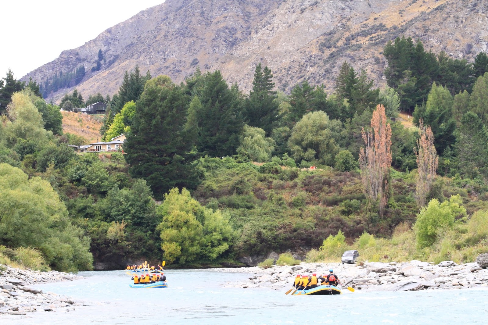 |
| Add caption |
 |
| White Water |
The group was divided to man the 5 or 6 rafts, each with a guide. Our guide’s name was “Chief”. The water was fast moving as it wound though the narrow and steep Skipper Canyon. The wet suits were nice to have – the water was cool but not cold –probably in the low 60’s – I never asked the temperature of the water. We went through several rapids classified as 3 or 4 – still nothing compared to the Little Pigeon River in the Great Smokies or the New River Gorge in West Virginia. Chief never explained anything about the river or the formations or the name or the rapids were travelling. The group was fun - - - the trip took about 2 hours.
At the end I
bought the video and pictures – that’s what is displayed here
FRIDAY February 26 2016
WEATHER: 17C/63F 62% humidity cloudy at 6
am , good chance of rain
Sunrise 7:17 AM –
Sunset 8:39 PM
TRAVEL: bus pickup at hotel to Milford Sound
 |
| Unfortunately this is not a clear picture -sorry |
This tour was advertised as follow: Discover Milford Sound Coach-Cruise-Coach - The pristine Milford Sound is part of the World Heritage Fiordland National Park, in the south west of the South Island, and is famed for its pristine natural beauty and remote atmosphere. It is New Zealand’s best known fiord and the only one that can be reached by road. Maori are believed to have discovered Milford Sound more than 1,000 years ago, returning seasonally to collect the prized pounamue (greenstone). The fiord extends 15km inland from the wild Tasman Sea and is regularly visited by wildlife including penguins, seals and dolphins. pounamu (greenstone).
Cascading waterfalls, sheer rock faces and dense rainforest. Your sightseeing tour to Milford Sound is made even more enjoyable by our glass-roofed coaches, which provide spectacular panoramic views as you travel along the Milford Road – one of the world's most scenic roads – and through the Homer Tunnel, before arriving for your Milford Sound cruise. Enjoy striking views of iconic Mitre Peak from the head of the Sound – it rises 1,692 metres from the south shore and is named for its resemblance to a bishop’s mitre (head dress).
My description
of this tour is: Almost
a 6 hour bus ride (some through pouring rain) , to have a buffet lunch on a
boat (in a pouring rain) and the best water park ride I’ve ever been on. Even
the 4+ hour ride back was enjoyable. At least when rafting yesterday,
they to to bring a towel and a change of clothes.
 |
| Kawarau River flowing out of Lake Wakatipu - Queenstown in the background |
 |
| The Remarkables along Lake Wakatipu |
We crossed the Kawarau
River Bridge, which I found
out was an outlet for Lake Wakatipu. The Kawarau
River also offered rafting and was the sight for several filming locations in
the Lord of the Rings. – traveled along the face of the
Remarkables with Lake
Wakatipu on the right..
 |
| The Steeples |
Saw a RAINBOW over Queenstown. Travelled through Kingston - on the other end of Lake Wakatipu – on to Garston to a range called the Steeples once sight of a goldmine.
The driver provided an excellent narration. I learned some more Kiwi phrases:
“irrigator” = irrigation system
“sheep are shifted by musters” = moved by
drovers/cowboys
“a right hander” = a right turn
“milk works” = dairy
“a good possum
is a squashum” = roadkill
“shootout” = hunt
“walk” = hike
“musterer” = cowboy
“running rocks” = falling rocks
“steep and deep country, steep as a hens face”
Turned west onto
SH 97 and saw another RAINBOW to Five
Rivers flat a
farming/dairy region. Interesting deer,
as well as cattle, are raised here for slaughter as meat. We hit some rain and
another RAINBOW.
 |
| Lake Te Anua |
Cabbage Trees
were named by Capt. Cook because their leaves provided some vitamins to sailors
and the boiled water tasted like cabbage water.
 |
| Eglinton River Valley |
Entering Fjiordland National Park we drove through the Eglinton River Valley (Flats) and
 |
| Christy Falls |
We made a short
stop at Monkey Creek and my camera batteries died – I replaced them. As we continued to drive – no doubt this is Rivendell
- passed Mt.
Talbot which was used
as a training climb for Sir Edmund Hillary before his Everest climb in 1953. We drove through
the Henry Homer Tunnel – 9 years to construct over an 18 year period –
completed in 1953 – opened the tourist industry to Milford Sound. A 10% grade descent – emerging on the other
side into a canyon – more Rivendell – if it had only cleared a little . . . .It was
amazing.
 |
| Totoku River Bridge |
 |
| Waterfalls - the pictures will not do them justice it was surreal |
 |
| Boat on Milford Sound |
Another short stop at the Totoku River Bridge – the driver referenced being “wet as a shag” I have no idea what he meant –travel along the Cleddue River and arrived at the Milford Sound Terminal at 1:05 pm for a 1:30 cruise. It was pouring.
We boarded the boat,
ate lunch and headed into the wind to where the boat meets the Tasman
Sea. Along the way we did meet a 60 knot gust that
I could tell affected the boat but not
problem The seas were not as rough as my
trips to Fort Jefferson in the Florida Keys or on Lake Superior to Isle Royale.
 |
| Milford Sound - Waterfalls - they were everywhere right and left |
 |
| Milford Sound |
 |
| Milford Sound |
 |
| World Heritage Area To get to Milford Sound the road goes South of Queenstown around Lake Wikatepu then down to Te Anau then up to Milford Sound |
 |
| Milford Sound |
When we came about at the entrance to Milford
Sound the wind was
pushing the rain mostly at the stern. I
was on the lower level and took some fantastic pictures from the bow – but the
pictures still cannot even begin to describe the majesty and beauty of
continuous waterfalls - the rain and
mist from the waterfalls made it the water park experience. We headed back on the bus at 3:30 pm and
arrived back at my hotel around 7:45 pm.
 |
| Deer Park a Lord of the Rings filming location near Queenstown |
 |
| Rainbows are appropriate |
During the ride I finished reading The Lord of the Rings Movie Location Guide. I really do wish I had read this before I came to New Zealand – I would have spent a few more days visiting with few days in Wellington. Again – saw some RAINBOWS on return trip – a perfect end..