SUNDAY July 31, 2016
WEATHER: 63 and clear at 5:30 am, in the
90’s when I got to Denver and 87 in Estes Park.
USAFA Colorado Springs, CO EL 7258’ Sunrise 5:59 am Estes Park, CO EL 7522’ Sunset 8:xx pm
TRAVEL: Perigrine Pines FAMCAMP, USAF Academy,
Colorado Springs, CO to Spruce Lake RV Park,
Estes Park, CO. Slow drive from Boulder to Estes
Park along Highway
36. Lots of bicyclists between Boulder
and
Denver. My truck needed a rest again about halfway
from Boulder to Estes
Park – an uphill
climb of almost 2,000 feet in 21 miles..
 |
| Spruce Lake RV Park Estes Park, CO truck & trailer |
 |
| Not my "happy place" |
Estes Park is like ‘Dells’
of the Rockies.
 326 ROCKY MOUNTAIN NATIONAL PARK, Estes Park CO
Rocky Mountain National Park is a hiker’s paradise – ant time of year.
There are over 103 trails ranging from the .3 mile Adams
Falls Trail to a grueling
ascent to 14,259 foot Long’s Peak (at least a 16 mile round trip – suggested to start at 3 am). Only 7 of these trails are at altitudes of
less than 9,000 feet. You could spend a
month here walking trails and that will probably not be enough time. I’ll be here 3 full days – not enough time.
 |
| Rocky Mountain National Park This map is inadequate, even when you look at it in the VC The 5 VCs are in Green, Alpine VC is top center left The dotted line top is the Old Fall River Road The Trail Ridge Road connects Beaver Meadow, Alpine and Grand Lakes VCs Fall Meadows it top righ, Moraine Park bottom right |
There are 5 Visitor Centers and at least 2 scenic drives. The Trail Ridge Road (40 miles) and the Old Fall River Road (9 miles). The Old Fall River Road, reaching an elevation of 11,796 feet at Fall River Pass, is a narrow, one-way. dirt ,road with no turn-arounds. Once you begin, there’s no turning back. Once you reach the end its 25 miles back to Estes Park along the Trail Ridge Road. The Trail Ridge Road is 40 miles in length from Deer Ridge Junction to the Grand Lake Entrance Station west of the Continental Divide.
The park had three
eco-systems: Montane, Subalpine and Alpine.
Montane (below 9,000 feet)
aspen, lodgepole pine, Douglas fir
Subalpine (9,000 – 11,400
feet) Engelman Spruce, fir trees,
Alpine (above 11,400
feet) tundra, thin soil, animals adapt
 |
| Rocky Mountain - Moraine Park VC view |
I drove to the Moraine
Park Discovery Center and arrived at
4:30 pm when it was closing. I did walk
a short ½ mile Nature Trail.
I continued on down the road and arrived at the Bear Lake Nature Trail about 5:10 pm. It is always interesting to walk a numbered nature trail without a trail guide – you can make up stories about what you should be seeing. The trail guides cost $2 and there were none at the trail-head. I started to rain just as I was finishing the trail.
 |
| Bear Lake Nature Trail Map |
 |
| Bear Lake Nature Trail |
 |
| Bear Lake Nature Trail |
MONDAY August 1, 2016
WEATHER: 54 at 4:30 am
Estes Park, CO EL 7522’ Sunrise 6:00 am Sunset 8:15 pm
TRAVEL: Spruce Lake RV Park,
Estes Park, CO to Rocky
Mountain NP to Spruce Lake
RV Park, Estes Park, CO
Spruce Lake RV Park: WIFI is fine before 7 am, useless in the evening –
people wake up, play games, stream movies – Spruce Lake gets a 6 of
10 points. If it weren’t so crowded it would probably be
fine – seems to me like “service – only when we’re not busy making money.” Time
for a WIFI upgrade to serve the customer.
Also, for a reason unknown to me the pool is closed, they work on it,
but it remains closed, I was not given a reason – not a good deal for families
with kids.
 |
| Bear Lake Trailhead Trail System - Bear Lake - Nymph Lake - Dream Lake - Emerald Lake to Lake Haiyaha and back to Bear Lake Trailhead |
This was a full
day. I headed for Bear
Lake at 6:30 am in
order to find a parking space. Already
by 7 am the parking lot was ¾ full. I
hiked a series of connecting trails for a 5.6 miles walk that took about 3
hours..
 |
| Nymph Lake |
Bear Lake Trailhead to Nymph Lake - .5 miles a lily-filled lake
 |
| Trail to Dream Lake a lot of people on this trail - well maintained |
 |
| Dream Lake |
Emerald Lake Trail - .6 miles mountain scenery, when I got here the wind was literally
racing down the mountain side – it must have been a steady 35 mph.
Return walk to Dream
Lake Trail Junction .6 miles
 |
| Emerald Lake the wind was really coming down the moutnain - at least 35 mph |
 |
| Emerald Lake Trail sign |
Lake Haiyaha Trail – 1.1 miles this ways a steady uphill climb to Lake Haiyaha. The lake is surrounded by boulders, almost reminiscent of Devils Lake in Wisconsin – but these are not as big and may be more rounded.
 |
| Lake Haiyaha Trail All uphill - more rugged than the trail to Emerald Lake |
 |
| Lake Haiyaha Trail some great views |
Return to Dream Lake Trail
Junction 1.1 miles most of this walk was downhill.
Return to Bear Lake
Trailhead – 1.1 miles – now it was a downhill walk.
 |
| Lake Haiyaha Trail |
 |
| Lake Haiyaha |
The 5.6 mile walk took about 3 hours – evens starting at 7 am there were plenty of people on the trail. Trying to find a parking place after 7:30 is almost impossible. The park does offer a shuttle for hikers. Best to use the shuttle if you don’t get here early
 |
| Moraine Park the dark forested hill is the moraine |
 |
| Moraine Park VC 2nd floor had great exhibits on glaciers |
Driving back I
stopped at the Moraine Park Discovery Center. The building
used to be a lodge, there is an excellent museum on the second floor, with a
sitting room, art gallery and bookstore on the main level.
I thought I’d stop again at the Beaver Meadows Visitor Center, however, when I got there about 10:40 the lot was full – no place to park. This VC is just before the entrance station to the park. I decided to re-enter the park – but the line was a mile long and it took me 10 minutes to regain entry – even with 3 ranger kiosks. I headed for the Fall River Visitor Center – not as much traffic from Estes Park entering here.
I then headed for
the Fall River Visitor Center through Deer Ridge Junction. On the return to the park I took
the Old Fall River Road.
OLD FALL RIVER ROAD
 |
| Old Fall River Road |
 |
| Old Fall River Road Chasm Falls - Mile 1.4 |
 |
| Old Fall River Road view |
The 9 mile historic roadway was built between 1913 and 1920. There is a guide that is marked off in miles with 19 highlighted areas. Only Chasm Falls at Mile 1.4 has any parking – it is also the only point marked by a sign. I kind of keep track of where I was per the guide by setting the mileage counter on the truck.
 |
| Old Fall River Road Chapin PAss |
Arriving at the Alpine Visitor Center at 1;20 pm was another exercise in futility – there was no parking. I even drove around in the lot twice in an attempt to find a spot – it was very slow moving – finally a ranger closed the entrance from Trail Ridge Road.
I left the parking
lot and went down Trail Ridge Road.
TRAIL RIDGE ROAD
I got turned around
– not thinking and headed down the Trail Ridge Road,
It was starting
to cloud up with, what looked to me, like the pollution
of Beijing – it was air
pollution, the smoke from the Walden Fire. I got worse
as the afternoon wore on.
 |
| Trail Ridge Road - Forest Canyon Overlook Stop 5 |
There is also a
guide for the Trail Ridge Road – Alpine VC is Stop 8. The Gore Range pullout, Lava
Cliffs - Stop 7, and Rock
Cut - Stop 6 did not have any
parking available – another train of automobiles on the road with some slowing
down to view elk grazing. I finally did
find parking available at the Forest Canyon Overlook – Stop 5.
Here I decided to head toward Kawuneeche VC in the hope of less traffic and
less people.
Passing the Alpine
VC, there still was no parking, I stopped at Medicine Bow Curve –
Stop 9. I did not stop at Milner
Pass – Stop 10 and Fairvew
Curve – Stop 11 – same, same . . .
. .
 |
| Trail Ridge Road - Forest Canyon Overlook Stop 5 |
 |
| Trail Ridge Road - Gore |
 |
| Trail Ridge Road Colorado River |
Kawuneeche Visitor Center was open – it is at the West Entrance to the park and also called Grand
Lake Visitor Center. It has a small
bookstore and exhibits. It shows the
same film I saw on Sunday.
 |
| Trail Ridge Road Holzwarth Historic Site |
 |
| Trail Ridge Road - Holzwarth Historic Site one of the rooms in 'mama's cabin' |
 |
| Trail Ridge Road - Holzwarth Historic Site the haze is actually smoke |
John Holzwarth Sr. was a successful 1st generation German immigrant saloonkeeper in Denver. With the enactment of Prohibition in 1916 – it was time to start over. He had previously worked in Grand Lake, and in the summer of 1918, the Holzworth’s, John, his wife Sophia and children staked a homestead 8 miles north of Grand Lake and made plans for a new life.
The opening of the Fall
River Road in 1920 prompted the Holzworth’s to serve the increasing number
of tourists; the ranch became the Holzwarth Trout Lodge.
The heyday of the Trout Lodge lasted until the Great Depression and their development of the Neversummer
Ranch. It was an excellent location for horseback
rides and all-day hay rides. Papa
Holzwarth died in 1932. The family continued to operate
Neversummer Ranch.
In 1973 the ranch
was sold to the Nature Conservancy with the understanding that the land would be preserved as open space
for the enjoyment of everyone. The
National Park
Service purchased the
ranch from the Conservancy in 1974.
I headed back to Estes
Park via the Trail
Ridge Road and did find
parking available at Alpine VC, however, it was
5:10 pm and the VC closed at 5 pm.
I continued along Trail
Ridge Road and Lava
Cliffs and Rock
Cut now had parking
but I did not stop. The same elk were
grazing along the road – people just came to a halt on the road - stopping
traffic – that is illegal and dangerous.
I’ve seen 3 elk in Estes Park alone – these people must have never
visited a zoo – same picture.
TUESDAY August 2, 2016
WEATHER: 54 at 4:30 am partly cloudy, 77 and mostly cloudy with some
occasional rain at 1 pm and again at 3 pm – still raining at 4 and the temp
dropped to 62;the sun came out around 6:30 pm it warmed up to the high 60’s
Estes Park, CO EL 7522’ Sunrise 6:01 am Sunset 8:14 pm
TRAVEL: Spruce Lake RV Park,
Estes Park, CO to Rocky
Mountain NP to Spruce Lake
RV Park, Estes Park, CO
Spruce Lake RV Park WIFI – I had hoped to check out Colorado
Rockies tickets and
hotels for a game in Denver tonight but
could not connect. I think this park
sinks to a 5 of 10 – for $59 a night this is not as bad as the $63 a night rate
for the RV Park near Washington, DC – at least the WIFI worked there.
I did drive to
the McDonald’s in Estes Park for a coffee and sausage McMuffin – do you believe they did
not have any coffee? Really! I think the
WIFI works so I’ll
return later but I headed for the Wild Basin Trailhead – a site the ranger told me
would be less crowded.
326 ROCKY MOUNTAIN NATIONAL PARK, Estes Park CO
 |
| Wild Basin Ranger Station |
 |
| Wild Basin Area Map - I hiked the trails to Copeland Falls - Calypso Cascades and Ouzel Falls - all uphill - it was downhill on the return trip |
What struck me most
here at Rocky Mountain NP is the people who have all the latest gear . . . . mostly ‘older’ adults
– hiking shoes, the latest non-rip
fabric hiking pants not shorts, jackets (it not that cold – even at 7am) and
the clink-clump of two retractable hiking poles and a never ending array of
floppy hats. Some of these folks are fit
– some think they are and most are hiking like the guys who walk in golf – to
stay fit – but you’ve got to do this more than once a year. Then of course there are the macho guys, and
the people who have to continuously talk – Like I’ve said earlier – only here
at Rocky Mountain NP - - - - - there is a much younger crowd and less children at Zion, Bryce, Grand Canyon, and even the California parks of
Yosemite and Sequoia
and they are not
dressed to the nines - these are mostly tourists.
 |
| Wild Basin Lower Copeland Falls |
 |
| Wild Basin Calypso Cascades |
 |
| Wild Basin Upper Copeland Falls |
 |
| Wild Basin - the last Ranger on a 4 person trail crew - 'trail hogs' walking at a pace of at least 3 mph each with a shovel in hand |
 |
| Wild Basin - this area suffered fire in 1988 the forest is recovering |
 |
| Wild Basin - Ouzel Falls |
The trail was a compilation of all 3 types of trails I encountered at the beginning and the end of the Appalachian Trail: R&B1, R&B2 and R&R.
R&B1 = Rocks and
Boulders
R&B2 = Roots and
Boulders
R&R = Roots and Rocks
The waterfalls were
not that terrific – if your from Texas – well then, maybe – but the best falls
I’ve seen were along the Delaware River in the Pocono Mountains.
The hike took was
all uphill 2.7 miles getting there, and 2.7 miles downhill getting back. I started at 7:40 am and finished at 10:30
am.
 |
| Wild Basin Rocks & Boulders |
 |
| Wild Basin Roots & Rocks |
 |
| Wild Basin Roots |
I headed for the McDonald’s where the WIFI works and updated July 29, 30 and started this post of July 31. I had hoped to purchase a ticket for the Rockies vs. Dodgers game and get a room using the net. It was past noon and it started to get cloudy and drizzle . . .
BOTTOM LINE: I decided not to go the game
1)
Coors Field is a
downtown ballpark
2)
Good single
tickets were $69 (tried 3x to buy a tickets,MLB website wouldn’t act)
3)
A room downtown
HIExpress – a mile away from the stadium was $200
4)
The drive to
Denver is 1½ hours, 79 miles, one-way on mostly mountain roads at least 2000 ft
down from here and up in the dark
5)
I didn’t want to
drive at night and they only play night games during the week
6)
The Rockies were
out of town on Sunday
IT JUST WASN’T WORTH IT
Seeing a ball
game at a park in the West has been a challenge, I spent more than 2 months in
AZ but couldn’t see a game in Phoenix – mostly because of the season and
schedule.
I updated words
for the blog – too much rambling I’m afraid - and labeled photos.
One more day in Estes
Park – not sure what
I’ll do tomorrow. If I go to the park - I have to leave early.
WEDNESDAY August 3, 2016
WEATHER: 51at 4:30 am, 74 by 8:30, rain around 2 - then it cleared
Estes Park, CO EL 7522’ Sunrise 6:01 am Sunset 8:13 pm
TRAVEL: Spruce Lake RV Park,
Estes Park, CO to Rocky
Mountain NP to Spruce Lake
RV Park, Estes Park, CO
I performed
surgery today – removal of the left front stabilizer on the trailer. It was a short simple operation involving a
11/16” and 5/8” wrench. A hammer was
available but not necessary to remove the bolts holding the stabilizer. I called Burlington RV to make an appointment for
replacement/repair in September - service is always busy, first thing in the
morning – left a message – somehow I don’t expect a return call.
326 ROCKY MOUNTAIN NATIONAL PARK, Estes Park CO
If you want to beat
the crowds you have to arrive at the trailhead before 7am and even then it can
be crowded. I entered the park at 8:50 and drove straight ot the Alpine
VC on Trail
Ridge Road. I arrived at 0925 and there was some available
parking . . . .
A lot of bicycles
on Trail Ridge Road, probably over 100 – must have been an organized ride – there were
several rest/watering stations set up at some of the stops on the road for the
bicyclists. I understand ROW, but I
think bicycling is hazardous on mountain roads – it’s a macho – endurance -
thing.
 |
| Alpine Ridge Trail - summit looking down at Alpine VC and the parking lot - it's 1015 am 'let the circling begin' |
TRAIL RIDGE ROAD
 |
| Alpine Ridge Trail it will take your breath away there is a top over the top |
 |
| Trail Ridge Road - Stop 7 Lava Cliffs |
The dark cliff is
composed of volcanic rock – tuff –created from a blanket of volcanic ash
created by volcanoes in the Never Summer Mountains 26-28 million years ago. Later glacial ice carved into the hillside
exposing the rock we see today.
 |
| Trail Ridge Road - Stop 6 Rock Cut Tundra Communities Trail There were an abundance of signs on this trail - most had to due with the wildlife and tundra flowers. This was an short but enjoyable walk |
 |
| Trail Ridge Road - Stop 6 Rock Cut Tundra Communities Trail I think this is a marmot - eating and getting fat for the winter |
 |
| Trail Ridge Road - Stop 6 Rock Cut Tundra Communities Trail dark metamorphic schist on top - lighter igneous granite beneath - just like the intrusions at Black Canyon |
 |
| Trail Ridge Road - Stop 6 Rock Cut Tundra Communities Trail View |
 |
| Trail Ridge Road - Stop 6 Rock Cut Tundra Communities Trail View of Trail Ridge Road looking toward the Lave Cliffs (right) and beyond the cliffs, the Alpine VC |
I got back to the
trailer around noon after a stop at the Beaver Creek VC – it was 88 in the RV Park - then it began to cloud up
– possibility of rain – 83 at 1:30 pm..
I will probably update the blog by going to McDonald’s
after I write and
label photos in the trailer.
THURSDAY August 4, 2016
WEATHER: 61 at 5:15 am, cloudy in Estes Park; in the 60’s until I turned off I-25 and
headed to Lusk. WY around noon when it finally broke 70; mid 70’s and cloudy in
Lusk
Estes Park, CO EL 7522’ Sunrise 6:02 am Lusk, WY EL 5020’ Sunset 8:13 pm
TRAVEL: Spruce Lake RV Park,
Estes Park, CO to BJ’s Campground,
Lusk WY. A 5 hour 239 mile trip – not much in Lusk
POP 1,617 EL 5,020’
I spent almost 4
hours in the Estes Park McDonald’s yesterday updating the blog because it has WIFI that works – but not as fast the
McDonald’s in Cedar Park,UT - these RV Parks that I’ve stayed at for the last 5
weeks (except for Salida, CO) have
terrible service – useless – a customer should expect more.
BJ’s Campground, Lusk, WY:
WIFI WORKS – THE FIRST RV
PARK I CAN THAT ABOUT SINCE THE END OF JUNE. Not much to BJ’s – 26 sites – only 4 occupied
today. This is not a KOA or Good Sam
affiliate. Lusk itself is smaller than
Durand; no McDonald’s – only 2 restaurants, 1 bar. If you travel 12 blocks either direction from
Main St you’re out of town.
FRIDAY August 5, 2016
WEATHER: 56 at 5:30 am, mostly cloudy
Lusk, WY EL 5020’ Sunrise 5:54 am MDT Sunset 8:12 pm MDT
 |
| This map shows the proximity of Agate Fossil Beds, Scotts Bluf and Fort Laramie to Lusk WY - which led to my visiting all 3 in 1 day. |
BJ’s Campground – having working WIFI is wonderful. The response is as good as it is when I’m
home. Additionally, the washrooms at BJs
are like walking in a large furnished bathroom in someone’s home – nicely
decorated – 2 showers – 2 sinks. No pool
but this place gets a 10. Public park with
playground is right across the street.
Eastern Nebraska
is on CDT, Harrison NE is on MDT. When I
travel to Rapid City, SD next week – the area is also on MDT.
326 AGATE FOSSIL BEDS National Monument, Harrison, NE
 |
| Agate Fossil Beds - map |
There is a small
Visitor Center, exhibit area and bookstore.
To include hiking the two trails allow at least 3 – 4 hours. There are 2 trails and each has a free trail
guide.
During
the 1890s, scientists rediscovered what the Lakota Sioux already
knew—bones preserved in one of the world's most significant Miocene Epoch mammal sites.
Yet, this place called "Agate" is a landscape that reflects many influences—from early animals roaming the valleys and hills, to tribal nations calling the High Plains home, to explorers passing through or settling in the American West.
Yet, this place called "Agate" is a landscape that reflects many influences—from early animals roaming the valleys and hills, to tribal nations calling the High Plains home, to explorers passing through or settling in the American West.
Agate Fossil Beds National Monument is located in
Sioux County in the northwest corner of Nebraska. The Wyoming border is 17
miles to the west, and the South Dakota border 42 miles to the north. The
county's only town, its county seat, is Harrison, population
251. The 2,000-square mile county itself has a population of only 1,500 people.
Much of the area's land is used for ranching and has a carrying capacity of at
least 25 acres for each cow-calf pair.
The
mammals found at Agate Fossil Beds National Monument date from the
early Miocene Epoch some 19 to 21 million years ago.
Scientists describe the Miocene Epoch as the period of time from 5 to 23
million years ago. At that time, today's Great Plains region was drying out.
Flowering plants proliferated, and the abundant animals, including birds,
responded to a new food source: grasslands that replaced forest and jungle.
Although slightly different anatomically, some of these creatures resemble
those of today. Others of these long extinct animals that succeeded the
dinosaurs came in bizarre shapes and sizes that influenced people's imagined
monsters of yesteryear.
Three particular mammals were associated with the death event(s) that came to create “The Great Bonebed Of Agate.” These were the Menoceras, a small rhinoceros; the large Moropus; and the fearsome Dinohyus. Another quarry site is comprised almost entirely of the once-abundant small gazelle-camel, the Stenomylus. Certain other nearby geological formations contain remains of a burrowing dry-land beaver, the Palaeocastor, and its curious spiral home, the Daemonelix. The final, less frequently found animal is the predator Daphoenodon from the beardog family.
Scientists
compare the area of the past to the Serengeti
Plain
in Africa and believe that the large amount of fossils in one place is similar
to what happens in the Serengeti.
Animals congregate around a waterhole – and drought occurs – even though
the water is still abundant – the forage causes the animals to browse for food
farther and farther from the waterhole.
They animals eat all of the food and eventually become malnourished. They return to the cool water – where they
rest and expire.
Three particular mammals were associated with the death event(s) that came to create “The Great Bonebed Of Agate.” These were the Menoceras, a small rhinoceros; the large Moropus; and the fearsome Dinohyus. Another quarry site is comprised almost entirely of the once-abundant small gazelle-camel, the Stenomylus. Certain other nearby geological formations contain remains of a burrowing dry-land beaver, the Palaeocastor, and its curious spiral home, the Daemonelix. The final, less frequently found animal is the predator Daphoenodon from the beardog family.
 |
| Agate Fossil Beds - artist depiction of animals at waterhole |
 |
| Agate Fossil Beds - full scale diorama of the artist picture above |
 |
| Agate Fossil Beds - Daemonelix Trail - map |
 |
| Agate Fossil Beds A preserved "devil's cockscrew" a fossil of the dry land beaver's burrow |
Daemonelix Trail
This one-mile (1.6 km) trail at the west end of the park offers a tour through through time. In addition to a dry land beaver's curious spiral burrows, the Daemonelix or Devil's Corkscrew, there are ancient sand dunes and fossil grassland soils called paleosols. From the number and concentration of their now petrified homes, paleontologists know that the paleocastor, the dry land beaver, formed and lived in colonies much like present-day prairie dogs. From the Deamonelix Trail's highest point, you can view James H. Cook's historic Agate Springs Ranch and the vast, open tablelands that form northern terminus of the High Plains east of the Rocky Mountains.
 |
| Agate Fossil Beds -Fossil Hills Trail - map |
 |
| Agate Fossil Beds -Fossil Hills Trail Excavations around University & Carneigie Hills |
This 2.7-mile (4.3-km) wheelchair-accessible paved trail begins at the visitor center. I took just under 1 ½ hours to walk the trial from the visitor center. The trail crosses the Niobrara River and its wetlands, passes through ecologically intact short- and mixed-grass prairie, and then loops around University and Carnegie Hills. It was on these hills that future local rancher James Cook discovered fossilized bones in the mid 1880's. Excavations didn't commence until nearly twenty years later, following a 1904 visit by Olaf A. Peterson, a paleontologist from the Carnegie Museum in Pittsburgh, Pennsylvania. Signs along the trail point out and discuss a variety of historic and geologic features; others identify the names of plants, including flowers and grasses.
 |
| Agate Fossil Beds Fossil Hills Trail University Hill |
that leads west to Harold J. Cook's homestead cabin. I did not walk this trail. Restored to what it looked like in 1910, while Harold and his wife Eleanor still lived there, the cabin was used after 1914 as the temporary residence for scientists who worked the fossil quarries. The American Museum of Natural History's lead excavator, Albert "Bill" Thomson, lived there whenever conducting field work in the bone-bed in the late 1910's and early 1920's
327 SCOTT’S BLUFF National Monument, Gering, NE


Towering
800 feet above the North Platte River, Scotts Bluff has served as a
landmark for peoples from Native Americans to emigrants on the Oregon, California and Mormon Trails to modern
travelers. Rich with geological and paleontological history as well as human
history, there is much to discover while exploring the 3,000 acres of Scotts Bluff National Monument.
Scotts Bluff is a remnant of ancestral high plains that
were 100s of feet higher than today’s Great Plains. Geologists have determined that wind, water
and volcanic eruptions deposited the material of the bluffs. The layers span a
10 million year history.
Four to five million years ago the land began to erode faster than new materials were deposited. Some patches of limestone resisted erosion, and acted as cap rock to protect layers beneath.
 |
| Scotts Bluff - Map or the Oregon Trail |
Four to five million years ago the land began to erode faster than new materials were deposited. Some patches of limestone resisted erosion, and acted as cap rock to protect layers beneath.
 |
| Saddle Rock Trail landslide across trail |
 |
| Scotts Bluff - View looking to the north view point from the south |
Throughout time, Scotts Bluff has been viewed as a landmark for those trekking a trail through history. Even the short walk at Scotts Bluff National Monument offered a glimpse of the varied resources of the area. Short and mixed-grass prairie, wildflowers, native trees and shrubs, geologic features, historic features, and many species of birds and mammals.
 328 FORT LARAMIE National Historic Site, Fort Laramie,
 WY
The
Visitor Center is in what used to be the Commissary building. It
was a large bookstore and exhibits describing the history of the fort. There is a 20 minute video. I spent about 2 hours here – same layout as other frontier forts I
visited - but you could spend 3 or 4 if
you stop and visit everything.
 |
| Fort Laramie |
 |
| Fort Laramie - Burt house Restored Officers Quarters |
 |
| Fort Laramie - Captain's Quarters inside dining room |
As America expanded westward, the outpost in Wyoming wilderness played a crucial role in the transformation of the West. First, as a fur trading post, then as a military garrison. For over 5 decades it was a landmark and way station for trappers, missionaries, emigrants, Pony Express riders, and miners. It was also a staging point for the US Army in its dealings with the plains tribes displaced by migration and settlement.
When the government closed the fort in 1890 and its buildings were sold at public auction, local residents dismantled the buildings and transferred the material to their homesteads for use. The National Park Service established ownership in the 1930s and restored many of the buildings.
The fort served as
a military outpost along the Oregon Trail but was never seriously threatened by
Indian attack. The post did become a
staging ground for Indian campaigns that
eventually led to the tribes’ confinement on reservations.
Most soldiers never
saw action against hostile Indians. The
majority of the soldiers stationed here were Infantry.
It was a joy to
visit all three of the sites above in one day – I had allowed a day for each
site – with the extra days I reviewed the schedule and decided to eliminate a
travel trailer journey of almost 580 miles from Missouri NRA to La Junta, CO to visit Bents Old Fort NHS and Sand
Creek Massacre NHS. I should have visited these sites when I was
in Colorado Springs or even before when I left Salida - La Junta is Highway 50. So on Sunday
morning I will travel to La Junta via Denver to see an afternoon Colorado Rockies game, stay at a Holiday
Inn Express (with points)
and after visiting Bents and Sand
Creek return to my
trailer early Monday evening. A long day but it will mean I return home 4
days earlier.
There may be an
added benefit – the Holiday Inn Express may just have ESPN and broadcast of the Packer-Colts game.
GOLF LUSK MUNICIPAL GOLF COURSE: The course is 9 holes, par 36
for men and 3,197 feet from the White tees; 6,492 from the blue tees with a
rating of 70.4 and a slope of 123. I had stopped by here yesterday – thinking I’d
play yesterday – the grand circle of National Park Service sites
took precedence. I shot a 48 with 19
putts and 1 lost ball. There was no sand
but there were hazards – water – well mostly lowland weeds now – but still a
hazard – snake country – if it goes in – its gone.
COORS FIELD – Colorado Rockies (7) vs. Miami Marlins (10) This is a great stadium
despite its downtown location – I liked the park – equal to Cleveland’s Progressive
Field, downtown park but
my favorites are still Miller Park then Citizens Bank Park in Philadelphia. I didn’t know it,
but I had Club Level seats in Section 219, Row 4, Seat 4.
Miami got 4 runs in
the 1st inning and another 4 in the top of the 4th – by then
it was 8 -1 and I had been in the park more than 2 hours – I still had a long
drive – I left the park. I was on the 1st
base side – sun all afternoon – avoid it for afternoon games.
SATURDAY August 6, 2016
WEATHER: 60 at 5:15 am, cloudy – cloudy and
60’s all morning – mid 70s with a breeze by mid afternoon Lusk, WY EL 5020’ Sunrise 5:55
am Sunset 8:11 pm
TRAVEL: Lusk WY
Spent all
morning cancelling, re-arranging the schedule and making reservations.
Yesterday, I
finished listening to a Great Courses lecture series: Great American Best Sellers:
The Books that Shaped America. Prepared by
Peter Conn, Professor of English at the University of Pennsylvania I found his
lectures interesting and worth listening to.
Admittedly some bias in selecting the “best sellers” but I have read at
least 12 of the 22 he selected to include Common Sense, The
Adventures of Huckleberry Finn, The Jungle, Main Street, The
Virginian. To Kill a Mockingbird, Native Son, The Catcher in the Rye and Catch-22. It just hit me that I read all these while
in high school or college. Others include How
to Win Friends and Influence People, The Good Earth, The
Grapes of Wrath, Uncle Tom’s
Cabin and Little Women.
 |
| Lusk Municipal GC(formerly Niobrara Country Club) Hole #4 |
 |
| Lusk Municipal GC(formerly Niobrara Country Club) Hole #4 |
SUNDAY August 7, 2016
WEATHER: 62 at 5:00 am Lusk, WY, forecast
high of 88 in Denver today;
Lusk, WY EL 5020 Sunrise 5:56 am La Junta, CO EL 4078’ Sunset 7:56 pm
 |
| Holy Ghost Church downtown Denver, CO |
TRAVEL: BJ’s Campground,
Lusk WY to Coors Field Denver CO (237 miles) to the HIE
LaJunta, CO (182 miles).
Noon Mass at Holy
Ghost Catholic Church in downtown
Denver. This was an older church in a
high rise downtown area. A mile walk
from Coors Field (my parking was in between but closer to the field). A cold and dark church – what might be called
Romanesque style but not a real dome – certainly not spires. Run by the Oblates of Mary – too much echo –
I can’t even tell you what the readings or the priest’s homily were about –
readers and the priest spoke from an old raised pulpit on the left of the
altar. Three servers, red cassocks with surplices. Cantor who really could sing – accompanied by
organ. Organist played a postlude that
displayed pyrotechnics at the organ.
 |
| Coors Field |
 |
| Coors Field Miami vs Rockies |
 |
| Packer Bar Half a block from Coors Field |
PACKERS VS. COLTS – 8
pm (EDT) ESPN This was a bummer – I had
secured a room at a Holiday Inn Express in La Junta, CO and was looking forward
to watching the game and it was cancelled - - - - something to do with paint
and the safety of the players?
MONDAY August 8, 2016
WEATHER: 65 at 6:30 am
La Junta, CO EL 4078’ Sunrise 6:03 am Lusk, WY EL 5020’ Sunset 7:55 pm
TRAVEL: Holiday Inn Express La
Junta to Bents
Old Fort NHS La Junta, CO
(10 miles) to Sand Creek Massacre
NHS, Eads, CO (88
miles) to BJs Campground, Lusk, WY (389 miles).
Another long busy day – but it will save me 4 days on the road with the
trailer.
As 675 cavalrymen came around a prairie bend, the camps of Peace Chiefs Black Kettle, White Antelope, and Left Hand lay in the valley before them. Black Kettle raised a 33 star American Flag and a White Flag over his tipi. The attack continued.
 331 BADLANDS National Park, 25216 Ben Reifel Rd, Interior, SD
 The Stronghold and Palmer
Creek Units (South Unit) are located within
the Pine Ridge Indian Reservation. These units are managed under a
cooperative agreement between the NPS and the Ogala
Lakota Sioux. The White River Visitor Center is located in the Stronghold
Unit. I’ll visit this another day.
The Stronghold and Palmer
Creek Units (South Unit) are located within
the Pine Ridge Indian Reservation. These units are managed under a
cooperative agreement between the NPS and the Ogala
Lakota Sioux. The White River Visitor Center is located in the Stronghold
Unit. I’ll visit this another day.
 The Loop
Road hugs the Badlands
wall, a long,
narrow, spine of formations that stretch 60 miles from Kadoka west towards the
town of Scenic.
The Loop
Road hugs the Badlands
wall, a long,
narrow, spine of formations that stretch 60 miles from Kadoka west towards the
town of Scenic.
WEDNESDAY August 10, 2016
Fossil Exhibit Trail – ¼ mile featuring fossil replicas and exhibits of extinct animals. EASY and fully accessible a 10 minute walk to
include reading the signage.
Notch Trail – 1 ½ mile meander through a canyon climbing a log ladder to a ledge and
the “notch” for a view of the White
River Valley. This was a moderate to
strenuous trail. The ladder was
interesting. The “notch” looks down on
the Cliff Shelf Trail and its juniper forest. A 50 minute walk.
Window Trail – ¼ mile round trip leads to a natural
window in the Badlands Wall with a view of an eroded canyon. This was an EASY fully accessible 15 minute walk.
332 MINUTEMAN MISSILE National Historic Site, SD
Minuteman Missile National Historic Site is located just north of I-90
Exit 131 – less than 15 miles north of Badlands National Park and the Ben
Raifel Visitor Center. There are 3 sites associated with Minuteman
Missile: the Visitor
Center, Delta-01 Launch Control, and Delta-09 site of a Minuteman Silo. The tours of Delta-01 are free but fill up
early – you cannot make a reservation on line.
The Visitor Center is a Cold War history center with emphasis on the Cuban Missile
Crisis and the fallout shelters of the 1950’s.
In 1991 as the Cold
War was coming to an
end, the Strategic Arms Reduction Treaty (START) was signed by President George
H.W. Bush and Soviet leader Mikhail Gorbachev. Both sides agreed to dramatically reduce
their nuclear arms.
Three Minuteman
missile fields ,
including the one in western South Dakota were chosen for deactivation. As the sites were being shut down, the USAF and the NPS worked together to find a site
that would represent the nuclear arms race, the Minuteman’s role during the Cold War, and the
dedication of Air Force personnel who
staffed the sites.
Today the
facilities are preserved in their historic state. The site at Delta -09 held a missile for 30 years,
today it holds a Minuteman training missile.
Went to the McDonald’s to update the blog,- WIFI works sometimes at Ellsworth usually first thing in the
morning before everyone gets out of bed – then gets more finicky as the day
goes on and users increase – still not good enough to update the blog.
Sturgis Motorcycle Rally – it’s a State Fair in a city – motorcycles and
vendors everywhere. My first impression – too many people – but
it may be a good time.
Stopped at Camping
World for chemicals –
looks like I can buy a leveler for the trailer off the shelf. I think the bars
may have had good business for a few hours.
Changed the oil and rotated the tires at Rapid Chevrolet & Cadillac – done in less than ½ hour – amazing –without an appointment.
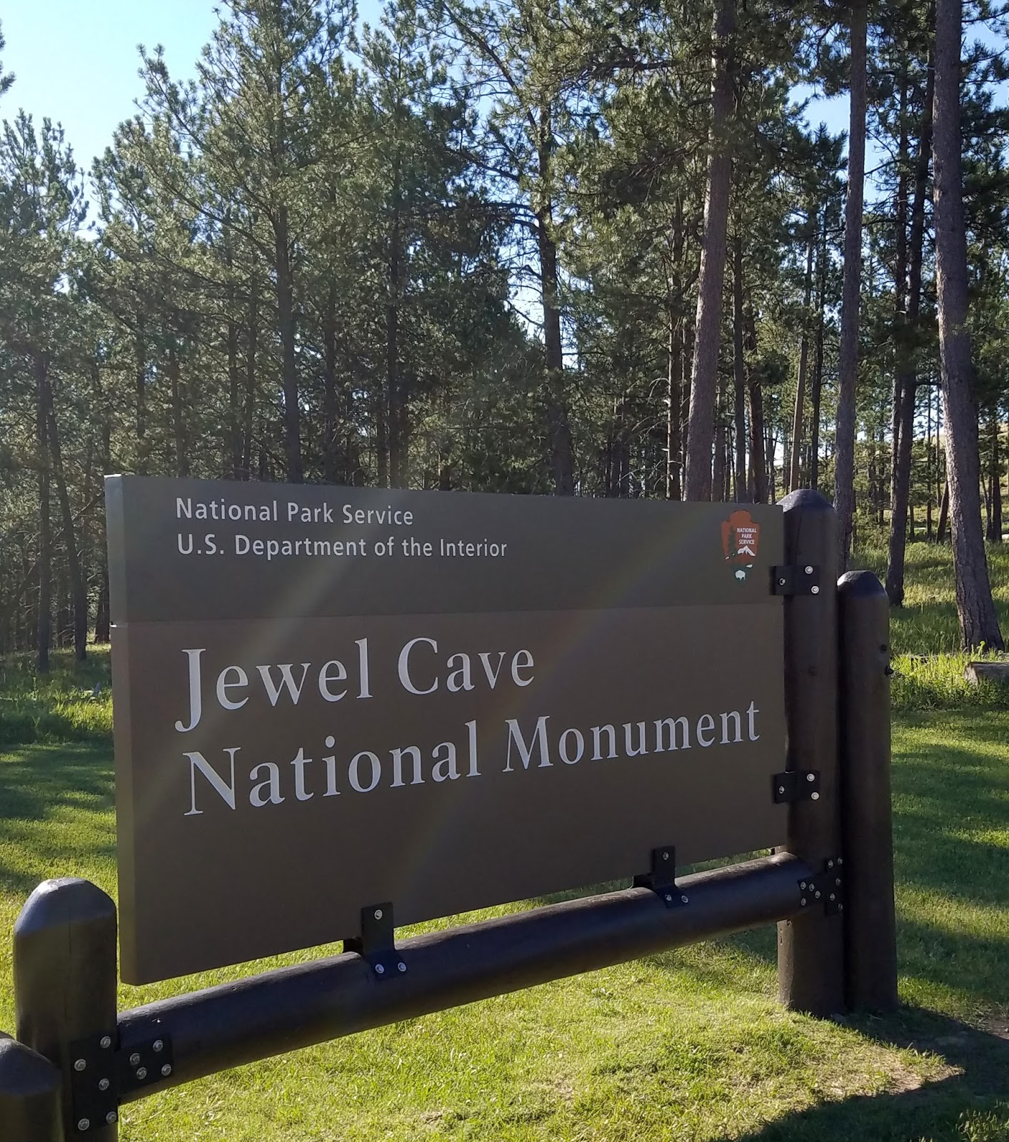
333 JEWEL CAVE National Monument, Custer, SD
EARLY CAVE
HISTORY:
The Michaud’s filed
the "Jewel
Tunnel Lode" mining claim in Custer
on October 31, 1900. Although calcite crystals had little commercial value, it
is apparent that they intended to develop this natural wonder into a tourist
attraction. During the following decade, they constructed a trail within the
cave, built a lodge up on the rim of Hell Canyon, and even organized the
"Jewel Cave Dancing Club" in 1902 to attract tourists. However, a
lack of people in this region and the difficulty of travel at that time made
the tourist venture anything but a financial success. Frank Michaud bought out Charles Bush's share of the cave in 1905
for $300. For a while, Frank continued to work at the cave, exploring and
keeping up the annual assessment work.
In 1928, a group of businessmen formed the Jewel Cave Corporation and provided tours to the public. This continued until 1939. The National Park Service began administering the monument in 1933 and park rangers from Wind Cave came to the monument in the summer.
RECENT
HISTORY:
At the beginning of 1959, approximately two miles of Jewel Cave had been discovered. Even though the cave was beautifully decorated with calcite spar crystals, the tour route was short, and some wondered whether this small cave was truly of national significance.
The initial discovery of the "Scenic Area"
of the cave
took place in 1961. But because the original boundaries of the National Monument dated back to a time when most of the cave was unknown, these new cave passages were actually outside of those boundaries, beneath U.S. Forest Service lands. In order to proceed with plans to develop a new tour route and visitor center, a land exchange with the Forest Service was accomplished in 1965, changing the monument boundaries. Construction of the present scenic area cave trail, the elevator shafts, one elevator, the visitor center, maintenance area, and parking lot began in 1966 and took nearly 5½ years to complete. The Scenic Cave Tour route and visitor center were first opened for touring on May 28, 1972.
334 WIND CAVE National Park, Custer, SD
In order to restore some of the missing parts to the park's ecosystem on July 4, 2007,
working with the US Fish and Wildlife Service, park biologists reintroduced one of the little known predators of the prairie - the black-footed ferret. These rare animals live on prairie dog towns and can consume over 100 prairie dogs in one year. They help maintain balance and restoring them continued the long history of Wind Cave National Park as a home to prairie plants and animals.
American Indians of the
area have known about the opening to Wind Cave and the winds that move
in and out of it for centuries. It is a sacred place for many tribes. In 1881 Jesse
and Tom Bingham were also attracted
to the cave by the whistling noise of the air coming out of the cave. As the
story goes, wind was blowing out of the cave entrance with such force that it
blew off Tom's hat. A few days later when Jesse returned to show this
phenomenon to some friends, he was surprised to find the wind had switched
directions and his hat was sucked into the cave. Today, we understand that the movement of the wind is related to the
difference in atmospheric pressure between the cave and the surface.
EARLY EXPLORATION
Several mining claims
were established at Wind Cave, but
the most noteworthy one was by the South
Dakota Mining Company in 1890. J.D.
McDonald was hired to manage the claim. The mining was unsuccessful, but McDonald and his family realized they
could make money by giving cave tours and selling formations from the cave.
They filed a homestead claim over the opening and worked on improving a manmade
entrance and enlarging passageways for tours.
One of J.D.'s sons, Alvin, spent much of his time exploring and mapping the cave,
faithfully keeping a diary
and making a map of his findings. On January 23, 1891, Alvin wrote that he had
"given up finding the end of Wind Cave". Alvin's explorations were
just the beginning of many adventures in the exploration of Wind Cave.
The Visitor Center provides several guided ranger tours for a fee. This was supposed to be a ‘expanded’ Visitor Center. I did visit here is 1976, I really can’t remember much but it must have been small and dumpy then. I watched a video in the auditorium and spent some time in the exhibit area. There is a bookstore.
The NPS rangers also offer a Candlelight Tour and a Wild Cave Tour.
335 MOUNT RUSHMORE National Memorial , Keystone, SD
When sculptor Gutzon Borglum looked at the knobby, cracked face of Mount Rushmore he saw a vision of four United States Presidents carved into the mountain. Between 1927 and 1941, with the help of over 400 workers and several influential politicians, Borglum began carving a memorial to the history of America. Today Mount Rushmore is host to over 3 million visitors each year.
The memorial is now host to an Information Center, Gift Shop, Café, Avenue of the Flags, Visitor Center and Amphitheater. Borglum’s Studio and the ½ mile Presidential Trail with 450 stairs are also on the site.
SATURDAY August 13, 2016
Prairie Ridge Golf Course. This is an Ellsworth
AFB facility but just
outside the main gate i.e. adjacent to the base, but you do not have to gain
access to the base in order to get to the golf course. Played in 2 hours behind
a foursome – had to wait on every shot – actually no-where to go. Cost was $21 with a cart. I shot 51 with 23 putts, 1 lost ball. The greens were tough.
 336 DEVIL’S TOWER National Monument , Devils Tower, WY
 GEOLOGY:
The Hulett Sandstone member, also part of the Sundance formation, is a yellow, fine-grained sandstone deposited on an ancient beach. Resistant to weathering, it forms the nearly vertical cliffs that encircle the Tower itself.
Geologists agree that Devils Tower was formed by the intrusion (the forcible entry of magma into or between other rock formations) of igneous material. What they cannot agree upon is how that process took place and whether or not the magma reached the land surface.
In 1907, scientists Darton
and O'Hara decided that Devils Tower must be an eroded remnant
of a laccolith. A laccolith is a large, mushroom–shaped
mass of igneous rock which intrudes between the layers of sedimentary rocks but
does not reach the surface. This produces a rounded bulge in the sedimentary
layers above the intrusion. This idea was quite popular in the early 1900s when
numerous studies were done on a number of laccoliths
in the Southwest.
The magma which formed Devils Tower cooled and crystallized
into a rock type known as phonolite porphyry. It is a light to dark-gray or
greenish-gray igneous rock with conspicuous crystals of white feldspar. Hot
molten magma is less dense and occupies more volume than cool hardened rock. As
the rock cooled, it contracted, forming hexagonal (and sometime 4-, 5- and
7-sided) columns separated by vertical cracks. These columns are similar to
those found at Devil's Postpile National
Monument in California but those at Devils Tower are much larger.
NEWS TODAY ALL
DELTA AIRLINES
FLIGHTS grounded
today due to a computer glitch – not surprising – worldwide havoc for travelers.
329 BENTS OLD FORT National Historic Site, 35110 Colorado 194,
La Junta, CO
William and Charles
Bent, along with Ceran St. Vrain, built the original fort on this site in 1833
to trade with plains Indians and trappers. The adobe fort quickly became the
center of the Bent, St.Vrain Company's expanding trade empire that included Fort St.Vrain to the north and Fort
Adobe to the south, along
with company stores in Mexico at Taos and Santa Fe. The primary trade was with
the Southern Cheyenne and Arapaho Indians for buffalo robes.
For
much of its 16-year history, the fort was the only major permanent white
settlement on the Santa Fe Trail between
Missouri and the Mexican settlements. The fort provided explorers, adventurers,
and the U.S. Army a place to get needed supplies, wagon repairs, livestock,
good food, water and company, rest and protection in this vast "Great
American Desert." During the war with Mexico in 1846, the fort
became a staging area for Colonel
Stephen Watts Kearny's "Army of the West". Disasters and disease
caused the fort's abandonment in 1849. Archeological excavations and original
sketches, paintings and diaries were used in the fort's reconstruction in 1976.
The
fort was left a ruin – nothing but a pile of adobe bricks. Today the reconstructed fort is the best I’ve
seen in the National Park Service. The reconstruction was meticulous, the
furnishing of the rooms is very detailed.
Rangers do the work of maintenance and staff dressed in period costume
greet visitors. There is a well stocked
bookstore. On occasion the working
blacksmith and carpenter run the forge and make wagon wheels.
Allow
at least 2 hours for a thorough visit.
There is a trail that goes around the grounds but I did not walk
it. The ½ mile walk to the fort is
paved.
330 SAND CREEK MASSACRE National Historic Site, 910 S Wansted
st, Eads, CO
November 29, 1864 changed the course of history.
The
Sand Creek Massacre: profound,
symbolic, spiritual, controversial, a site unlike any other in America.
June 27, 1864 - Colorado Territorial Governor John Evans issued a proclamation to the “friendly Indians of the Plains” and tells them to go to designated
“places of safety.”
Southern
Cheyenne and Arapaho are sent to Fort Lyon (formerly Fort Wise) on the
Arkansas River.
August 11, 1864 – Governor John Evans issues a proclamation authorizing citizens to “kill and destroy . . . hostile Indians.” The War Department authorizes a
100 day volunteer cavalry regiment, the 3rd
Colorado Volunteer Cavalry. It is under
the command of COL John Chivington.
August 29, 1864 – In response to Evans’
proclamation of June 27, Chief Black Kettle has George Bent and another man write letters to the Indian Agent at Fort Lyon asking for a
meeting. They turn over prisoners and
meet with territorial and US Army representatives.
September 28, 1864 – Cheyenne and
Arapaho leaders, including Black Kettle meet with Governor Evans and COL Chivington near Denver. Chivington tells them to
lay down their arms and turn themselves in at Fort
Lyon.
October 1864 – Evans writes that “winter . . .
is the most favorable time for their chastisement . . . . “ (when the Indians
horses are weak and tribes typically do not make war). Cheyenne arrive at Fort Lyon. Following
discussions they go to Sand Creek, where Black Kettle’s band is already
camped and the game and forage are better.
By mid-October there are 130 tipis and 700 Indians, mostly Cheyenne with a few Arapahoe.
November 20, 1864 – Colorado
Third Volunteer Cavalry (mockingly
called the “Bloodless Third” having seen no combat) leave Denver. Companies from the 1st and 3rd
Cavalry are already enroute. Other
companies join them along the way.
November 28, 1864 – COL Chivington arrives at Fort Lyon with 850 men.
To keep his plans secret, he halts outgoing mail and restricts everyone
to the fort. He leaves Fort Lyon that night with 675 men and four 12 lb
mountain howitzers, The column heads to Sand Creek.
Chvington prepared to attack the camp. Two Company Commanders refuse to attack the
camp and partake in the slaughter and subsequent mutiliation.
As 675 cavalrymen came around a prairie bend, the camps of Peace Chiefs Black Kettle, White Antelope, and Left Hand lay in the valley before them. Black Kettle raised a 33 star American Flag and a White Flag over his tipi. The attack continued.
The
cavalry massacred of over 200 Cheyenne and Arapaho, to include many women and children
The
treachery of the attack damaged the credibility of remaining Peace Chiefs –
across the Plains the Cheyenne declared all out
war
In
1865, the Congressional Joint Committee on the Conduct of
the War (the
Civil War was still in progress) took testimony, finding that Chivington had “surprised
and murdered, in cold blood . . . unsuspecting women and children . . who had every reason to believe that they
were under (US) protection.”
Despite the condemnation, no one was ever indicted or tired in a
civilian court.
There
is not much at this site – no movie – a small Information
Center –
a bookstore - 2 full time rangers - it
is sacred.
LTC George Armstrong Custer also staged s similar
attack on Black Kettle’s camp several years later along
the Washita River in Oklahoma – it was not called
a massacre by Congress.
TUESDAY August 9, 2016
WEATHER: 59 at 5:15 am - up to 98 in the Badlands, very windy in the
evening – rocking the trailer – the plexiglass window faces west – difficult
keeping it in place - so far I’m glad
it’s not raining. Lusk,
WY EL 5020’ Sunrise 5:58 am Ellsworth
AFB, SD EL 3279’ Sunset 8:04 pm
 |
| Ellsworth FamCamp concrete pad, full hookup |
TRAVEL: BJs Campground, Lusk,
WY to Ellsworth
AFB FAMCAMP to Badlands National Park to Ellsworth
AFB FAMCAMP.
Ellsworth AFB FamCamp – WIFI is all
but non-existent, this was expected, there is a McDonald’s 7 miles down
I-90.

The park has three
units. The North
Unit is the best known
and easiest to access. This is where I
went today, entering the park just south of I-90 and Wall, SD at the Pinnacles
Entrance. I followed the Badlands Loop Road to the Ben
Reifel Visitor Center near Interior, SD.
 |
| Badlands National Park - really no roads in the southern units 68 miles west of Ellsworth AFB - a 50 minute drive at 80 mph on I-90 |
 The Stronghold and Palmer
Creek Units (South Unit) are located within
the Pine Ridge Indian Reservation. These units are managed under a
cooperative agreement between the NPS and the Ogala
Lakota Sioux. The White River Visitor Center is located in the Stronghold
Unit. I’ll visit this another day.
The Stronghold and Palmer
Creek Units (South Unit) are located within
the Pine Ridge Indian Reservation. These units are managed under a
cooperative agreement between the NPS and the Ogala
Lakota Sioux. The White River Visitor Center is located in the Stronghold
Unit. I’ll visit this another day.
All the trails are
located in the North Unit. I’ll return tomorrow to walk most of these
trails.
GEOLOGY:
Deep canyons,
towering spires, and flat-topped tables can all be found among the Badlands buttes. They are largely the result of deposition and
erosion.
The
Badlands did not begin
eroding until about 500,000 years ago.
When water began to cut down through the rock layers, carving fantastic
shapes into what had been a vast floodplain.
The rock is still eroding at 1” per year – it is estimated that in
another 100-500,000 years the rock will be completely eroded away.
 The Loop
Road hugs the Badlands
wall, a long,
narrow, spine of formations that stretch 60 miles from Kadoka west towards the
town of Scenic.
The Loop
Road hugs the Badlands
wall, a long,
narrow, spine of formations that stretch 60 miles from Kadoka west towards the
town of Scenic.
The Badlands were deposited in layers of soft
sedimentary rock composed of grains of sand, silt and clay.
There are no
dinosaur fossils in the Badlands, During the Age of Dinosaurs the Badlands were
covered by a shallow inland sea. There
are fossils of extinct mammals that once roamed this region.
 |
| Badlands - Panorama Point Overlook |
 |
| Badlands - Pinnacles Overlook |
WEDNESDAY August 10, 2016
WEATHER: 75 at 5:15 am, mostly cloudy – a
breeze – red sky in the east . Up to 99
in the Badlands at noon – 88 amd cloudy with wind and isolated rain in the west
at 5 pm
Ellsworth AFB, SD EL 3279’ Sunrise 5:50 am Sunset 8:03 pm MDT
TRAVEL: Ellsworth AFB FAMCAMP,to Badlands
NP to Minuteman NHS to Wall, SD to Ellsworth
AFB FAMCAMP
331 BADLANDS National Park, 25216 Ben Reifel Rd, Interior, SD
 |
| Badlands - trails along the Loop Road Fossil Exhibit Trail...Saddle Pass Trail...Cliff Shelf Trail...Notch Trail...Window Trail...Door Trail with more time the Saddle Pass Trail to Medicine Loop and back on Castle Trail would make a good hike |
 |
| Badlands Fossil Exhibit Trail wildlife |
 |
| Badlands Fossil Exhibit Trail cast of fossils with explanations along the trail make this trail educational |
Saddle Pass – ¼ mile up to a view through of the Badlands Wall over the White River
Valley. This was a short but strenuous
climb – and even more treacherous coming down – steep and the gravel made it
very slippery. This trail would be
unsafe in the rain or when it is wet.
The trail connects with Castle and Medicine Root Trails. This trail took
30 minutes to walk.
Cliff Shelf Nature Trail – ½ mile on a boardwalk and stairs through a juniper forest perched along the Badlands Wall. Moderate climb of about 200’
 |
| Badlands Saddle Pass Trail |
 |
| Badlands Saddle Pass Trail this is the trail looking up I just came down - it is steep and slippery |
 |
| Badlands Saddle Pass Trail |
 |
| Badlands - Cliff Shelf Nature Trail the "notch" is evident right center |
 |
| Badlands Cliff Shelf Nature Trail the green trees made this environment unique |
Cliff Shelf Nature Trail – ½ mile on a boardwalk and stairs through a juniper forest perched along the Badlands Wall. Moderate climb of about 200’
 |
| Badlands - Notch Trail the ladder |
 |
| Badlands Notch Trailhead |
 |
| Badlands - Notch Trail looking back to the ladder while walking on the shelf |
 |
| Badlands - Notch Trail the warning is serious |
 |
| Badlands - Notch Trail looking down at the Cliff Shelf Nature Trail |
 |
| Badlands - WindowTrail |
Window Trail – ¼ mile round trip leads to a natural
window in the Badlands Wall with a view of an eroded canyon. This was an EASY fully accessible 15 minute walk.
Door Trail – ¾ mile round
trip leads through a break in the Badlands Wall known as “the Door” to a view of the Badlands. A 30 minute walk among the rocks.
 |
| Badlands - Door Trail |
332 MINUTEMAN MISSILE National Historic Site, SD
 |
| I remember air raid drills in the 1950's there was a belief we could survive a nuclear war This is Stalin but Kruschev took his shoe off in the UN and pounded on the table "We Will Bury You" |
 |
| Minuteman Missile Visitor Center |
Minuteman Missile was once a secret facility that where Air Force personnel controlled and
maintained ten nuclear missiles , part of a force of 150 nuclear missiles
located in South Dakota.
The park consists
of three sites along I-90, immediately north of Badlands National Park.
The Visitor Center is located immediately north of I-90 at Exit 131
The Delta-09
Missile Silo is located ¼ mile
south of I-90 at Exit 127.
The Delta-01
Launch Control Center is located ¼ mile
north of I-90 at Exit 127. Reservations
are required to be made the day of the tour to gain access to this site.
 |
| The deployment of Minuteman Missiles in South Dakota |
The Visitor Center is a Cold War history center with emphasis on the Cuban Missile
Crisis and the fallout shelters of the 1950’s.
I visited the Black
Hills/Badlands in 1976, stayed at
a Best Western hotel in Wall, SD, and drove right
past these sites, I had no idea they were there.
 |
| Minuteman Missile - signage at Delta-09 |
 |
| Minuteman Missile Delta-09 Silo Site it was all below ground |
 |
| Minuteman Missile |
In 1999 Minuteman
National Historic Site was
established. It was the first national
park service site exclusively dedicated
to the Cold War.
Delta-01 included an
underground Launch Control Center (LCC) where two Air Force Officers (missileers)
worked on 24 hours alert duty shifts, ready to launch missiles if there was a
nuclear attack. There were 100 LCCs and each one, like the LCC at Delta-01
remotely monitored
10 missiles.
 |
| Badlands Harley Davidson - Wall, SD the HD stores in Wall, Rapid City and Sturgis appear to be all part of the same franchise |
 |
| Wall Drug - Wall, SD |
Wall, South Dakota – I visited Wall Drug Store, the Badlands
Harley Davidson store and walk
the all two blocks of the main drag.
THURSDAY August 11, 2016
WEATHER: 67 at 4:45 am, cloudy
Ellsworth AFB, SD EL 3279’ Sunrise 5:50 am Sunset 8:03 pm MDT
TRAVEL: Ellsworth AFB FAMCAMP to Sturgis, SD to Spearfish, SD to Deadwood, Sd to Lead, SD to Ellsworth
AFB FAMCAMP
 |
| Sturgis |
 |
| Strugis - one block from Main Street |
I drove the Spearfish
Canyon Scenic Drive to Lead and
Deadwood – really did not stop anywhere except the Spearfish Chamber of
Commerce for a map. Then the rain started
when I reached Savoy, SD – a lot of bikes pulled off the road for lunch and to
avoid the rain.
 |
| South Dakota Air & Space Museum B1 Bomber |
 |
| South Dakota Air & Space Museum Minuteman II Missile Model |
Changed the oil and rotated the tires at Rapid Chevrolet & Cadillac – done in less than ½ hour – amazing –without an appointment.
Stopped at the South
Dakota Air & Space Museum. It is located just outside the
Main Gate to Ellsworth AFB. FREE.
This is a stop most families, anyone - should make – just because. There
are exhibits inside regarding the Minuteman missile wing and B-1 bombers. There is a large collection of planes
surrounding the museum.
FRIDAY August 12, 2016
WEATHER: 61 at 5:15 am, partly cloudy –
seventies in Black Hills and scattered rain in the late afternoon Ellsworth AFB, SD EL 3279’
Sunrise 5:50 am Sunset 8:03 pm MDT
TRAVEL: Ellsworth AFB FAMCAMP to Jewel Cave NM to Wind
Cave NP to
Mount Rushmore NMem to Ellsworth
AFB FAMCAMP. This route took through the Balck Hills and a
number of towns . . . all were welcoming the Sturgis Rally – lots
of cycles on the road. I could have
stopped in Custer, Hill
City, Pringle, or Keystone
but decided to
drive through. The goal of my trip is
still National Park Service sites, Major League Baseball Parks and a round of
golf in each state I visit. I think I’d
rather be walking a trail in a park than the Main Street of a town.
 |
| Jewel Cave Entrance |
333 JEWEL CAVE National Monument, Custer, SD
Jewel Cave National Monument contains Jewel Cave, currently the
third longest cave in the world, with 181.89 miles of mapped passageways. It is
located approximately 13 mi west of the town of Custer in South Dakota's Black Hills.
 |
| Jewel Cave - Statistics in Visitor Center |
The earliest written account of Jewel Cave is a mining claim filed by Frank and Albert Michaud in
1900. The brothers described the entrance as a hole that was too small for
human entry, with a blast of cold air coming out. After subsequent enlargement
with dynamite, they entered the cave with Charles Bush, a friend of the family,
discovering crawlways and low-ceilinged rooms coated with beautiful calcite crystals that sparkled like "jewels" in their lantern
light.
 |
| Jewel Cave - Formations in Jewel Cave most is Dogtooth and Nailhead Spar |
JEWEL CAVE
MONUMENT:
A local movement to set Jewel
Cave aside for preservation culminated in the proclamation of the cave as a
National Monument by President Theodore Roosevelt on February 7, 1908. The Michaud brothers eventually moved away
and their family sold the claim to the government for about $750.
In 1928, a group of businessmen formed the Jewel Cave Corporation and provided tours to the public. This continued until 1939. The National Park Service began administering the monument in 1933 and park rangers from Wind Cave came to the monument in the summer.
The Civilian Conservation
Corps established a camp at Jewel
Cave in May
1935. Twenty-five men, with a budget of $1,500, accomplished
several projects for the Park Service. A three-room cabin and comfort stations
were built. Sewage and water connections were completed for the cabin and
public campground. The cave entrance was altered to provide easier access, and
a surface trail of approximately 800 feet was constructed, along with a new
stone stairway. The Michaud’s original log building was removed at this time.
 |
| Jewel Cave There was very little of this in the cave |
In 1939, a National Park Service Ranger was stationed at the monument and began
conducting cave tours and providing visitor services. The cabin became home to
the monument’s first permanent ranger in 1941. Except for a brief period of
closure during World War II, NPS rangers staffed the cabin and cave tour
operation. Then, in the late 1950s, significant discoveries were made within
the cave, which lead to development of a new visitor center and cave tour
route.
 |
| Jewel Cave - Nailhead Spar |
At the beginning of 1959, approximately two miles of Jewel Cave had been discovered. Even though the cave was beautifully decorated with calcite spar crystals, the tour route was short, and some wondered whether this small cave was truly of national significance.
Then a geologist by the name of Dwight Deal enlisted the aid of two rock-climbing enthusiasts, Herb and Jan Conn, to help him explore
within Jewel Cave. The Conns were
particularly dedicated to exploring and mapping new passages, and by 1961, they
had extended the known length of the cave to more than 15 miles. By then, the National
Park Service had become interested in developing additional tour routes for
the public to visit.
 |
| Jewel Cave - this cave had some visuals - much better than Wind Cave |
took place in 1961. But because the original boundaries of the National Monument dated back to a time when most of the cave was unknown, these new cave passages were actually outside of those boundaries, beneath U.S. Forest Service lands. In order to proceed with plans to develop a new tour route and visitor center, a land exchange with the Forest Service was accomplished in 1965, changing the monument boundaries. Construction of the present scenic area cave trail, the elevator shafts, one elevator, the visitor center, maintenance area, and parking lot began in 1966 and took nearly 5½ years to complete. The Scenic Cave Tour route and visitor center were first opened for touring on May 28, 1972.
I arrived at the cave around 8:30 and was able to get the last
ticket for the 9am the Scenic Cave Tour. It was given by a friendly ranger. An elevator took you down and up 234 feet
below the highest level of the cave.
This is a “dry cave” – no stalagmites or stalactites as found in most
limestone caves – a cool and constant 47 degree temperature and a lot of steps
on the 1 ½ hour tour – not the most
‘scenic’ I’ve been on but probably better than the Lantern Tour.
 |
| Jewel Cave - look closely - Do you see a dolphin on the cave ceiling |
 |
| Jewel Cave Tour Group coming out of the Lantern Tour Entrance |
The Lantern Tour
enters and exits the cave near the ‘natural entrance.’
The cave is now considered the 3rd largest in the
world with 186 miles of explored passageways.
It is considered that only 3% of the cave has been explored. The 3% figure is based on air calculations of
the cave. Exploration of the cave
continues, providing park managers with an increasing amount of information to
use for future protection of this impressive resource.
334 WIND CAVE National Park, Custer, SD
 |
| Wind Cave - Visitor Center |
Wind Cave isn’t all underground. Wind Cave National Park is 33,851
acres. Because of its relatively small size and because there are missing
parts, park managers must take an active role in helping the ecosystems
function as they might have in the past.
This requires
understanding how everything in the park relates and how the naturally
operating system would have functioned. Park rangers work with researchers to
replicate that natural system using prescribed fires, bison round-ups, and
biological control of exotic plant species.
 |
| Map of the areas in the Black Hills I visited today Jewel Cave - Wind Cave and Mount Rushmore - still a lot of cycles on the raod and in the towns |
In order to restore some of the missing parts to the park's ecosystem on July 4, 2007,
working with the US Fish and Wildlife Service, park biologists reintroduced one of the little known predators of the prairie - the black-footed ferret. These rare animals live on prairie dog towns and can consume over 100 prairie dogs in one year. They help maintain balance and restoring them continued the long history of Wind Cave National Park as a home to prairie plants and animals.
‘DISCOVERY’ OF WIND CAVE
 |
| Wind Cave Original Entrance |
EARLY EXPLORATION
The first person
reported to have entered the cave was Charlie
Crary in the fall of 1881. He claimed to have left twine to mark his trail,
and others entering the cave later found his twine. These early explorers were
the first to see a rare cave formation called boxwork.
 |
| Wind Cave - Lakota Nation |
 |
| Wind Cave - Middle Level Boxwork - 95% of all the boxwork in the world is in Wind Cave - it is on the ceilings and walls of the cave. It is calcite. |
FEUDING
During the fall of 1893, J.D. and Alvin McDonald went to the Columbian
Exposition in Chicago to advertise the cave. On the trip Alvin caught typhoid fever and was
never really well again. He died that year at the age of 20. Shortly after
Alvin's death, things began to go sour for the Wonderful Wind Cave Improvement Company.
The McDonalds accused the Stablers
of keeping profits for themselves and demanded additional money.
Meanwhile Peter Folsom had gained control of the
mining claim on the cave. Folsom and
the Stablers joined forces against
the McDonalds in court with both
sides trying to prove that the other party had no claim to the cave. In
December 1899, the Department of the
Interior decided that since no mining nor proper homesteading had taken
place, neither party had any legal claim to the cave. In 1901, the land around
the cave was withdrawn from homesteading.
A National Park
Evolves
On
January 3, 1903, President Theodore Roosevelt signed the bill creating Wind Cave
National Park. It was the eighth
national park created and the first one created to protect a cave. The
parklands at that time were small and there were no bison, elk, or pronghorn. They came later as the
park boundaries expanded.
 |
| Wind Cave - Ceiling of the Upper Level no boxwork on this level - a flat ceiling |
In
1912, the American Bison Society was
looking for a place to reestablish a bison herd. Because of the excellent
prairie habitat around the park, a national game preserve was established bordering Wind Cave. It was managed by the U.S. Biological Survey. In 1913 and
1914, the animals began to arrive. Fourteen bison came from the New York Zoological Society, 21 elk
arrived from Wyoming and 13 pronghorn came from Alberta, Canada. Today there is a managed bison herd in the
park.
The Visitor Center provides several guided ranger tours for a fee. This was supposed to be a ‘expanded’ Visitor Center. I did visit here is 1976, I really can’t remember much but it must have been small and dumpy then. I watched a video in the auditorium and spent some time in the exhibit area. There is a bookstore.
There
are 5 tours available – I must have taken the Natural Entrance Tour in 1976.
Garden of Eden Tour
This
1-hour tour is our least strenuous tour. It is a wonderful sample of Wind Cave. Small amounts of all of the beautiful cave
formations - boxwork, cave popcorn, and flowstone - are seen along this 1/3
mile tour. The tour is designed for people with limited time or abilities. It
enters and leaves the cave by elevator with 150 steps along the tour route.
 |
| Wind Cave - Boxwork |
Natural Entrance Tour
This
tour includes a visit to the natural entrance of Wind Cave where visitors
can see where the cave was discovered and learn how it got its name.
Participants enter the cave through a man-made entrance and journey through the
middle level of the cave. Wind Cave's famous boxwork is abundant throughout this trip. Most of the 300
stairs along this route are down. This moderately strenuous 2/3 mile tour lasts
1¼ hours and exits the cave by elevator.
Fairgrounds Tour
This
1½ hour tour explores both the upper and middle levels of Wind Cave. Boxwork is abundant along the trail in the middle
level of the cave. In the upper level, the trail winds through the larger rooms
where popcorn and frostwork can be seen. This is our most strenuous walking
tour. The tour enters and exits the cave by elevator and there are 450 stairs
along the 2/3 mile route with one flight of 89 steps going up.
 |
| Wind Cave - Toru Routes |
The NPS rangers also offer a Candlelight Tour and a Wild Cave Tour.
While investigating the
naturally operating systems, park managers realized that the cave is not an
isolated environment. What happens on the land can and often does influence the
cave. Understanding where cave passages are located in relation to the land above
helps to avoid damaging the cave. For example, if the land is altered, it might
change the way water travels through the cave and change cave formations. Exploration is important and is a
continuous project with several miles of new cave being surveyed each year.
In 1959 exploration trips conducted by the National Speleological Society, a group
devoted to the exploration, study and protection of caves, resulted in new
passages being mapped within the vicinity of the tour routes. Their
explorations renewed interest in exploring and studying the unique passages of Wind Cave. The cave currently has 139 miles of explored
passages and it is estimated that 5-10% of the caves passages have been
discovered.
 |
| Mount Rushmore |
335 MOUNT RUSHMORE National Memorial , Keystone, SD
A lot has changed here since a visit in 1976. Cary
Grant certainly would not recognize the place. First of all there are 4 huge parking
structures run by a concessionaire at a charge of $11 per automobile. Somehow, I think the NPS gets a cut of this.
 |
| Mount Rushmore - layout of the site |
When sculptor Gutzon Borglum looked at the knobby, cracked face of Mount Rushmore he saw a vision of four United States Presidents carved into the mountain. Between 1927 and 1941, with the help of over 400 workers and several influential politicians, Borglum began carving a memorial to the history of America. Today Mount Rushmore is host to over 3 million visitors each year.
 |
| The original model in Borglum's Sculpture Shop The model is 1/12 the size of the sculpture 1" on the model equal 1 foot on the mountain the bottom part of the model was not finished because rock was not strong enough |
The memorial is now host to an Information Center, Gift Shop, Café, Avenue of the Flags, Visitor Center and Amphitheater. Borglum’s Studio and the ½ mile Presidential Trail with 450 stairs are also on the site.
There is what seems to be a rather old film narrated by Tom
Brokow, shown every 10 minutes, in two theaters.
SATURDAY August 13, 2016
WEATHER: 61 at 5:15 am, partly cloudy –
seventies in Black Hills and scattered rain in the late afternoon Ellsworth AFB, SD EL 3279’
Sunrise 5:54 am Sunset 7:59 pm MDT
TRAVEL: Ellsworth AFB FAMCAMP
Almost drove to Devil’s
Tower NM, WY but decided
Monday will be a better day. Still
reconciling NPS sites visited - - - edited and labeled yesterday’s photos
- laundry at this FamCamp is FREE so I
did laundry – Sunday Mass is said in the Base Chapel at 0930 – WIFI here is
still not reliable most of the time – will go to McDonald’s after lunch.
Today is the
last official day of the Sturgis Rally – most cycles are headed for home.
SUNDAY August 14, 2016
WEATHER: 61 at 6:15 am, a rare sleep in
for me, some wisps of cloud
South Dakota weather
windy most of the day; high in the 90’s’ clouds form and thunderstorms in the
early evening to cool things off 71 at 1915; you can see the storms in the
distance – some hit some don’t
Ellsworth AFB, SD EL 3279’ Sunrise 5:55 am Sunset 7:57 pm MDT
TRAVEL: Ellsworth AFB FAMCAMP
Mass 0930 St.
Christopher’s Catholic Community in the Black Hills Chapel of the Ellsworth
AFB. It appears this is a permanent catholic
chapel on base. There is a separate Protestant Chapel. The pastor is a Msgr, and probably an Air
force Colonel. Attendance of about 90; mostly
young families with children. Four
servers in albs, three girls, one boy and a deacon. Choir of 4 women’s voices accompanied by a
lady on the baby grand. The homily was
directed specifically at the younger people starting school, but a message for all – do the right thing
based on the first reading.
Sturgis is
officially over. People leaving the
FamCamp today and heading home.
 |
| Prairie Ridge Golf Course Club House Ellsworth AFB - South Dakota |
 |
| Prairie Ridge Golf Course 1st Hole top of the hill |
Ellsworth AFB FAMCAMP WIFI – down at 6pm and for the rest of the evening
– just when it seemed to be working fine during the day.
MONDAY August 15, 2016
WEATHER: 61 at 4:45 am, a number of t-storms ran through here between
8 and 11 last night, South Dakota weather a hot - afternoon close to 90 then clouds
isolated storms and rain – it cools down quick
Ellsworth AFB, SD EL 3279’ Sunrise 5:56 am Sunset 7:56 pm MDT
TRAVEL: Ellsworth AFB FAMCAMP to Devil’s
Tower National Monument, WY to Belle
Fouche to Ellsworth AFB FAMCAMP. Past Sturgis twice – just no
desire for a drive through again – still some bikes on the road but the bikers
are gone.
 336 DEVIL’S TOWER National Monument , Devils Tower, WY
This site was not
on the plan for this year – but with some extra time and it’s not that far away
- - - I thought I may save a day or two
in next year’s travels.
Devils Tower rises above the surrounding grassland and
Ponderosa pine forests like a rocky sentinel. Northern Plains Tribes have lived
and held ceremonies near this remarkable geologic formation for thousands of
years. Fur trappers, explorers, and settlers alike were awed by the tower's
majesty. In 1906, President Theodore Roosevelt established Devils Tower as our nation's first
national monument.
I have also been enthralled with Devils Tower
as a rock formation – very unique. Close Encounters cinched
it . . . . I’ve passed by this way in the past but never stopped for a visit.
Most
of the landscape surrounding Devils Tower is composed of sedimentary rocks. These
rocks are formed from broken or dissolved fragments of other rocks and are
usually deposited by water or wind. Devil’s Tower itself is igneous rock.

The
oldest rocks visible in Devils Tower National Monument were laid down in a shallow inland sea. This
sea covered much of the central and western United States during Triassic time, 225 to 195 million
years ago. This dark red sandstone and maroon siltstone, interbedded with
shale, can be seen along the Belle Fourche River. Oxidation of iron rich minerals causes the
redness of the rocks. This rock layer is known as the Spearfish Formation.
Above
the Spearfish Formation is a thin band of white gypsum, called the Gypsum Springs Formation. Gypsum is an important
mineral resource commonly used in making drywall. This layer of gypsum was
deposited during the Jurassic
time, 195 to 136 million years ago.
Seas
retreated and returned. Gray-green shales deposited offshore in deep marine
environments were interbedded with fine-grained sandstones, limestones, and
sometimes thin beds of red mudstone. These rock layers, called the Stockade Beaver member, are part of the Sundance Formation—also of Jurassic Age.
 |
| Kiowa Legend of how Devils Tower Was Formed |
 |
| Kiowa Legend |
The Hulett Sandstone member, also part of the Sundance formation, is a yellow, fine-grained sandstone deposited on an ancient beach. Resistant to weathering, it forms the nearly vertical cliffs that encircle the Tower itself.
Seas
retreated and advanced; landforms developed and eroded. New sediments were
deposited. Approximately 50 to 60 million years ago, during Tertiary time,
pressures within western North America climaxed, uplifting the Rocky Mountains and the Black Hills. At this time or shortly
after, magma (molten rock) welled up toward the surface of the earth, intruding
into the already existing sedimentary rock layers.
 |
| Devils Tower Prairie Dog Village |
Geologists agree that Devils Tower was formed by the intrusion (the forcible entry of magma into or between other rock formations) of igneous material. What they cannot agree upon is how that process took place and whether or not the magma reached the land surface.
Numerous ideas have
evolved since the official discovery of Devils
Tower. Geologists Carpenter and Russell studied Devils Tower in the late 1800s and came to the conclusion that the
Tower was indeed formed by an igneous intrusion. Later geologists searched for
more detailed explanations.
 |
| Devils Tower from Prairie Dog Village |
Other ideas have
suggested that Devils Tower is a
volcanic plug or that it is the neck of an extinct volcano. Although there is
no evidence of volcanic activity - volcanic ash, lava flows, or volcanic debris
- anywhere in the surrounding countryside, it is possible that this material
may simply have eroded away.
The simplest explanation
is that Devils Tower is a stock—a small intrusive body formed by magma which
cooled underground and was later exposed by erosion.
 |
| Devils Tower from Tower Trail |
Until erosion began its
relentless work, Devils Tower was
not visible above the overlying sedimentary rocks. But the forces of erosion,
particularly that of water, began to wear away the soft sandstones and shales
above and around the Tower. The much harder igneous rock of the Tower survived the onslaught of
erosional forces, and the gray columns of Devils
Tower began to appear above the surrounding landscape.
As rain and snow
continue to erode the sedimentary rocks surrounding the Tower's base, and the Belle
Fourche River carries away the debris, more of Devils Tower will be exposed. But at the same time, the Tower
itself is slowly being eroded. Rocks are continually breaking off and falling
from the steep walls. Rarely do entire columns fall, but on remote occasions,
they do. Piles of rubble, broken columns, boulders, small rocks, and stones,
lie at the base of the Tower, indicating that it was, at some time in the past,
larger than it is today.
Eventually, at some time
far in the future, even Devils Tower
itself will erode away.
Arrived here about
8:45 am and event then the parking lot was 80% full . . . some bikers and a busload of Japanese tourists. There is a small Visitor
Center, bookstore – no
video. There are 3 short trails. The Tower
Trail around Devil’s
Tower was closed halfway due to maintenance. I walked it halfway and came
back. The KOA is just ouside the
entrance – not much else here – glad I saved the trip next year.
This is the
first time in almost a week that I’ve heard jets at Ellsworth AFB - - - I’m
almost a mile away but I think it may have been a B1 – very loud and I a huge
tail – never saw it take off.
TRAVEL: Ellsworth AFB FAMCAMP to Badlands
National Park to
Ellsworth AFB FAMCAMP.
Updated the blog at McDonald's in Rapid City
332 MINUTEMAN National Monument,
SD
331 BADLANDS National Park,
SD
The White
River Visitor Center is a seasonal
contact station, no bookstore; exhibits focus on Ogala Lakota Sioux.
Pine Ridge and the South
(Stronghold) Unit of the Badlands
NP were used as
bombing ranges during WW II. There are
no roads through the Badlands Stronghold Unit but probably some unexploded ordinance.
South Dakota Air & Space Museum After the second disappointment of taking a tour at Minuteman
Missile NHS, I decided to
take the tour of Ellsworth AFB Minuteman II Training Facility. The cost of
the tour was $8, payable to the Ellsworth Heritage Foundation.
Admission to the museum is FREE.
There were only 5 on the tour bus and this included a visit into the
training silo, explanation of how the missiles were installed and maintained in
the silos. Nothing like this is
available at the NPS site.
WEDNESDAY August 17, 2016
TUESDAY August 16, 2016
WEATHER: 62 at 5:15 am, sunny high in the
upper 80’s; several squall lines came through in the evening
Ellsworth AFB, SD EL 3279’ Sunrise 5:58 am Sunset 7:52 pm MDT
 |
| Minuteman Missiile Entrance |
Updated the blog at McDonald's in Rapid City
Ellwsorth AFB: Today I saw 5 B-1s – they really do exist. Saw a pair land this afternoon. They may be as many as 35 on this base.
 |
| Minuteman Missile NHS Seun Tzu quot |
This was a
revisit. I arrived at 9 am and attempted
to schedule a tour of the Launch Control Facility (LCF).
The first opening was 1:45 pm. I
wasn’t going to hang around the Badlands for 4 more hours. Tours are given
every 15 minutes. Reservations are only
taken the day of the tour. I didn’t ask
‘Do people form lines at 8 am?’ I saw a
replica of the LCF at the South
Dakota Air & Space Museum.
 |
| Badlands White River Contact Station |
Another revisit;
with a goal of visiting the South Unit adjacent to and part of the Pine
Ridge Indian Reservation. I drove south through the Northeast
Entrance, a quick stop at
the Ben Reifel Visitor Center and exited the park at Interior.
I continued the drive west along SD Hwy 44 to Scenic (Pop 44 – the Main Street is a
dirt road). There were still a few bikes
on the road. South from Scenic and entering the Pine
Ridge Indian Reservation to the White
River Visitor Center.
 |
| Badands South Unit looking east |
Wounded Knee is still south of the VC. I did
not make the visit but headed west along Hwy 2; then north along Hwy 41
skirting the boundary of the Badlands. The area is jointly managed by
the NPS and the Lakota
Sioux. Hwy 41 turns into
Hwy 40 to Hermosa and back to Rapid City and Ellsworth AFB.
This appears to be
another good “bike ride.” There were
special ‘watering holes,’ advertising ‘cold beer’ set up along the route during
the Sturgis Rally.
 |
| Badlands South Unite along Hwy 40/41 looking West to the Black Hills |
 |
| Ellsworth AFB Description of Launch Facility |
I did spend
sometime walking the museum again and viewing the collection of planes outside
of the museum.
 |
| 44th Missile Wing Training Launch Facility |
| Transport Vehcile for the Minuteman II Stage I and Stage 2. Used for trnasport' to the missile silo. |
 |
| "A" hatch is open this was for personnel to access to the silo |
 |
| The van carried the 1.2 megatib warhead the collar (part of the van) went around the silo to keep eyes off the silo access |
 |
| "A" hatch ladder on landing in silo |
 |
| Minuteman II Training Missile in training silo |
WEDNESDAY August 17, 2016
WEATHER: 65 at 5:15 am, sunny; again several squall lines came through in the
evening Ellsworth AFB, SD EL
3279’ Sunrise 5:58 am Sunset 7:52 pm MDT
TRAVEL: Ellsworth AFB FAMCAMP
A laid back day
. . . read Kit
Carson: The Life of an American Border Man; cleaned the trailer, prepared for the last two
weeks on the road this year.
I’m glad the Air
Force decided to fly again this week – it just didn’t sound like an air base
last week. Plenty of B1s around here.
Ellsworth Fam Camp – WIFI was able to transfer some photos and words but slow
and just wouldn’t accept updates anymore after 0630.
The Niobrara National Scenic River is not just the premier recreation river in Nebraska. It is a unique crossroads where many species of plants and animals coexist unlike anywhere else. High water quality and the relatively free-flowing nature of the Niobrara support diverse life while unique fossil-filled sandstone cliffs host over 200 waterfalls.
The Visitor Center is run by the U.S.
Fish and Wildlife Service. I visited
at 4:40 pm it closes at 4:30. Earlier by
luck, I found the beginning of the Niobrara
National Scenic River at Bridge
on Highway 220.
The deep ravines and canyons along the Niobrara River provided ideal places to hide stolen cattle, and cattlemen’s associations and vigilante groups were formed to curb the rustling.
I first visited the Cherry County Museum. FREE but donations are accepted. A room for cowboys and ranchers, a room of dolls/pianos-organs/military uniforms; a room of business equipment old typewriters, dentists, optometrists. A very helpful staff. This is not the NPS VC.
Cherry County’s first homesteader, Charles Sears, staked his claim ten miles east of Valentine and received his patent in 1886. Niels Nielsen, a Danish immigrant, estimated that a sod house cost about $50 to build, and a wood-frame house cost $250 to build in 1889. $272 in materials would build the two miles of barbed-wire fence to enclose a 160 acre quarter-section homestead. Promoters and developers made dubious claims regarding the productivity of the land and amount of rainfall, leading to a high failure rate among homesteaders who tried their hand at dry-land farming.
The 20th Century
WEATHER: 61 at 5:45 am, rained most of the
night, raining again at 0645.
337 NIOBRARA National Scenic River, NE
In 1991 Congress designated 76 miles of the Niobrara River east of Valentiine, NE as part of the Wild and Scenic Rivers System.
The Niobrara River begins in the high plains of eastern Wyoming and flows 553 miles to join the Missouri River in northeastern Nebraska.
Golf – The Prairie Club
This club has two18
hole courses (the Dunes and the Pines) and a 10 hole par 3 course (the
Horse) designed with the
idea of ‘leave well enough alone’. The quotes above are from golf magazines.
The Dunes is a Par 73, 7,583 yard
course. The website says the Dunes is “ marked by dramatic
elevation changes, views of the Nebraska Sandhills in all directions and immense
blowouts. This is a wind-shaped
landscape and rolling seascape looking for a bright calm slick of green.”
338 MISSOURI National Recreational River, NE
Sacred Heart Church 8 am Mass. Two servers, a boy and a girl, the boy couldn’t have been
much over 3’ 10” – he was small; keyboardist and cantor. The priest’s homily was related to the gospel
and discipline. He related, how we all
as children were disciplined by our parents – probably daily – but we only
remember a few instances. His homily did
not drag on and he was interestng. So
there is discipline in our growing up and then there is self- discipline. .
.the Olympic athletes – his ending comment “don’t ever give up.” Inspirational
- coincidental – I just decided this morning that I would attempt to
visit all the NPS sites in Alaska.
337 MISSOURI National Recreational River, NE
Today is a Sunday and yes the NRR’s HQ is not open on Sunday.
Tne ACOE VC,located on Calumet Bluff just below the Gavins Point Dam, offered 4 films, a good bookstore and some outstanding exhibits. I watched the Lewis and Clark film – produced in 1991 – still a good film - something tells me I may have even seen it before.
The folks here had no idea about a Driving Tour and the NPS, but did admit that they get some literature from the NPS. . . . . the fact that the VC is in Nebraska the drive route is in SD may have something to do with it..
Lewis and Clark
Grant Marsh
He was probably the greatest Missouri River pilot during the Steamboat Era. His flawless record of safe voyages along the mighty river made him a legend. His vast amount of experience as a riverboat pilot led to him to be requested as master and pilot of the Far West to accompany Gen. Alfred Terry and Lt. Col. George Custer on their ill-fated campaign against the Sioux and Northern Cheyenne in 1876. Marsh traveled 64 miles up the shallow Bighorn to the mouth of the Little Big Horn in support of the troops. The Far West's 54-hour, 710-mile day-and-night dash to Bismarck with more than 50 wounded troopers brought news of the Seventh Cavalry's fate to the rest of the nation then celebrating its centennial year.
Salina KOA: Like the KOAs I remember – adjacent to an Interstate – I-70 is about
150 yards south of my site, the WIFI is questionable – a tower is two lots away
but I can’t connect – reminds me of MOAB
– site is gravel – almost level – there is some shade – people are friendly. I’m about as far as you can get from the
shower house which is very clean and decorated nicely. The owners live on site.
340 NICODEMUS National Historic Site, 304 Washington Avenue,
Nicodemus, KS
Formerly enslaved African Americans left Kentucky in organized colonies at the end of the of post-Civil War Reconstruction period to experience freedom in the "promised land" of Kansas. Nicodemus represents the involvement of African Americans in the westward expansion and settlement of the Great Plains. It is the oldest and only remaining Black settlement west of the Mississippi River.
The five historic buildings represent spirit of Nicodemus - church, self government, education, home, and business. They illustrate the individual and collective strength of character and desire for freedom of these early pioneers, who established Nicodemus - one of the oldest and most famous Black towns on the western plains.
 341 FORT LARNED National Historic Site, 1767 Hwy 156, Larned, KS
Serious natural hazards aside, Santa Fe Trail travelerAdd captions were also trespassing on land already inhabited by tribes such as the Kiowa, Apache, Comanche, Arapaho, and Cheyenne. Although most interactions between trail travelers and American Indians were peaceful, distrust was pervasive on both sides. Wagon trains laden with supplies were high-value targets for the type of ambush attacks and raiding in which Native warriors excelled. Pushed farther from productive hunting grounds and frustrated by white activities and hostility over time, many Native warriors struck back to defend their homes. As trail traffic increased by the mid-19th Century, episodes of violence increased in kind. Fear of being attacked was nearly constant for trail travelers.
Fort Larned was established in response to hostilities along the Santa Fe Trail. “It is a proper place for a military post, and should be the depot of supplies for any troops acting against Indians on that line,” reported Maj. John C. McFerran in 1865, as construction was beginning on the sandstone buildings of the fort. Fort Larned is situated directly on the Dry Route of the Santa Fe Trail, which follows the Pawnee Fork of the Arkansas River. Fort Larned is just a few miles north of the Wet Route, which more closely follows the Arkansas River.
 Dwight D. Eisenhower Presidential Library, Abilene, KS
Abilene is about
35 miles east of Salina. The grounds
cover several city blocks to include, parking, a presidential library, the
tombs of Ike and Mame, a museum, visitor center and Ike’s boyhood home.
FORT RILEY KANSAS – Home of the 1st Infantry
Division “The Big Red One” Like many army posts this place
is a fraction of what it was 30 or 40 years ago.
Custer Hill Golf Course, Ft. Riley, KS I played 9 holes with a cart for $22 and shot 48 with 2 balls in the sand
and 20 putts. The course was in
excellent shape, the ball is fluffed on the grass even in the rough. I think the great shape is a result of very
little play. I was the only one
on the course. After talking to the folks
in the pro-shop I found out that course will be closed permanently after
September. It’s not paying for itself
and there is a cutback in MWR funds. It
will be sad to see it go to seed.
THURSDAY August 18, 2016
WEATHER: 67 at 4:45 am, mostly cloudy –
windy at 9 am; very,very windy with squalls all around at 5:30 pm . . . .
admittedly the wind can be scary – trailer rocking. Lightning in the distance . . . no rain here
– no thunder but very, very windy – ooops there was some very distant thunder and then the rain came
Ellsworth AFB, SD EL 3279’ Sunrise 5:59 am MDT Valentine, NE EL 2582’ Sunset 8:39 pm CDT
TRAVEL: Ellsworth AFB FAMCAMP to Fishberry
Campground, Valentine, NE Niobrara
National Scenic River. A 200 mile drive 9.2 mpg over 3.5 hours.
 |
| Fishberry Campground Valentine, NE |
Fishberry Campground: only 22
sites; 4 are occupied. iWIFI s high-speed
and appears dependable – but this is the prairie – just a lot of low hills and
prairie all around – few trees and a constant wind.
337 NIOBRARA National Scenic River, NE
There Visitor
Center which is said to be located at 214 W Hwy 20, Valentine, NE is actually the Cherry County Historical Museum. No connection with the NPS.
 |
| Fort Niobrara National Wildlife Refuge US Fish & Wildlife Service |
The Niobrara National Scenic River is not just the premier recreation river in Nebraska. It is a unique crossroads where many species of plants and animals coexist unlike anywhere else. High water quality and the relatively free-flowing nature of the Niobrara support diverse life while unique fossil-filled sandstone cliffs host over 200 waterfalls.
Most land along the Niobrara River (including the
streambed, banks, and islands) is privately owned.
The National Park Service, the U.S.
Fish and Wildlife Service, Nebraska Game
and Parks Commission, other federal, state, and county agencies, and private
landowners work in partnership to manage the Niobrara National Scenic River.
 |
| Fort Niobrara Visitor Center US Fish & Wildlife Service |
Cattlemen from south of
the sandhills were the first Euro-Americans to spend any great length of time
in the sandhills and to extensively exploit the central Niobrara River area.
In the 1870s, using
Texas cattle, Mexican cattle-raising methods, and the free grass of the plains,
a small number of men profited from the open range of the sandhills and the
Niobrara River valley. They found a ready market at the military forts where
the army purchased cattle to supply the Indian reservations.
 |
| Niobrara map of western part of the NSR Note location of Borman Bridge & Fort Niobrara VC |
The deep ravines and canyons along the Niobrara River provided ideal places to hide stolen cattle, and cattlemen’s associations and vigilante groups were formed to curb the rustling.
Federal and local regulations began to restrict the free range, but it took the farmer to settle the sandhills, change ranching, and convert a frontier to a state. While the eastern third of the state was populated in the 1850s, it would be another thirty years before the central Niobrara Valley was settled.
 |
| Borman Bridge over the Niobrara River Hwy 220 single lane - wood planked Picture taken from Borman Landing |
 |
| Borman Bridge Landing the beginning of Niobrara NSR |
I first visited the Cherry County Museum. FREE but donations are accepted. A room for cowboys and ranchers, a room of dolls/pianos-organs/military uniforms; a room of business equipment old typewriters, dentists, optometrists. A very helpful staff. This is not the NPS VC.
 |
| Niobrara National Scenic River mapn |
 |
| Niobrara NSR - Geology |
Cherry County’s first homesteader, Charles Sears, staked his claim ten miles east of Valentine and received his patent in 1886. Niels Nielsen, a Danish immigrant, estimated that a sod house cost about $50 to build, and a wood-frame house cost $250 to build in 1889. $272 in materials would build the two miles of barbed-wire fence to enclose a 160 acre quarter-section homestead. Promoters and developers made dubious claims regarding the productivity of the land and amount of rainfall, leading to a high failure rate among homesteaders who tried their hand at dry-land farming.
 |
| Niobrara NSR - Geology |
One animal unit (cow and
unweaned calf) requires from 10 to 30 acres of grazing in this rangeland, so a
traditional 160 acre homestead could only support from 5 to 16 head of breeding
stock – not a profitable number. In 1904, President Theodore Roosevelt signed the Kincaid
Act, increasing the size of a western Nebraska homestead to 640 acres, a
full square mile section. This acreage proved more practical for the type
of prairie range present in the area, and made ranching a more attractive
prospect than attempting to grow crops.
Between 1900 and 1935,
the average sandhills ranch had doubled in size from 640 to 1280 acres.
However, as ranches increased in size to over 4000 acres by the end of the
1900s, population steadily declined, with 1990 census counts lower than those
of 1890. In some respects, the area is returning to its frontier phase as
sparsely populated rangeland.
FRIDAY August 19, 2016
 |
| Niobrara River with dam |
Valentine, NE 2582’ Sunrise 6:53 am Sunset 8:37 pm CDT
TRAVEL: Fishberry CG to Niobrara
NSR to The
Prairie Club to Fishberry
CG
Return to the Visitor
Center. A pleasant surprise with a fairly large book
store and exhibits. The VC is run by the
Sandhills Prairie Refuge Association.
There is an auto tour through the wildlife refuge. I walked a short trail to view the Fort
Falls.

In 1991 Congress designated 76 miles of the Niobrara River east of Valentiine, NE as part of the Wild and Scenic Rivers System.
 |
| Niobrara - Fort Falls |
 |
| Niobrara River - Fort Falls Trail |
The Niobrara River begins in the high plains of eastern Wyoming and flows 553 miles to join the Missouri River in northeastern Nebraska.
 |
| The Prairie Club 17 miles south of Valentine, NE this is all there is at the entrance and then its a dirt road |
“Top 50 Most Fun Courses in the US” – Golf Digest 2012
“Top 100 Greatest Public Courses” – Golf Digest 2015
 |
| Prairie Club Hole #1 from Green Tees Par 4 359 yds Where is the green. Hit to the center |
I had an 1130 tee
time – no one in front of me – there was a tee time of 0930 for a twosome on
the Dunes Course. One of the courses is designated
for non-members.
 |
| All of the greens were undulating anything but flat - surrounded by tall prarie grass |
 |
| The Dunes Saloon on Hole #9 inside much better than outside good food and drinks |
 |
| The Prairie Club Hole #13 Par 3 131 yds from the white tees also passes the Dunes Saloon again Luckily - I greened it here - Where is the green? Look hard you can see the pin against the sky. I still took a 4 You can't tell from here but the green is huge i.e very long and undulating. and when you putt it rolls & rolls & rolls & rolls |
I played from the GREEN
TEES Course rating 69.9; Slope 118; 6,428 yds Par 73. I shot 50 on the front 9 with 23 putts (10 on
the 1st 3 holes) 2 lost balls and one in the sand. I shot 49 on the back with 22 putts and 2
lost balls. This was the most I’ve ever
paid for a round of golf $240 – but I
had a ball. I think the price was good
for as much golf as I wanted. It’s $149
if you stay here but the rooms are $249 a night.
I had a great
time. The course was in great shape,
lots of sand traps but the fairways were mostly wide, forever undulating. Don’t hit it in the rough (the prairie) it’s
gone. Most shots to the greens were
blind shots. Surprise when you got to
the greens - they were large and
undulating – hard as concrete and fast.
I played 18 in just about 3 hours.
You cannot walk this course.
SATURDAY August 20, 2016
WEATHER: 49 at 5:45 am, clear in
Valentine, NE
Valentine, NE 2582’ Sunrise 6:54 am CDT Yankton, SD EL 1211’ Sunset 8:23 pm CDT
TRAVEL: Fishberry CG Valentine, NE to Yankton/Missouri KOA Yankton,
SD to Missouri
NRR to
Yankton/Missouri KOA
Yankton/Missouri KOA: a typical Midwestern KOA – WIFI works, gravel site
is mostly level – not near an interstate, sites not immediately on top of each other - only issue here is flies - means they're breeding somewhere. First flies in 8 weeks. Killed more flies than weeks on the road.this summer.
338 MISSOURI National Recreational River, NE
Today is a Saturday
and I have planned to stay through Sunday.
Typical of the NPS and its NRR sites there is no
Visitor Center. Well they say there is a VC but its run by
another agency. I wonder what the
rangers really do? The HQ is located at 508 E 2nd
Street, Yankton, SD. Of course it is only
open Monday through Friday 8am – 4:30 pm (except Federal Holidays) - prime
time for families to use recreational facilities.
 |
| Missouri National Recreational River HQ Yankton, SD |
I found a 65 mile
long Wild & Scenic Middle Missouri River Driving Tour advertised on line, but it is
hard to obtain a brochure on a weekend.
A
100-mile stretch of North America's longest river, a vestige of the untamed
American West. The Missouri National Recreational River is where
imagination meets reality. Two free flowing stretches of the Missouri make up the NPS site
Humans have shaped and in
turn been shaped by the mighty Missouri
River. Changes to the river brought about by human activity over the past
two centuries have dramatically changed the lives of countless people. Some of
these people have become renowned historical personages:
Chief Standing Bear
This Ponca Indian chief made history as a civil rights advocate and in the process helped all Native Americans become citizens of the United States. The case of Standing Bear v. Crook began on May 1, 1879 before Judge Elmer S. Dundy in U.S. District Court in Omaha. On May 12, Judge Dundy ruled in favor of Standing Bear, reasoning that he & his band were indeed "persons" under the law, entitled to sever tribal connections & were free to enjoy the rights of any other person in the land.
This Ponca Indian chief made history as a civil rights advocate and in the process helped all Native Americans become citizens of the United States. The case of Standing Bear v. Crook began on May 1, 1879 before Judge Elmer S. Dundy in U.S. District Court in Omaha. On May 12, Judge Dundy ruled in favor of Standing Bear, reasoning that he & his band were indeed "persons" under the law, entitled to sever tribal connections & were free to enjoy the rights of any other person in the land.
There is
something called Riverboat Days going in Yankton – along the river across from the
Missouri River NRR HQ – that’s why the parking lot was full on a
Saturday.
SUNDAY August 21, 2016
WEATHER: 54 at 5:45 am, clear
Valentine, NE 1211’ Sunrise 6:42 am CDT Yankton, SD EL 1211’ Sunset 8:21 pm
TRAVEL: Yankton SD area
 |
| Sacred Heart Church - Yankton, SD |
 |
| Missouri NRR Army Corps of Engineers Lewis & Clark VC NOTE the ACOE logo |
Today is a Sunday and yes the NRR’s HQ is not open on Sunday.
I did download and
print the mile long Wild & Scenic Middle Missouri River Driving Tour from the NPS web site. Amazingly it starts form the Park HQ. Well,
at least I thought it did – without a map it is impossible – I went on a wild
goose chase trying to find a non-existent highway – but I did find a golf course
and most importantly the Lewis and
Clark VC run the Army
Corp of Engineers (ACOE).Don’t follow the
GPS address from the NPS website it’ll put you on the golf course. The VC
itself is marked but easy to miss.
 |
| Missouri NRR Army Corps of Engineers Lewis & Clark VC - Gavins Point Dam & Powerplant |
Tne ACOE VC,located on Calumet Bluff just below the Gavins Point Dam, offered 4 films, a good bookstore and some outstanding exhibits. I watched the Lewis and Clark film – produced in 1991 – still a good film - something tells me I may have even seen it before.
The folks here had no idea about a Driving Tour and the NPS, but did admit that they get some literature from the NPS. . . . . the fact that the VC is in Nebraska the drive route is in SD may have something to do with it..
ACOE has some great
camping facilities. I picked up a CD that covers them all state by state.
 |
| Missouri NRR Army Corps of Engineers Lewis & Clark VC - route of the 'Corps of Discovery' on the return Lewis & Clark split the group in the Bitteroot Mountains meeting at the confluence of the Yellowstone & Missouri Rivers |
The
Lewis and Clark expedition in search of the Missouri River's headwaters left the first
detailed record of the flora, fauna and geology of North America's longest waterway. The Missouri National Recreational River corridor serves as a microcosm of the expedition. Nearly all the activities that the party was to engage in throughout the two and a half year journey were acted out in this region. The landmark events along the MNRR corridor included:
detailed record of the flora, fauna and geology of North America's longest waterway. The Missouri National Recreational River corridor serves as a microcosm of the expedition. Nearly all the activities that the party was to engage in throughout the two and a half year journey were acted out in this region. The landmark events along the MNRR corridor included:
- The two captains recorded
their first impressions and descriptions of Plains Indians tribes,
primarily of the great Sioux nation. Their council with the Ihanktonwan Nakota (Yankton Sioux) at the end of August 1804
demonstrated their diplomatic efforts.
- Clark drew maps of this part of the river, though
unfortunately his originals are lost.
- Lewis engaged in scientific
inquiries, to the point of becoming violently sick from tasting the rock
and minerals at today's Ponca State Park.
- Joseph
Fields killed the party's first
bison near today's Burbank, South Dakota.
- Expedition members
discovered new species of fauna such as the pronghorn, the prairie dog and
the mule deer, all along what is now the park's 39-mile reach.

 |
| Missouri NRR Army Corps of Engineers Lewis & Clark VC - Grant Marsh |
Grant Marsh
He was probably the greatest Missouri River pilot during the Steamboat Era. His flawless record of safe voyages along the mighty river made him a legend. His vast amount of experience as a riverboat pilot led to him to be requested as master and pilot of the Far West to accompany Gen. Alfred Terry and Lt. Col. George Custer on their ill-fated campaign against the Sioux and Northern Cheyenne in 1876. Marsh traveled 64 miles up the shallow Bighorn to the mouth of the Little Big Horn in support of the troops. The Far West's 54-hour, 710-mile day-and-night dash to Bismarck with more than 50 wounded troopers brought news of the Seventh Cavalry's fate to the rest of the nation then celebrating its centennial year.
Finished reading
Kit Carson: The Life of an American Border Man. Published by the University of Oklahoma Press
it promised by be an interesting read – the author presented a balanced Kit
Carson to include the fictional Kit Carson from the dime novels to the real Kit
Carson who was a mountain man, guide for three Fremont expeditions west, Indian Fighter, Indian Agent and Civil War Colonel. A balance between the myth, the merciless
Indian killer, and the man of few words with a high devotion to duty – no doubt
there is a history of controversial relations with American Indians. The Navajo to this day do not depict him as ‘hero.’
MONDAY August 22, 2016
WEATHER: 67 at 5:30 am, clear – 87 and
partly cloudy at 3:30 pm in Salina, KS,
Yankton, NE 1211’ Sunrise 6:44 am CDT Salina, KS EL 1227’ Sunset 8:14 pm CDT
TRAVEL: Yankton SD KOA to Salina KS KOA – a trip of
about 300 miles almost due south.
 |
| Salina KOA - Note WIFI tower eventually it connected and works great |
Adjusted the
count of NPS sites, this
time I believe it to be on target and correct.
Nicodemus is 340 out of a
possible 412 to visit. I’ll probably go
back and renumber the sites on the blog. There are 24 in Alaska including World
War II Valor in the Pacific (which also includes Pearl Harbor-whichAdd caption I’ve been to several times) and Yukon
Gold Rush (which also
includes a site in the state of Washington that I will visit before I go to AK)
– Bottom Line I’ve decided to try to visit all in Alaska leaving only 7
– most created by Obama in the last 3 years – so they do not even have
facilities yet. – all in the eastern US but one is on the south side of
Chicago.
TUESDAY August 23, 2016
WEATHER: 75 at 5:15 am, it’s warm with a
steady wind and high clouds
Salina, KS 1227’ Sunrise 6:51 am Sunset 8:13 pm CDT
TRAVEL: Salina KOA to Nicodemus NHS to Fort
Larned NHS to Salina,
KOA. Alot of driving . . . . . but worth it - saw a lot of rural Kansas
Salina KOA: Finally made a connection to the WIFI – like doing research
“persistence” and as the priest said in his homily on Sunday “don’t give up”
 |
| Nicodemus Visitor Center and Town Hall Represenitng Self-Government - one of the Pillars of an African-American Community I think this is the permanet VC not temporary |
A
visit here is like a visit to Arkansas Post, you really
have to want to get here; and as usual a very pleasant surprise. Today Nicodemus has a
population of 18. The ranger in the Visitor Center (Town Hall) was extremely friendly – I’m
pretty sure she loved what she was doing.
The VC has a film produced in 1991 that is basically interviews with
people who grew up in Nicodemus; those who parents and grandparents were the
founders.
The
Five Historic Buildings represent the five pillars that continue to anchor
African-American communities: Church (AME & First
Methodist), Self-Government (Town Hall), Busines/Home (St. Francis Hotel/Switizer Resdience) and
Education (School District No 1). Plan
about an hour for a visit.
 |
| How Nicodemus got started |
Formerly enslaved African Americans left Kentucky in organized colonies at the end of the of post-Civil War Reconstruction period to experience freedom in the "promised land" of Kansas. Nicodemus represents the involvement of African Americans in the westward expansion and settlement of the Great Plains. It is the oldest and only remaining Black settlement west of the Mississippi River.
The
National Park Service has a temporary Visitor Center in the Nicodemus Township
Hall located south of the Roadside Park off Highway 24. The Visitor Center has exhibits, an
audio-visual program, and a bookstore. Also, don't forget to stamp your
Passport while you're there! The temporary Visitor Center is the only one of the
five historic buildings fully accessible to the public, but the foyer of the AME Church has been opened to allow
visitors to view the interior. If you would like to explore the town on foot, a
walking tour brochure is available at the Visitor Center.
 |
| The growth of Nicodemus but without a railroad growth did not continue |
 |
| African Methodist Episcopal Church |
The five historic buildings represent spirit of Nicodemus - church, self government, education, home, and business. They illustrate the individual and collective strength of character and desire for freedom of these early pioneers, who established Nicodemus - one of the oldest and most famous Black towns on the western plains.
The five historic
buildings were declared a unit of the National
Park System on November 12, 1996. Nicodemus
National Historic Site was signed into law by former President William J. Clinton.

The Visitor
Center is in a former
Barracks. It has a short film about the
history of the fort, a good bookstore and some exhibits. The walk through the fort and furnished
buildings takes about 1 ½ hours. .
From
the 1820s to the 1870s, the Santa Fe
Trail was a vital commercial route. Although the trail was also used by
some settlers and travelers continuing west to places like California, most Santa Fe Trail users were motivated by
the promise of profit. Intrepid traders loaded their wagons with goods such as
textiles and manufactured goods produced in the United States and hauled them
overland to Santa Fe for sale. The
nearly 800 mile journey took an average of two months to complete one way.
After selling their goods in Santa Fe,
the traders returned east with gold, silver, mules, and other goods acquired in
Santa Fe. Mexican traders made the same journey on the Santa Fe Trail in the opposite order.
 |
| Santa Fe Trail |
 |
| Santa Fe Trail - note the split of the Mountain Route through Bent's Fort and Raton Pass and the Cimmarron Route which was shorter, more isolated and had less water |
Those
who undertook the journey from Independence, Missouri to Santa Fe and
back had much to gain and everything to lose. While some travelers made the
trip without incident, the unforgiving climate, illness, mechanical failures,
starvation, dehydration, and the potential for violent encounters created an
array of challenges to prepare for and overcome. While some struck it rich,
others lost their fortunes, their health, or their lives. “I wondered, too, if
the breezes that swept this high table-land could speak, what tales of
snowstorms, of sand storms, of freezing and starving cattle, or perishing men,
it would whisper in our ears,” wrote Santa
Fe Trail traveler Hezekiah Brake in 1858.
 |
| Fort Larned - aerial view Officer Row left - Barracks & Hospital back shops right -commissary & quartermaster front |
 |
| Fort Larned Hospital Note the yellow floor |
Serious natural hazards aside, Santa Fe Trail travelerAdd captions were also trespassing on land already inhabited by tribes such as the Kiowa, Apache, Comanche, Arapaho, and Cheyenne. Although most interactions between trail travelers and American Indians were peaceful, distrust was pervasive on both sides. Wagon trains laden with supplies were high-value targets for the type of ambush attacks and raiding in which Native warriors excelled. Pushed farther from productive hunting grounds and frustrated by white activities and hostility over time, many Native warriors struck back to defend their homes. As trail traffic increased by the mid-19th Century, episodes of violence increased in kind. Fear of being attacked was nearly constant for trail travelers.
 |
| Captain's Quarters - Parlor of the Surgeon |
Fort Larned was established in response to hostilities along the Santa Fe Trail. “It is a proper place for a military post, and should be the depot of supplies for any troops acting against Indians on that line,” reported Maj. John C. McFerran in 1865, as construction was beginning on the sandstone buildings of the fort. Fort Larned is situated directly on the Dry Route of the Santa Fe Trail, which follows the Pawnee Fork of the Arkansas River. Fort Larned is just a few miles north of the Wet Route, which more closely follows the Arkansas River.
1867
and 1868 were Fort Larned's most consequential years. In the spring of 1867, General Hancock blundered into war with the Cheyenne, a
season of fighting known as Hancock's War. That conflict
ended with the pivotal Medicine Lodge Treaty in October,
1867, which Fort Larned supplied. The following year, the gifts
promised by the treaty were distributed at Fort Larned.
WEDNESDAY August 24, 2016
WEATHER: a warm 77 at 5:45 am, windy, with
wisps of clouds – forecast highs 90-95 always a potential for rain
Salina, KS 1227’ Sunrise 6:52 am Sunset 8:12 pm CDT
TRAVEL: Salina KOA to Abilene,
KS to Fort
Riley KS to Salina
KOA
Salina KOA: WIFI worked fine last night, this morning difficulty
making a connection again – similar to what I experienced when I checked in
here on Monday. Able to connect with my phone . . . . unreliability is frustrating and wastes time
 Dwight D. Eisenhower Presidential Library, Abilene, KS
 |
| "I Like Ike" Eisenhower's Presidential Campaign brought back memoris of the 1950's |
Access to the
grounds is free. There is a fee for the
museum and the house. The home tour is just the first level parlor, bedroom,
kitchen and dining room – 10 minutes. If
you haven’t visited the World War II Museum in New Orleans – the museum here
will do nicely and there are a lot less people.
The museum was originally built to honor veterans, after Ike became
president it was enlarged.
 |
| Fort Riley - 1st Division Museum worth the visit |
 |
| Exhibit from the Cavalry Museum next to the 1st Division Museum |
 |
| Fort Riley Cavalry Museum on display - so much for 'heritage' I didn't see any red arrows here |
There are two
very good free museums on the post The 1st Infantry
Museum and the Cavalry
Museum. The Custer Home is also open to
visitors. There is also a very good book
store/gift shop – better the the RedLeg Sutler at Fort Sill. The museums are alos head and shoulders above
Fort Sill’s museums.
 |
| Fort Riley - Custer Hill GC unfortunate it will be closing next month |
THURSDAY August 25, 2016
WEATHER: 69 at 4:45 am, rain and distant
thunder-lightning, sun by 7 am; hot and humid in Lawrence – cooler in the
evening when the clouds covered the sun
Salina, KS EL 1227’ Sunrise 6:52 am CDT Lawrence
KS EL 866’ Sunset 8:01 pm CDT
TRAVEL: Salina KS to KC Jellystone, Lawrence,
KS to Brown
v. Board of Education NHS to KC Jellystone. Topeka environs has a toll road along I-70
called KTS
 |
| Brown v. Board of Education Monroe Elementary School VC |
KC Jellystone, Lawrence, KS: 1st impressions - not
worth $40 per night; WIFI does not work; haven’t seen a site
this bad since Virginia, yes there is an Interstate to my left and railroad
tracks to the right. My computer has
been “crashing” the past two days – the ‘blue screen of death’ – only in Kansas - I think it’s
tired –
100th ANNIVERSARY Of The NATIONAL PARK SERVICE
342 BROWN VS. BOARD OF EDUCATION National Historic Site, 1515 SE
Monroe St, Topeka, KS
A
visit here was a pleasant surprise. The Visitor Center is in the old Monroe Elementary School of Topeka and the exhibits are as good as,
perhaps better than those at Little Rock Central High
School National Historic Site.
 |
| Brown v. Board of Education - Mr. Brown filed suit because he lived close to the school and thought that his daughter going to the "colored school" was to far to go - unfair |
 |
| Brown v. Board of Education |
There
is a very good video that show on three screens with three different
views. It cover black military service,
the right to vote after the Civil War and the
following disenfranchisement with Jim Crow laws, and the Civil Rights Movement. The
topics are covered in a conversation between a young black teenager and her
grandfather. IT is done very well. It is shown in the school auditorium.
Several
of the classrooms on the first floor hold exhibits. The kindergarten is set up for kids of all
ages. There is a small bookstore.
 |
| Brown v. Board of Education standard reading in a 1950's kindergarten |
 |
| Brown v. Board of Education Ike was president |
The
story of Brown vs. Board of Education, which ended
legal segregation in public schools, is one of hope and courage. When the
people agreed to be plaintiffs in the case, they never knew they would change
history. The people who make up this story were ordinary people. They were
teachers, secretaries, welders, ministers and students who simply wanted to be
treated equally.
The U.S. Supreme Court decision in Brown
v. Board of Education (1954) is one of the most pivotal opinions ever rendered by that
body. This landmark decision highlights the U.S. Supreme Court’s role in affecting changes in national and
social policy. Often when people think of the case, they remember a little girl
whose parents sued so that she could attend an all-white school in her
neighborhood. In reality, the story of Brown
vs. Board of Education is
far more complex.
 |
| Brown v. Board of Education Chief Justice Earl Warren's Decision 1954 |
In December, 1952, the
U.S. Supreme Court had on its docket
cases from Kansas, Delaware, the District of Columbia, South Carolina, and Virginia, all of which challenged the constitutionality of racial
segregation in public schools.
The U.S. Supreme Court had
consolidated these five cases under one name, Oliver Brown et al. v.
the Board of Education of Topeka. One of the justices later
explained that the U.S. Supreme Court
felt it was better to have representative cases from different parts of the
country. They decided to put Brown first “so that the whole question
would not smack of being a purely Southern one.”
This collection of cases
was the culmination of years of legal groundwork laid by the National Association for the Advancement of
Colored People (NAACP) in its work to end segregation. None of the cases
would have been possible without individuals who were courageous enough to take
a stand against the segregated system.
KC Jellystone: my experience with Kansas RV Park WIFI
– UNRELIABLE
– I connected
about 5:15 am then it dropped me and unable to re-connect - same with my phone – it’s the WIFI system not my phone of pc
343 HARRY S. TRUMAN National Historic Site, 219 N Delaware St,
Independence, MO
The
VC is about 5 blocks east of the Truman House.
The Presidential Library is about 5 blocks north of the Truman House.
Harry and Bess met in Sunday school Harry age 6, Bess age 5. They both graduated from high school together in 1905. Harry never went to college. He served in the US Army in WW I as an Artillery Officer. As Captain of Battery D, 129th FA, 35 Div – a National Guard Unit,he did not lose any men in combat – but he learned that he was a LEADER.
1922
– His habidashery fails and is elected Eastern District Judge (administrator)
of Jackson County Court. His election is
part of a political machine.

1945 – Truman
becomes 33rd President of the United States on April 12th
after FDRs death. Announces end of war
in Europe on May 8th; attends Potsdam; authorizes use of the atomic
bomb; Japan
surrenders ending WW II on August 14th.

1951 – Popularity wanes as the war drags on; fires GEN Douglas MacArthur for criticizing
his foreign policies.

 ls
ls
Kaufman Stadium – Home of the Kansas
City Royals doesn’t appear to be a bad ball park – advantages – right next
door is the Kansas City Chiefs Stadium – so like Philadelphia
they share the same parking lot and even though ‘in the city’ they are not
downtown – plenty of open air parking – probably more than Philadelphia.
The Royals are out of town until Monday, and the Chiefs play Green
Bay next week Thursday night.
I guess I have to watch the pack on TV in Wisconsin. No chance of hanging around here for a few
more days to watch sports in KC.
Located on Stevens Knoll – 2 guns
No sooner had Latimer’s guns gone into position than
Union batteries on Cemetery Hill opened fire. Latimer’s guns returned the fire. The distance was about 1,300 yards. On Culp’s Hill the guns of Atwell and Kinzie also opened fire on Latimer’s battalion, as did Stevens’ and Rigby’s guns. “Benners Hill was a hell infernal.” The artillery fight lasted about two hours. Latimer was mortally wounded (he died of wounds on August 1); another 50
casualties were sustained. His wounding
marked the end of Ewell’s demonstration and
the withdrawal of the guns from Benner’s Hill.
WEDNESDAY September 7, 2016
Richard H. Anderson, CSA led a division of A.P. Hill’s Third Corps. On July 1 the divisions of Henry Heth and Dorsey Pender preceded Anderson in the march
to Gettysburg. First Heth, then Pender were thrown into the fight with
the Union forces on the ridges west of Gettysburg. There was no fighting for Anderson’s
men on July 1. Lee ordered them into bivouac.
On July 2 Anderson’s five brigades were ordered forward and the right of Confederate formations on Seminary Ridge.
Two of Longstreet’s
divisions, under John Bell Hood and Lafayette McLaws arrived to take
position on Anderson’s right . As
Longstreet moved to attack the two Union
corps opposed his and Anderson’s Division’s, MG Dan Sickles’ III Corps had the
bulk of Birney’s division facing
south, stretching from the Sherfy Peach Orchard, while most of Humphreys’
division was spread north along the Emmitsburg Road.
Hancock’s II Corps were to
the rear of Humphreys’ men along Cemetery Ridge. The two corps were not connected.
HANCOCK’S LINE July 3, 1863 I parked a the Pennsylvania Memorial and walked to over 60 monuments and markers on the current Hancock Avenue. I have done this before but this was the first time I stopped and read each of the monuments and markers. The walk included the 1st Minnesota’s monument , the unit which blunted the attack of Wilcox’s Bde, Anderson’s Division on July 2. The site of Hancock’s wounding, the copse of trees, the angle, the Bryan House and the Leister House. A short drive to a location with access to the Bliss Farm site concluded this excursion.
345 WORLD WAR I NATIONAL MEMORIAL, Pershing Park, Washington DC
An
oasis within the heart of the thriving capital city, Pershing Park offers opportunities for
both relaxation and remembrance. It is here where one may pause to honor John J. Pershing, whose World War I leadership propelled him
to the rank of General of the Armies a rank he shares only with
George Washington.
346 BELMONT-PAUL WOMANS EQUALITY National Monument, 900 Ohio Drive SW Washington, DC 20024
Tucked
behind the U.S. Capitol, this
200-year-old house stands as a testament to our nation's continued struggle for
equality. Belmont-Paul Women’s Equality
National Monument tells the
story of a community of women who dedicated their lives to the fight for
women’s rights. The innovative tactics and strategies these women devised
became the blueprint for civil rights progress throughout the 20th century.
Robert Sewall, a member of one of
Maryland’s most influential and prominent families, built the original house at
2nd Street and Constitution Avenue, NE in 1800. Sewall rented the house to Albert Gallatin from 1801 until 1813. Gallatin served as Secretary of the
Treasury under Presidents Jefferson
and Madison. During the War of 1812, the house was destroyed by
fire during the British invasion of Washington in August 1814. It was one of
the only buildings from which the occupants made an attempt to resist the
British Army. Sewall rebuilt the
house by 1820.
 The Dales sold the house to the National Woman’s Party (NWP) to use as
their headquarters in 1929. The NWP
renamed the property the “Alva Belmont House” in honor of Alva Belmont, NWP President from
1920-1933 and its primary benefactor. Belmont donated thousands of dollars to
the women’s equality movement and gave the NWP the ability to purchase the new
headquarters. The house also functioned as a hotel and second home for some
members up until the 1990s.
The Dales sold the house to the National Woman’s Party (NWP) to use as
their headquarters in 1929. The NWP
renamed the property the “Alva Belmont House” in honor of Alva Belmont, NWP President from
1920-1933 and its primary benefactor. Belmont donated thousands of dollars to
the women’s equality movement and gave the NWP the ability to purchase the new
headquarters. The house also functioned as a hotel and second home for some
members up until the 1990s.
 I arrived just before 11
am for a tour of the house. The docent
knew her stuff – there were only four of us on the walk through – it was very
informative and took about 1¼ hours.
I arrived just before 11
am for a tour of the house. The docent
knew her stuff – there were only four of us on the walk through – it was very
informative and took about 1¼ hours.
National Woman's Party
FRIDAY August 26, 2016
WEATHER: 71 at 5:00 am,
Lawrence, KS EL 866’ Sunrise 6:45 am Sunset 7:59
pm CDT
TRAVEL: KC Jellystone, Lawrence, KS to Harry
S. Truman NHS to Truman
Presidential Library to Kaufman
Stadium to KC
Jellystone.
 |
| KC Jellystone Looks like a KOA gone Yogi |
 |
| KC Jellystone truck & trailer |
Interesting - -
- - just heard an interview on NPR about a just released documentary “Floyd
Norman: An Animated Life” grew up in
Santa Barbara, California – from a black family – he never felt discrimination
- got a job at Disney in 1955 – he
applied because he was never told that he couldn’t – kudos for Disney – he said
the new artists included himself, a Native American and a Latino - still
working freelance – in reference to some of Disney’s cartoons that today could/are
considered ‘racist’ – he basically said “let it go – the past is in the past” –
‘it was reflection of the time’ – and then referenced Bill Cosby and “Fat
Albert” – he said ‘
Cosby was drawing on his childhood experience growing up in Philadelphia . . .
making fun of himself . . . 'I do that everyday in my cartoons.’
 |
| Truman NHS Visitor Center |
Independence, MO
President
Harry S Truman took America from its traditional isolationism into the age of
international involvement. Despite his power, he never forgot where he came
from. Visitors experience the surroundings Truman knew as a young man of modest
ambition through his political career and final years as a former president.
 |
| Truman House with ranger no photos allowed on the inside |
Tours
of the house are given by rangers. It is
in its 1982 setup when Bess Truman died.
Harry died in 1972. Both are
buried on the grounds of the Truman Library.
The
NPS VC has a film, a small bookstore, and very little in the way of
exhibits. The main showcase is the tour
of the Trurman House. The Wallace Home (an aunt’s home across the street) has a
few exhibits and is self guided.
 |
| Harry & Bess Truman |
Harry and Bess met in Sunday school Harry age 6, Bess age 5. They both graduated from high school together in 1905. Harry never went to college. He served in the US Army in WW I as an Artillery Officer. As Captain of Battery D, 129th FA, 35 Div – a National Guard Unit,he did not lose any men in combat – but he learned that he was a LEADER.
Truman
married Bess on June 28, 1918 and moved in with her family. He lived in his mother-in-law’s home until
she died sometime after he left the presidency.
 |
| Harry S. Truman, CPT, FA |
1924
- Daughter Margaret is born and he loses
re-election.
1926-34
– Elected Presiding Judge of Jackson County Court, serves two four-year terms;
is still a member of the ARNG.
1934
– Elected to the US Senate. He won the
rural areas with his background as a farmer; the political bosses delivered the
cities.
1941
– Elected to a 2nd term as US Senator,
1944
– Democratic Party bosses select Truman as running mate for FDR; effectively
selecting him as the next US President, knowing FDR would not serve out his
term

HARRY S. TRUMAN PRESIDENTIAL LIBRARY
 |
| Harry S. Truman Presidential Library and Museum |
The major issues
and events of Harry Truman’s Presidency are highlighted in the 10,500
square-foot core exhibition. Featuring
two decision theaters, enhanced audio and video programs and interactive
elements, this exhibition forms the center piece of the Truman
Library and Museum.
 |
| Decisions |
1947 – Issue the
Truman Doctrine; signs the National Security Act establishing the
CIA.
1948 –
Desegregates the armed forces; orders airlift against Soviet
blockade of Berlin; elected to 2nd
term as President; moves to Blair House as the White House is renovated until
1952.
1950 – Orders US
Forces to join South Korean troops against the North Korean Communists.

1951 – Popularity wanes as the war drags on; fires GEN Douglas MacArthur for criticizing
his foreign policies.
1953 – 57 Korean
War ends; Truman retires to Independence, MO.
This is a large
library and museum. Truman oversaw it’s
construction from 1953-57. He died on December 26, 1972 at age 88.


 |
| Kauffman Field Kansas City Royals |
 |
| The home of the Kansas City Chiefs is next to Kauffman Field |
I updated the
blog at a McDonalds’s in Independence, MO – no problems.
When I got back to KC Jellystone – couldn’t
connect to WIFI with my PC or my
cell phone and amazingly the pc begins it’s “blue screens of death” I’m still in
Kansas – “there’s no place like home”
GREEN BAY vs SAN FRANCISCO – Levi’s Stadium, Santa Clara, CA 9
pm CDT – this is broadcast on the NFL network – it’ll be on a 8 pm CDT and
don’t think I’ll find a place to watch it. Certainly not at the KC
Jellystone - it says it has cable
can’t find the cable at my site – couldn’t find it at Salina,
KOA either.
SATURDAY August 27, 2016
WEATHER: 73 at 4:45 am, clear high in the 80's
Lawrence, KS EL 866’
Sunrise 6:46 am Sunset 7:58 pm CDT
TRAVEL: Jellystone, Lawrence, KS to Tallgrass Praire
National Preserve to Lawrence, KS – this drive took me about 4 hours longer
than it should have – I went to the wrong place initially and had to back track
– it’s complicated but I spent more time in the truck than I wanted to
First stop at
McDonald’s to post the blog through yesterday – couldn’t connect either the
phone or PC here at Yogi – but seems like
the same system that caused crashes at Salina KOA – three crashes this morning
in the trailer – WIFI at KC Jellystone is a waste of time – it
doesn’t exist. – and I
believe the system like it’s mate in Salina is bugged . . . .
 |
| Tallgrass Prairie National Preserve |
344 TALLGRASS PRAIRIE National Preserve, 2480 Hwy 177, Strong
City, KS
A small Visitor
Center, bookstore and
some exhibits – a ten minute video. They
were celebrating the NPS 100th Anniversary – there were wagon rides, lariat – lassoing – animals – quite frankly I
didn’t find the folks very friendly.
 |
| Tallgrass Prairie |
There are 40 miles
of trails but with an 1130 arrival – in the heat of the day – a walk on the
open prairie just didn’t seem very appealing.
I did walk through the ranch house and barn.
Tallgrass prairie once covered 170 million acres
of North America. Within a generation the vast majority was developed and
plowed under. Today less than 4% remains, mostly here in the Kansas Flint Hills.
 |
| Tallgrass Prairie Trail System |
On
November 12, 1996 Congress created a 10,894 acre preserve. The preserve protects a nationally
significant seremnant of the once vast tallgrass
prairie
and its cultural resources. Here the tallgrass
prairie
takes its last stand
 |
| Tallgrass Prairie Spring Hill Ranch House |
At
10 a.m. and 2:30 p.m. daily guided house tours of the 1881 limestone Spring Hill Ranch house are conducted from
May through October. Winter house tour hours vary based on available staffing.
All activities are free of charge.
 |
| Tallgrass Prairie |
Prairie Bus Tours - A tour through the
prairie via an air conditioned bus. Monday through Friday a daily bus tour is
given at 11 a.m. On Saturday and Sunday a bus tour is given at 11 a.m. and 1
p.m. IT is suggested to call 620-273-8494 (hit 0) in advance to reserve a
tour. I did not. I’ll take my
chances. All activities at the preserve are free of
charge. Wet road conditions or lack of staff may cancel a tour. If you have
made a reservation and a tour must be cancelled, you will receive a call the
morning of the tour. Come experience the preserve and all its beauty and
history.
4:30 pm Mass at St. John the Evangelist – the church was full - over
200 people – 2 servers a boy and a girl, cantor, organist in choir loft and a
violin. The priest was a Franciscan –
simple alb and stole over his brown robe.
Two Baptisms – homily short – based on the first reading and gospel -
Humility
SUNDAY August 28, 2016
WEATHER: 71 at 4:30 am, clear
Lawrence, KS EL 866’
Sunrise 6:47 am Burlington WI EL 748’ Sunset
7:32 pm CDT
TRAVEL: Jellystone, Lawrence, KS to Burlington, WI; a
578 mile 9 ½ hour drive
TUESDAY September 8, 2016
WEATHER: high 80’s iin Gettysburg
TRAVEL: United
Airlines MKE-ORD-BWI; pickup at car at ALAMO and drive to Gettysburg
GETTYS BURG National Military Park
EWELL’S DEMONSRATION July 2, 1863 4:00 pm – 6:00 pm
On July 2, 1863
Genral Robert E. Lee decided to strike
the Union’s left flank with two divisions of Longstreet’s First Corps. A.P. Hill’s Third Corps was to strike the
enemy’s center to prevent reinforcements being drawn to either wing. Richard S. Ewell’s Second Corps “was instructed to
make a simultaneous demonstration upon the enemy’s right to be converted into a
real attack should the opportunity offer.”
Ewell decided to use his
artillery to make the demonstration.
There were few good artillery opposite the Union right. Only one (Benners Hill) was selected to make the
demonstration.
I have visited this
site many times in the past but this is the first that I spent 3-4 hours thoroughly
visiting the sites of all the Union and Confederate battery locations that
participated in artillery duel.
MAJ Joseph W. Latimer (age 19) commanded the Confederate Artillery Battalion (BN) located on Benners
Hill.
CONFEDERATE CANNON – 20 guns
Located south of
the Hanover Road – 14 guns
CPT William D. Brown’s
Battery Chesapeake (MD) Artillery 4 10lb Parrott Rifles
CPT John C.
Carpenter’s Battery Allegheny (VA)
Artillery 2 12lb
Napoleans; 2 3” Ord Rifles
CPT William F.
Dement’s Battery 1st Maryland
Battery 4 12lb Napoleans
CPT Charles I
Raine’s Battery Lee (VA) Artillery 10lb Parrott Rifle; 3”
Ord Rifle
Located north of
the Hanover Road – 6 guns
CPT Archibald
Graham’s Battery Rockbridge (VA) Artillery 4 20lb Parrott Rifles
CPT Charles Raine’s
Battery Lee (VA) Artillery 2 20 lb Parrotts
UNION CANNON – 37 guns
Located on Cemetery
Hill – 24 guns
CPT Michael Wiedrich I, 1st NY Light
Artillery 4 3” Ordnance Rifles
CPT James Cooper B, 1st PA Reserves 5
3” Ordnance Rifles
CPT Gilbert Reynolds L,
1st NY Light Artillery 5
3” Ordnance Rifles
CPT Elijah Taft 5th NY Light 4 20lb Parrott Rifles
LT George W. Norton H, 10th OH Light
Artillery 6 3” Ordnance Rifles
 |
| Monument to Knap's Battery Powers Hill |
Located on Culp’s
Hill – 5 guns
LT Charles A. Atwell E,PA
Light (Knap’s) 2 12lb
Napoleans
LT David H. Kinzie K,
5th US Artillery 3
10lb Parrott Rifles
Located on Stevens Knoll – 2 guns
CPT Greenleaf T.
Stevens 5th ME
Light Artillery 2
12lb Naploeans
Located on Powers
Hill – 6 guns
CPT James Rigby A,
Maryland Light Artillery 6 3” Ordnance
Rifles
 |
| Powers Hill - this is the first time in over 70 days on the battlefield that I've visited Powers Hill - view is looking north |
WEDNESDAY September 7, 2016
WEATHER: rain overnight, 72 and very humid
at 5:30 am, in the mid 90’s by afternoon
TRAVEL: Gettysburg
GETTYS BURG National Military Park
ANDERSON’S ATTACK July 2, 1863 4:00 pm – 6:00 pm
 |
| Willoughby Run ford - seldom visited - used today and by Anderson's Division |
 |
| Charge of the 1st Minnesota into Wilcox's Brigade |
On July 2 Anderson’s five brigades were ordered forward and the right of Confederate formations on Seminary Ridge.
 |
| View from Cordori Farm on the Emmitsburg Road to Cemetery Ridge - Pennsylvania Memorial in the distance |
 |
| 1st Minnesota Monument on Cemetery Ridge near the Pennsylvania Memorial |
I drove the route
of Anderson’s division from the Wisler House (first shot marker) on the Chambersburg Pike south along Knoxlyn
Road to Black
Horse Tavern Road where it intersects with the Fairfield
Road and to the small
ford on Willoughby Run to the positions on Seminary Ridge.
The remainder of
the tour was to landmarks, markers and monuments along the Fairfield and Emmitsburg
Roads.
 |
| Marker for the site of Hancock's wounding Cordori barn in the backgournd |
HANCOCK’S LINE July 3, 1863 I parked a the Pennsylvania Memorial and walked to over 60 monuments and markers on the current Hancock Avenue. I have done this before but this was the first time I stopped and read each of the monuments and markers. The walk included the 1st Minnesota’s monument , the unit which blunted the attack of Wilcox’s Bde, Anderson’s Division on July 2. The site of Hancock’s wounding, the copse of trees, the angle, the Bryan House and the Leister House. A short drive to a location with access to the Bliss Farm site concluded this excursion.
THURSDAY September 8, 2016
WEATHER: mid 90’s in DC
TRAVEL: Gettysburg to Shady Grove Metro Station to Union
Station - visits to Sewell-Belmont House and Pershing
Park – Metro back to
Shady Grove – drive to BWI and cab to Hyatt downtown Baltimore.
 |
| Statue of John J. Pershing - Pershing Park Washington, DC |
John J. Pershing
devoted his life to serving his country and remains most deserving of his
memorial along Americas Main Street. Pershing saw service along
America's western frontier, during the Spanish-American War and in Mexico before he commanded the American
Expeditionary Force
sent to Europe in 1917. During his service in Mexico in 1915, he received word
that a fire at the Presidio in
San Francisco, California took the lives of his wife and three daughters,
sparing only the life of his son, Warren. Pershing somehow recovered from this
tragedy with enough strength to lead American forces to victory in World War I.
He resisted calls to distribute American forces among Allied units, preferring
to preserve the fighting integrity of American units. The A.E.F.s bravery remains
immortalized here upon engraved granite panels as an enduring testimony of the
American spirit to later generations.
 |
| Willard Hotel - across from Pershing Park |
 |
| Pershing Park |
This
park is immediately across the street from the White House Visitor Center. It was interesting that the folks in the VC
could not tell me where Pershing Park was.
Additionally, a secret service guard at the White House could not tell
me where the Pershing Monument was – “outside of my space” - it across the
street 200 yards to his front.
Pershing Park
covers a 1.76-acre trapezoid-shaped landscape designed by M. Paul Friedberg,
with later revisions by Oehme-Van Sweden; it lies within an area bordered by
Pennsylvania Avenue and 14th, 15th and E Streets, NW
– also across from the Willard Hotel. Pershing Park was dedicated on May 14, 1981.
 |
| Sewell-Belmont House sign |
346 BELMONT-PAUL WOMANS EQUALITY National Monument, 900 Ohio Drive SW Washington, DC 20024
Home
to the National Woman's Party for 90 years,
this was the epicenter of the struggle for women's suffrage and women's rights.
From this house in the shadow of the U.S. Capitol and Supreme Court, Alice Paul and the NWP developed
innovative strategies and tactics to secure passage of the 19th Amendment and
more. President Barack Obama designated the national monument on April 12,
2016.
 |
| Sewell-Belmont House front |
History of the House
Built on Capitol Hill in 1800, the house that
today is Belmont-Paul Women’s Equality
National Monument is among the
oldest residential properties in Washington, D.C. The original house was
destroyed by British forces during the War of 1812. In the 20th century, the
house became the headquarters of the National
Woman’s Party, a political movement that fought for equal rights for women.
 |
| Sewell-Belmont Welcome |
The Sewall family descendants owned the
house for over 120 years. In 1922, Senator
and Mrs. Porter Dale of Vermont purchased
and rehabilitated the house after it had been vacant for a decade.
 The Dales sold the house to the National Woman’s Party (NWP) to use as
their headquarters in 1929. The NWP
renamed the property the “Alva Belmont House” in honor of Alva Belmont, NWP President from
1920-1933 and its primary benefactor. Belmont donated thousands of dollars to
the women’s equality movement and gave the NWP the ability to purchase the new
headquarters. The house also functioned as a hotel and second home for some
members up until the 1990s.
The Dales sold the house to the National Woman’s Party (NWP) to use as
their headquarters in 1929. The NWP
renamed the property the “Alva Belmont House” in honor of Alva Belmont, NWP President from
1920-1933 and its primary benefactor. Belmont donated thousands of dollars to
the women’s equality movement and gave the NWP the ability to purchase the new
headquarters. The house also functioned as a hotel and second home for some
members up until the 1990s.
 |
| 19th Amendment Ratification |
National Woman's Party
Alice Paul founded the NWP in 1916 to address women’s suffrage and equality. Under Paul’s leadership, the NWP refocused
the women’s suffrage movement from a state-by-state effort to a push for a
constitutional amendment. In 1923, the NWP
introduced the Equal Rights
Amendment and launched a campaign to win full equality for women. They
successfully pushed for the inclusion of gender equality language in both the
United Nations Charter and the 1964 Civil
Rights Act. In 1997, the NWP ceased lobbying activities and became a
501(c)3 educational organization. Today, the NWP focuses on educating the public about the women's rights
movement.
THURSDAY-MONDAY September 8-12, 2016
NATIONAL GUARD ASSOCIATION OF THE UNITED STATES
138th GENERAL CONFERENCE & EXHIBITON
I have attended
18 of the last 20 conferences. In
addition to the industry exhibits the business sessions feature leaders from
Washington that can provide some insight to how and why our government and
military does what is does past, present and future.
Highlights
included presentations by:
The Honorable Deborah Lee James, Secretary of the Air Force – a friend of the guard and
reserve, she has spoken here several times before
General Mark A. Milley, Army Chief of Staff – spoke last year after just
being appointed. His words caused me
some concern as called for more training days for the NG and more use of the
the NG as an “operational force.” Same
message this year but toned down . . . . I’m not sure if he says it’s ‘one
army’ or ‘his army.’ He did reference
something that sounded like “intergration’ of active and guard – a ‘a lot of
hurdles to cross’ – if the plan makes the guard and active and reserve units
equal – they train together – they go to war together - - - - - - - well then
maybe I see it easier to say this is ‘one army’ – radical thinking and a lot of
hurdles to cross . . . .
General Joseph L. Lengyel, Chief of the National Guard Bureau – encouraging view from the top
but does it get support from the rank and file i.e. “our mission is to support
the M-Day soldier/airman” – acknowledges “there is a breaking point” but
doesn’t know where it is.
The Honorable Lindsey Graham, Senator from South Carolina – he has spoken here several
times in the past – he is no nonsense and says it the way he sees it. He looks at ten more years of war to defeat
ISIS and to protect the US here.
General David L. Goldfein, Air Force Chief of Staff – Space, Cyber, ISR, Nuclear
General Lori Robinson, Commander, US Northern Command – first female 4 star
“The making of the film Citizen
Soldier” - Oklahoma’s 45th Combat Infantry
Brigade in Afghanistan – got to see it.
Donald Trump Republican Candidate for President of the United
States – unfortunately
Clinton and Trump continue to slam each other . . . . . not much about the national guard or the
strength of the military - - - - - yet still several stops for applause . . . .
. . only at the end did the comment of ‘one country, one God, one flag’ hit me
. . . . more political than anything.
No comments:
Post a Comment